1851 McIntyre Wall Map of Salem, Massachusetts - in stunning original condition
Salem-mcintyre-1851$2,500.00


Title
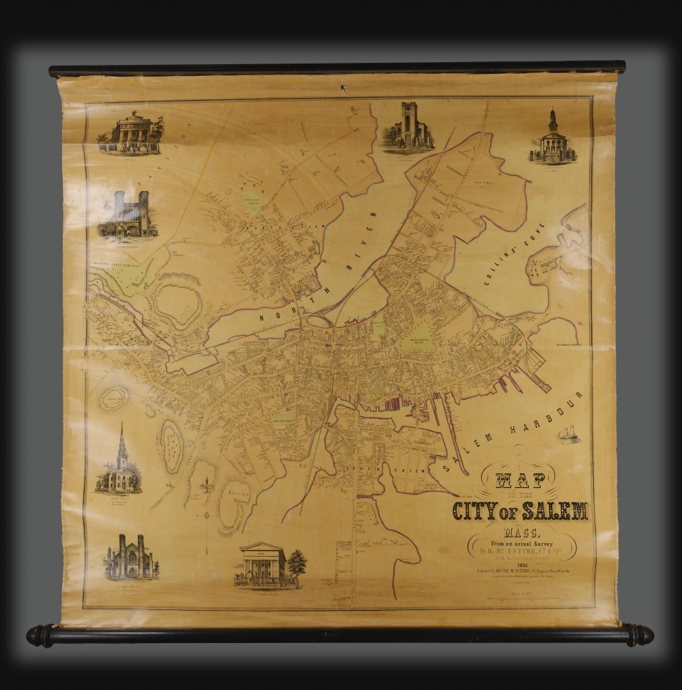
Map of the City of Salem Mass.
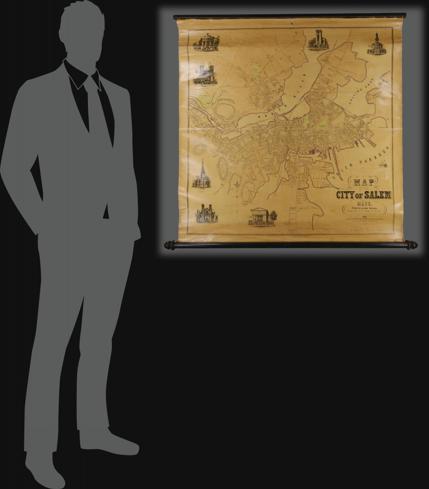
1851 (dated) 36.25 x 36.5 in (92.075 x 92.71 cm) 1 : 3048
1851 (dated) 36.25 x 36.5 in (92.075 x 92.71 cm) 1 : 3048
Description
A rare 1851 map of Salem, Massachusetts, by civil engineer Henry McIntyre. The map is the second major map of Salem, following Jonathan Saunder's much smaller scale 1820 Plan of the Town of Salem. It marks Salem's transition from a maritime hub rich from the China and Pepper Trade to a mill and manufacturing center.
A Closer Look
The detail of the plan is incredibly granular, being executed at a scale of 250 feet to the inch (advertised at 300). Consequently, the layout of individual houses can be discerned - many of which are still in use today. Virtually every structure is labeled, either with its purpose (School Houses, Court houses, and so on) or its owner. This extends to the maritime industries of Salem: wharves, mills, factories, etc. The plan is decorated with seven views of prominent buildings: the Eastern R. R. Station, City Hall, North Church, 1st Baptist Church, South Church, East Church, and the Courthouse.Documentary History
An advertisement placed by McIntyre in the Salem Observer (Issue 69, September 28, 1850) announced the map,MAP OF SALEM. We wish to call the attention of our readers to the proposals of Mr Mc'Intyre, to publish and furnish to our citizens a new and accurate Map of Salem. It will be on a large scale, 300 feet to an inch, and will contain the names of the owners of all the houses in the city. It is drawn from accurate surveys made by H. McIntyre, Civil Engineer, assisted by H. E. B. Taylor.Later, it was promoted in the Boston Register (January 9, 1851) by Henry Whipple, a Salem stationer located at 190 Essex Street:
The execution of the map, as we know from a view of the plan, is of the first order. It will be neatly colored, varnished and mounted on cloth rollers, and will be furnished to subscribers at the very low price of $3 per copy …
Should the proprietors of the churches and other public buildings, deem it expedient to incur the expense of adding a full view of their several buildings, these can be engraved around the margin enhancing greatly the beauty of the map. A plan of Salem, on a large and handsome scale like this, has been long wanted.
NEW MAP OF SALEM. The map of Salem, which has been prepared by Mr. H. McIntyre, is now nearly ready for publication, and a specimen copy is left at H. Whipple's bookstore for examination. It is a very elegant affair and differs in style from any heretofore published. Beautiful representations of some of our handsomest Churches and public buildings are engraved upon the margin, from designs drawn by our talented young artist, Mr. Sylvester P. Hodgdon, Every citizen of Salem will be proud of so fine a plan and picture of the cityAnd again by Whipple in the Boston Register (March 13, 1851):
It is one of the most elegant maps we have ever seen - handsomely colored, varnished and mounted on rollers, and noting distinctly the public grounds and buildings, the estates and names of householders, etc. etc. The map is drawn on a scale of 300 feet to the inch, and is a specimen of artistic taste and skill most, creditable to all concerned. Elegant views are presented of the Court House, the East, South, North, and First Baptist Churches, the Eastern Railroad Depot, and the City Hall - public buildings which are an ornament to the city, and equal to those of any place of its size in the Union. Every Salem man will be proud of so beautiful a plan of his native or adopted city.
Salem
By 1851, Salem, Massachusetts, was already steeped in maritime history and legacy. The once-thriving seaport, which had reached its zenith in the late 18th and early 19th centuries as a hub for whaling and the Far East pepper trade, was facing a decline in maritime commerce. This was due to the War of 1812, the 1807 Embargo Act, and new developments in shipbuilding, which made Salem's harbor outdated and too shallow. Nonetheless, while the harbors were less bustling, reminders of its seafaring prosperity could be seen in its many grand Federal-style mansions lining the streets - a testament to the wealth of sea captains and traders. The economy shifted to manufacturing, with industrial shoe-making, textile mills, and leather processing becoming prominent. The Eastern Railroad Station, opened in 1838, hinted at the industrial changes soon to sweep across the nation. Salem's identity as a pivotal port had begun to shift towards a more diversified economy, setting the stage for the Salem of the future.Publication History and Census
This map was compiled by Henry McIntyre and his assistant H. E. B. Taylor. It was printed in Philadelphia by F. Kuhl. All McIntyre maps are scarce on the market; few were produced, and those that survive only appear in a handful of institutional collections. His maps, like comparable maps by Francis Walling, were issued by subscription, with only small print runs. We are aware of examples at The Leventhal Map Center at Boston Public Library, the Peabody Essex Museum, the Salem Athenaeum, and Harvard. Scarce to the market.CartographerS
Henry McIntyre (fl. 1850s) was an American publisher of maps between 1850 and 1852. His surviving output focused exclusively on large city plans of New England towns - Boston, Lynn, Salem (1851), Danvers, Newburyport (1851), and Norwich, Connecticut - in spite of many of his works being actually printed in Philadelphia. It would appear that, like many more successful map and atlas publishers, McIntyre produced a handful of large, impressive maps either on a subscription model or as a speculative venture. The extremely short period of time during which McIntyre’s maps were produced suggests that his efforts were insufficiently fruitful. We find no trade advertisements for McIntyre’s map ventures in the newspaper record, and indeed, we find no biographical information for him whatsoever. (Perhaps had he been more assiduous at placing advertisements, this would not have been the case.) His offices were located at the N.E. Corner of Perry and Pine Streets, although which city these streets are/were in remain a mystery. More by this mapmaker...
Frederick Kuhl (c. 1812 - 18??) was a German-American lithographer and printer active in Philadelphia from about 1840-1853, then in San Francisco, California from 1854. Kuhl was born in Hesse Darmstadt, Germany, and, in 1839, emigrated to New York. He was naturalized in Philadelphia. He worked with lithographer Augustus Kollner in the early 1840s and partnered with George Kuhl (brother?) as 'F. and G. Kuhl' (1842 - 1846). In California he appears to disappear from record. There are some indications that he may have worked for the Chinese language presses in San Francisco, and others that suggest he managed a 'liquor saloon'. Learn More...
Condition
Very good. Remarkable unrestored original condition w/ original rollers. Some discoloration along bottom border. Minor puncture top center margin. Even overall toning. Original varnish.
References
OCLC 714043702. Boston Public Library, G3764.S2 1851.M35.