This item has been sold, but you can get on the Waitlist to be notified if another example becomes available, or purchase a digital scan.
1935 Bloodgood Pictorial Map of San Diego / California Pacific International Expo
SanDiego-bloodgood-1935-2$197.50


Title
San Diego. The California Pacific International Exposition.
1935 (dated) 21.25 x 31.25 in (53.975 x 79.375 cm)
1935 (dated) 21.25 x 31.25 in (53.975 x 79.375 cm)
Description
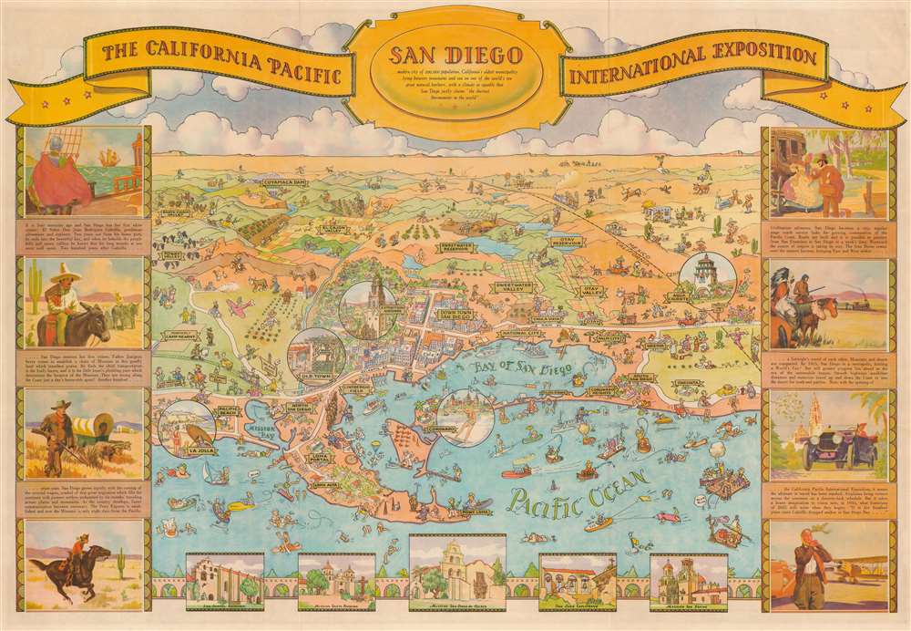
This is an attractive 1935 Don Bloodgood pictorial map of San Diego, California. Drawn to celebrate the 1935 California Pacific Exposition, the map looks eastward from a fictional high point above the Pacific Ocean and depicts San Diego from La Jolla to Oneonta and inland as far as Cuyamaca Dam. Cartoonish figures populate the map and illustrate the residents going about their daily lives and the many tourists enjoying their vacation. Circular vignettes emphasize areas of interest, including La Jolla, Old Town, the Exposition Grounds (which became Balboa Park), Coronado, and Agua Caliente. A pictorial history of San Diego surrounds the map with views of missions along the bottom border.
A Pictorial Map of the California Pacific International Exposition
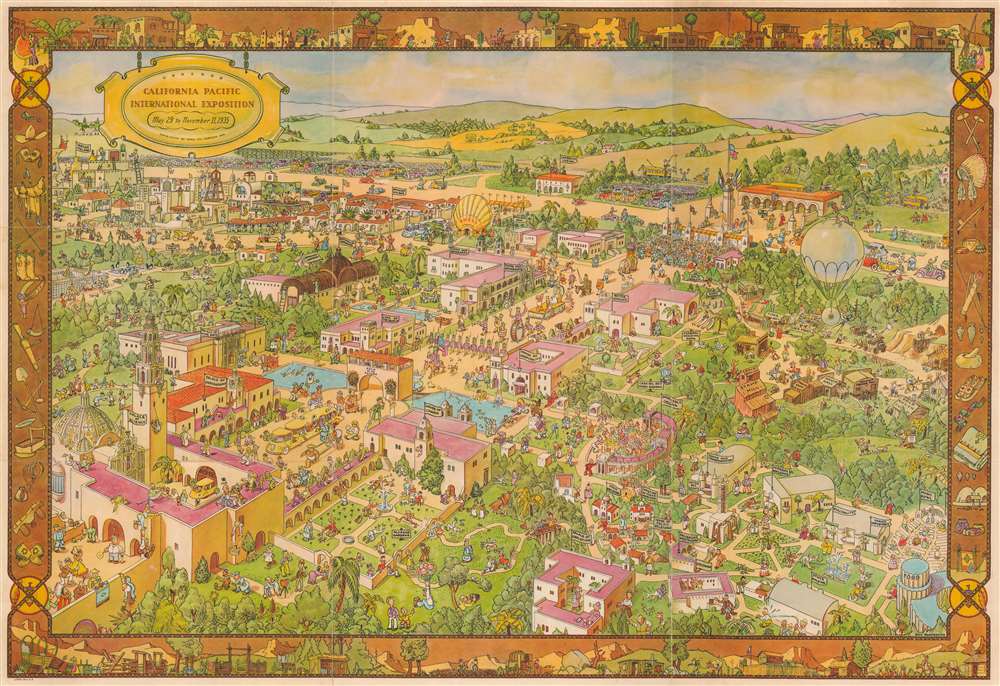
A pictorial map of the California Pacific International Exposition occupies the verso. The exposition's numerous buildings are illustrated and identified, along with the other attractions, such as the Botanical Gardens and the Turtle Farm near the zoo. Caricatures of the exposition's visitors run rampant throughout the fairgrounds. People are drawn doing just about everything imaginable! In the background, the parking lot is filled to capacity with cars of every color.The California Pacific International Exposition
Held in San Diego from May 29, 1935 to November 11, 1935 and from February 12, 1936 to September 9, 1936, Balboa Park hosted the Exposition. The Exposition promoted San Diego and supported its economy and used many of the buildings constructed for the 1915 - 16 Panama - California Exposition. Attendance proved to be such a success in 1935 that the fair was reopened in 1936. The buildings proved to be so popular that many were reconstructed to be more permanent and are still in use today.Publication History and Census
This map was drawn by Don Bloodgood and published by the Shell Oil Company in 1935. We note five examples cataloged in OCLC which are part of the collections at Harvard University, the University of Florida, the University of California San Diego, the University of California Berkeley, and the San Francisco Public Library.Cartographer
Donald Newman Bloodgood (October 21, 1896/7 - February 6, 1989), known as 'Don', was an American illustrator, map maker, and cartoonist active in the middle part of the 20th century. Born in California, he relocated to Sedona, Arizona, in 1960. Bloodgood produced a large corpus of pictorial maps between 1935 and 1968, most for either Shell Oil or the Pic-Tour guide series. His first known map is the illustration of San Diego drawn for the California Pacific International Exposition in 1935. Much of Bloodgood's work was produced in conjunction with Shell Oil. His work is considered stylistically similar to that of Jo Mora. More by this mapmaker...
Condition
Very good. Light wear along original fold lines. Pictorial map of Exposition on verso.
References
Rumsey 8580.001. OCLC 47680123, 38518439.