This item has been sold, but you can get on the Waitlist to be notified if another example becomes available, or purchase a digital scan.
1930 Bekins Map of San Francisco, California
SanFrancisco2-bekins-1930$50.00

Title
Latest City Map of San Francisco.
1930 (undated) 18.5 x 17 in (46.99 x 43.18 cm) 1 : 34000
1930 (undated) 18.5 x 17 in (46.99 x 43.18 cm) 1 : 34000
Description
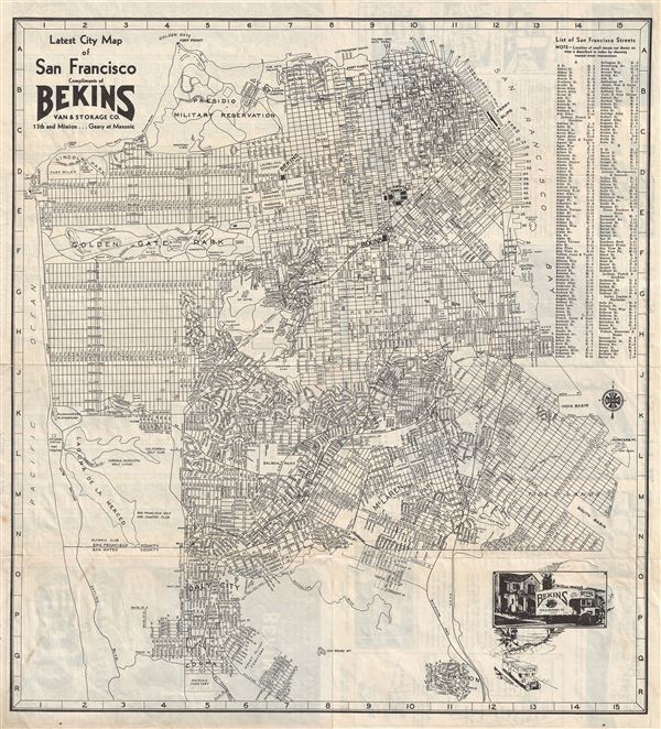
This is a fine c.1930s pocket map of the city of San Francisco by the Bekins Van and Storage Co. The map covers from Fort Point and the Presidio Military Reservation (Presidio Park) south as far as Colma and the Masonic Cemetery, beyond the San Francisco City limits. It All major streets, piers, parks, cemeteries, railroads are noted. A street index is included in the top right quadrant of the map. The bottom right quadrant features a photograph and graphic of the Bekins Company. All Bekins storage locations are noted on the map. The verso contains a continuation of the Street Index along with advertisements for the Bekins Company. The population of San Francisco at the time this map was issued, as mentioned on the cover of the folded map was 650,000, indicating that this map dates back to the 1930s,before the construction of the Golden Gate Bridge in 1937. This map was published and distributed by the Bekins Van and Storage Co.
Condition
Very good. Minor toning and wear over original fold lines. Professionally flattened and backed with archival tissue.