This item has been sold, but you can get on the Waitlist to be notified if another example becomes available.
1977 Robin G. Dustin Pictorial Map of the Saranac Lakes, Adirondacks, New York
SaranacLakes-dustin-1977$137.50

Title
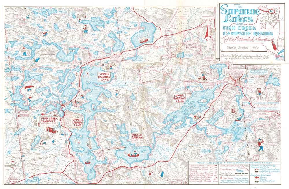
The Saranac Lakes and Fish Creek Campsite Region of the Adirondack Mountains.
1977 (dated) 24.25 x 37.25 in (61.595 x 94.615 cm) 1 : 31680
1977 (dated) 24.25 x 37.25 in (61.595 x 94.615 cm) 1 : 31680
Description
This is a delightful 1977 Robin G Dustin pictorial map of the Saranac Lakes and the Fish Creek campsite region in the Adirondack Mountains in New York State. The map depicts the region from Altamont Township to North Elba Township, and from Santa Clara Township to Harrietstown Township. Upper, Middle, and Lower Saranac Lake, along with numerous smaller ponds, brooks, lakes, and islands. Several campsites are noted, including Rollins Pond Campsite and Fish Creek Campsite. The Saranac Inn near Upper Saranac Island appears along with the town of Saranac Lake on the right. Numerous vignettes of outdoor enthusiasts, including fishermen, boaters, swimmers, and sunbathers, are playfully sketched. In the upper right, a hunter and a bear flee from one another. The hunter seems to have left behind his gun! Nearby deer bound through the forests.
Publication History and Census
This map was drawn, published, and copyrighted by artist Robin G. Dustin of Center Sandwich, New Hampshire, in 1977. It is scarce to the market.Condition
Very good. Wear along original fold lines. Blank on verso.