This item has been sold, but you can get on the Waitlist to be notified if another example becomes available, or purchase a digital scan.
1928 Kroll Map of Seattle
Seattle-kroll-1928$200.00


Title
Guide map of Seattle.
1928 (undated) 33 x 20.5 in (83.82 x 52.07 cm) 1 : 31680
1928 (undated) 33 x 20.5 in (83.82 x 52.07 cm) 1 : 31680
Description
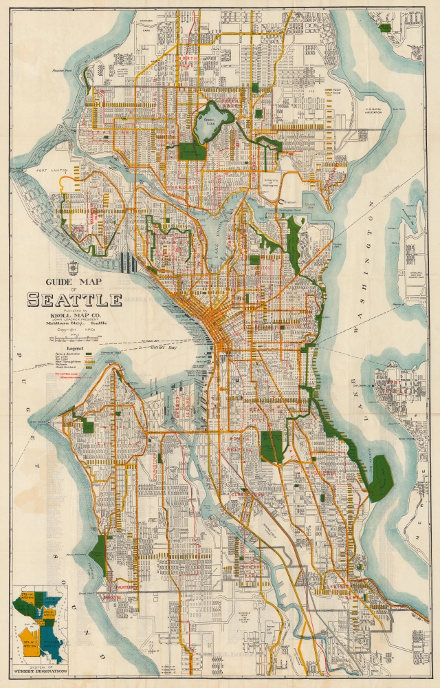
A large-format c. 1928 folding map of Seattle, Washington, produced by the Kroll Map Co., a prominent local map publisher. It underscores the city's recovery from the Great Fire of 1889, its rapid growth in the wake of the Klondike Gold Rush, and the ambitious public works projects that reshaped it in the years just prior to this map's publication.
As the city grew, its topography and geography changed. 'Regrades,' in which the tops of hills were shaved off, not only made the city more easily navigable, they also provided the basis for coastal landfill (in progress work shaded blue here), including Harbor Island at the mouth of the Duwamish River, expanding available real estate in or near the city's most densely populated neighborhoods. Waterways were similarly remade, with the Lake Washington Canal being the most notable example.
Although Kroll regularly produced large-format folding maps of Seattle in the company's early decades, examples from the prewar era are scarce. The OCLC notes a map with this title dated c. 1928 among the holdings of Stanford University, the University of Chicago, and the University of Iowa, while eight other institutions hold maps of the same title from the same era with various dates suggested.
A Closer Look
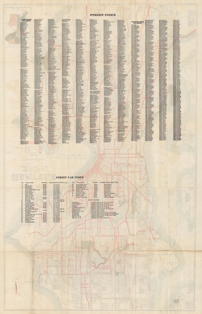
Neighborhoods, parks, 'main thoroughfares,' and streetcar, bus, and ferry lines are indicated throughout. The University of Washington sits prominently towards top-right. The operators of piers along the downtown waterfront are labeled. An inset map at bottom-left explains the geographic division of street designations. A grid surrounds the map, corresponding to an index of streets, along with bus and streetcar lines, on the verso.Risen from the Ashes
By the time this map was published, Seattle was the third largest city on the West Coast after San Francisco and Los Angeles, a hub for regional transportation and trade, and home to monumental architecture, including Smith Tower (at 2nd Ave. and Yesler Way), then the tallest building west of the Mississippi River. But the city's grandeur was far from guaranteed; much of it had been destroyed by a fire in 1889. Resolute commitment to reconstruction allowed Seattle to rebound, aided greatly by the Klondike Gold Rush, which created a demand not only for supplies and steamships, but also for financial and legal services. The city became a magnet for migrants from throughout the U.S. and across the world, and it expanded rapidly beyond its historical core to the north and south.As the city grew, its topography and geography changed. 'Regrades,' in which the tops of hills were shaved off, not only made the city more easily navigable, they also provided the basis for coastal landfill (in progress work shaded blue here), including Harbor Island at the mouth of the Duwamish River, expanding available real estate in or near the city's most densely populated neighborhoods. Waterways were similarly remade, with the Lake Washington Canal being the most notable example.
Publication History and Census
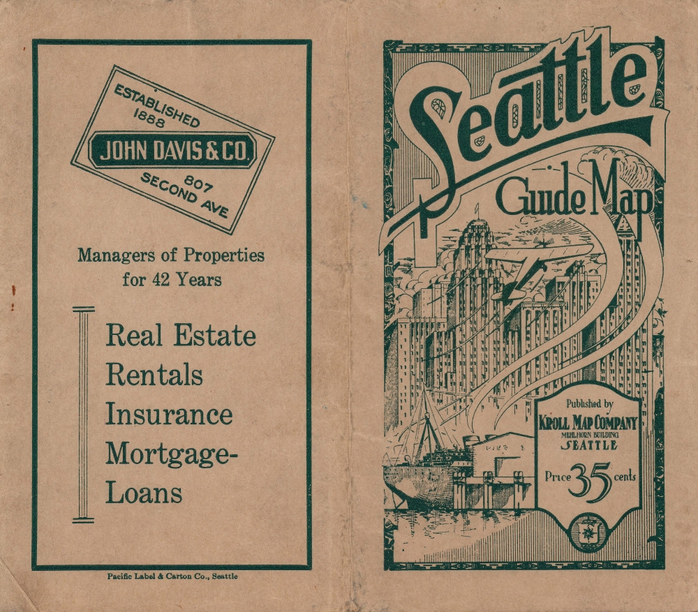
This map was produced by the Kroll Map company in 1928 or shortly thereafter. It is undated but appears similar if not identical to a map listed in the OCLC (53260348) that is speculatively dated to 1928 (as the map includes Boeing Airfield, the future King County International, opened 1928). Kroll's own website records it as circa 1926. However, an advertisement on the cover of this map would seemingly date its publication to 1930.Although Kroll regularly produced large-format folding maps of Seattle in the company's early decades, examples from the prewar era are scarce. The OCLC notes a map with this title dated c. 1928 among the holdings of Stanford University, the University of Chicago, and the University of Iowa, while eight other institutions hold maps of the same title from the same era with various dates suggested.
Cartographer
Kroll Map Company (1911 - Present) is a Seattle-based map company. Founded in 1911 when Carl Kroll acquired both Anderson Map Company and Washington Map and Blueprint Company, both of which had been in business since the 1870s. From its inception, Kroll Map Company has ‘focused on mapping for real estate and local government, custom mapping, and the publication of numerous general mapping products.’ Carl Kroll sold a half-share of the company to John Loacker, his close friend and employee, in 1920. Loacker then purchased the company outright in 1925. He maintained the feel of a family business by working with his son Waldemar, who eventually took over. Waldemar J. Loacker (April 16, 1902 - February 12, 1995) worked at Kroll for the rest of his life, only leaving the company after suffering a stroke in 1992. Then his son John Loacker (b. 1955), who began working at Kroll in his youth, officially inherited the business and continues operating it to this day. In 1999, Kroll Map Company and Metsker Maps of Seattle formed a partnership of ‘two historic Seattle businesses.’ Today, the Kroll Map Company creates custom maps for individuals worldwide. More by this mapmaker...
Condition
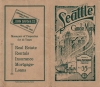
Very good. Slight creasing along the fold lines. Areas of discoloration in whitespace appear to be due to offsetting rather than soiling. Accompanied by original cover.
References
OCLC 53260348.