This item has been sold, but you can get on the Waitlist to be notified if another example becomes available, or purchase a digital scan.
1916 Taisho 5 Large Scale 2 Sheet Map of Seoul, South Korea
SeoulKorea-taisho5-1916$975.00

Title
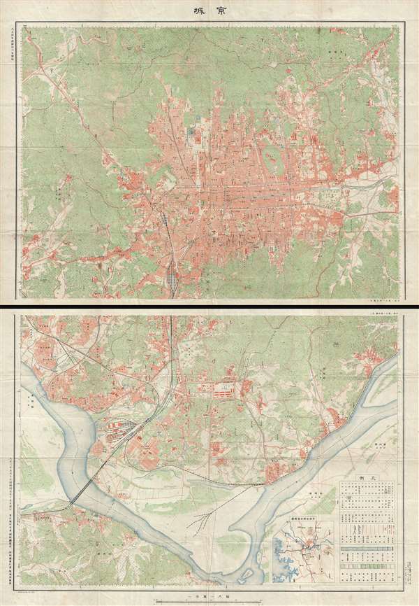
京城 / Capital.
1916 (dated) 45 x 32 in (114.3 x 81.28 cm) 1 : 10000
1916 (dated) 45 x 32 in (114.3 x 81.28 cm) 1 : 10000
Description
Titled simply 'Capital' (京城), this is a detailed two-part map of Seoul, South Korea, prepared in 1916 (Taisho 5), following the Japanese Annexation. The map is impressive in both its size and detail, extending from the Bukhan-Dong to the Han River. It indicates dopography, the street gird, individual bocks and important buildings, transportation networks, and more. This map was issued during a period of consolidated Japanese political and military power in Korea following the 1910 Japan-Korea Treaty annexation and the ultimate suppression of the Uibyeong armies in 1916. Such highly detailed topographic maps were rarely made and limited to only the most important centers – of which Seoul was most certainly the greatest. Likely circulation would have been highly curtailed and access limited to administrative and military personnel. This is, as such, a rare find – the first such example we have seen.
Condition
Very good. Minor wear on original fold lines with slight loss at one or two fold intersections. Two sheets, unjoined. Measurement indicates size of entire map as if joined.