1780 Raynal and Bonne Map of Northern Brazil
SeptBresil-bonne-1780$125.00

Title
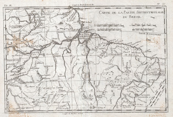
Carte De La Partie Septentrionale Du Bresil
1780 (undated) 9 x 13 in (22.86 x 33.02 cm)
1780 (undated) 9 x 13 in (22.86 x 33.02 cm)
Description
A fine example of Rigobert Bonne and Guilleme Raynal's 1780 map of Northern Brazil. This detailed map features the northern portion of Brazil from Bahia to Guyana. This also includes a portion of the Amazon River and its adjancet rainforest, the largest and most species-rich tract of forest in the world. Of note is the legendary Lake Parime in the northwest. It was on the shores of this lake that many explorers believed they could find the city of Manoa, or El Dorado. Explorers such as Sir Walter Raleigh searched this area in a vain attempt locate the lake and legendary City of Gold. The map also includes the eastern Amazon interior rivers, Mission Territories, Goyza and the coastal regions, with coastal currents noted. Atlas de Toutes les Parties Connues du Globe Terrestre, Dressé pour l'Histoire Philosophique et Politique des Établissemens et du Commerce des Européens dans les Deux Indes.
Cartographer
Rigobert Bonne (October 6, 1727 - September 2, 1794) was one of the most important French cartographers of the late 18th century. Bonne was born in Ardennes à Raucourt, France. He taught himself mathematics and by eighteen was a working engineer. During the War of the Austrian Succession (1740 - 1748) he served as a military engineer at Berg-op-Zoom. It the subsequent years Bonne became one of the most respected masters of mathematics, physics, and geography in Paris. In 1773, Bonne succeeded Jacques-Nicolas Bellin as Royal Cartographer to France in the office of the Hydrographer at the Depôt de la Marine. Working in his official capacity, Bonne compiled some of the most detailed and accurate maps of the period - most on an equal-area projection known erroneously as the 'Bonne Projection.' Bonne's work represents an important step in the evolution of the cartographic ideology away from the decorative work of the 17th and early 18th century towards a more scientific and practical aesthetic. While mostly focusing on coastal regions, the work of Bonne is highly regarded for its detail, historical importance, and overall aesthetic appeal. Bonne died of edema in 1794, but his son Charles-Marie Rigobert Bonne continued to publish his work well after his death. More by this mapmaker...
Source
Raynal, G., Atlas de Toutes les Parties Connues du Globe Terrestre, Dressé pour l'Histoire Philosophique et Politique des Établissemens et du Commerce des Européens dans les Deux Indes, 1780.
Condition
Good. Mnor discoloration left center near the Rio Negro and in the lower left corner. Original centerfold. Platemark visible. Blank on verso.