This item has been sold, but you can get on the Waitlist to be notified if another example becomes available, or purchase a digital scan.
1909 Ottoman Mehmet Eşref Map of Singapore and Borneo
SingaporeBorneo-esref-1909$250.00

Title
(Turkish Map of Singapore and Borneo)
1909 (undated) 5 x 3.75 in (12.7 x 9.525 cm)
1909 (undated) 5 x 3.75 in (12.7 x 9.525 cm)
Description
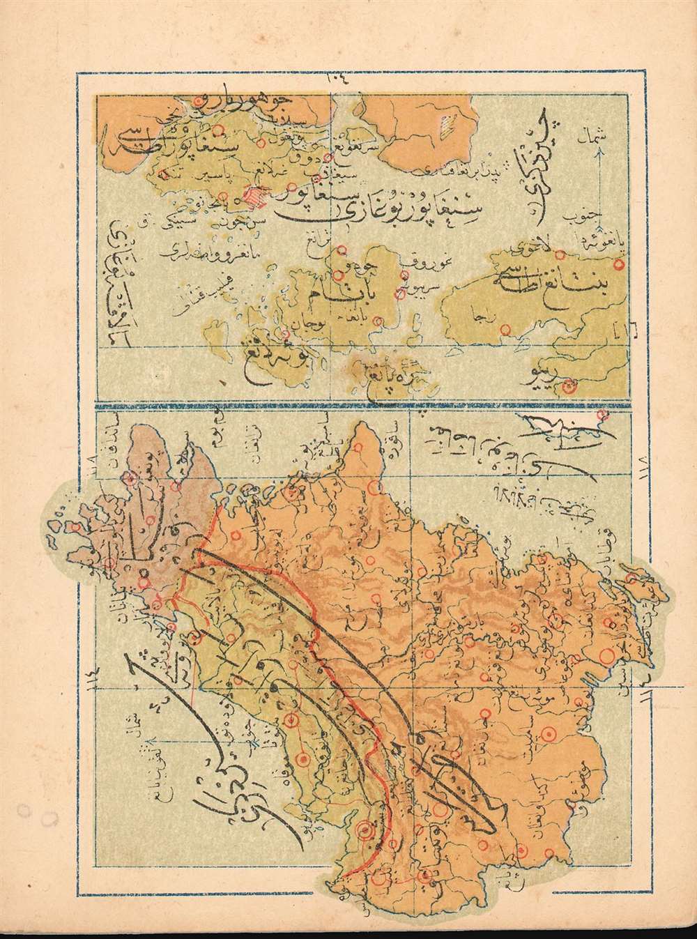
This is a 1909 Turkish map of the Singapore Strait and island of Singapore, combined with a map of Borneo, produced by the Turkish educator and publisher Mehmet Eşref. Most likely the only specific Ottoman map of these areas available to the collector. All titles and descriptive text are in Ottoman Turkish. On the Singapore Straits portion of the map, the city of Singapore itself is marked in red hachure. The map of Borneo is oriented to the west, and its colonial division between the English and the Dutch -which would materially affect the political boundaries of post-colonial Borneo- is indicated with color. Chromolithograph.
Publication History and Census
Turkish atlas maps are rare on the market. This one was published in Eşref’s Umum-i vilayat-ı Şahaneyi havi küçük atlas/( اطالس كوچك حاوى يى شهان ى والياة عموم), of which OCLC lists only a single copy at the Bogazici University Library in Istanbul.Cartographer
Mehmet Esref (1846 or 1847-1912) was a Turkish educator and publisher active in the first part of the 20th century. He published several historical and educational atlases, all of which are rare on the market and contain many of the first Turkish maps of the regions they depict. More by this mapmaker...
Source
Eşref, Mehmet.Umum-i vilayat-ı Şahaneyi havi küçük atlas/ اطالس كوچك حاوى يى شهان ى والياة عموم
Condition
Very good. Some trace pencil marks in margin.
References
ÖZEGE 25533. OCLC 949501827.