
Eşref, Mehmet

Mehmet Esref (1846 or 1847-1912) was a Turkish educator and publisher active in the first part of the 20th century. He published several historical and educational atlases, all of which are rare on the market and contain many of the first Turkish maps of the regions they depict.
One of the Only Acquirable Turkish Mountain Profile Charts
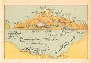
(Turkish Profile of Comparative Mountains and Ocean Depths)
$450.00
Acquire
- Digital Map Information
- Suitable for large format printing
- File Size: 0.92 MB
- File Type: ZIP / TIFF
- ICC color profile embedded
- Delivered instantly via download link
This is a rare 1909 Turkish chart relating the relative heights of mountains around the world, and comparing these with the depths found in the world's oceans. It was produced by the Turkish educator and publisher Mehmet Eşref. We suspect it to be the only such printed Ottoman work available to the collector. All titles and descriptive text are in Ottoman Turkish. Chromolithograph. (more details)
Likely the Only Printed Turkish Map of Korea, Capturing the Early Stages of Japanese Colonial Rule
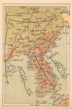
(Turkish Map of Korea, Showing the South Manchuria Railway Zone)
$500.00
Acquire
- Digital Map Information
- Suitable for large format printing
- File Size: 1.1 MB
- File Type: ZIP / TIFF
- ICC color profile embedded
- Delivered instantly via download link
This is a 1909 Turkish map of Korea and Manchuria, produced by the educator and publisher Mehmet Eşref, It is certainly the first, and may be the only Turkish map of the region. Its publication reveals Korea and neighboring Manchuria at a critical historical period: just a year before Japanese colonial rule in Korea, and four years into the Japanese administration of southern Manchuria as the 'South Manchurian Railway Zone.' The latter (Mantetsu for short) was a large National Policy Company of Japan, formed in 1906 to operate the railways taken over from Russia at the end of the Russo-Japanese War. The map shows major railway lines linking Vladivostok, Harbin, and Dalian, which were the major trunk lines operated by Mantetsu. All titles and descriptive text is in Ottoman Turkish. National borders are indicated with color: Manchuria is in green, Korea in brown. Russian Free Port of Vladivostok is shown in yellow, while the Kwantung Leased Territory (acquired by Japan from China in the 1898 Treaty of Shimonoseki) is marked in pink. Chromolithograph. (more details)
One of the Only Acquirable Turkish Maps of Üsküdar
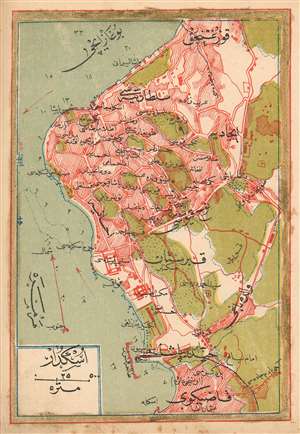
(Turkish Plan of Üsküdar)
$350.00
Acquire
- Digital Map Information
- Suitable for large format printing
- File Size: 1.41 MB
- File Type: ZIP / TIFF
- ICC color profile embedded
- Delivered instantly via download link
This is a 1909 Turkish plan of Üsküdar, produced by the Turkish educator and publisher Mehmet Eşref. It is one of the earliest, if not the only early Turkish printed plan of this part of Istanbul available to the collector. All titles and descriptive text are in Ottoman Turkish. The plan encompasses the neighborhoods of Harem, Doğancılar, Nakkaştepe and İcadiye, and indicates significant green space beyond these limits. Depth soundings are noted in the Bosphorus, and the famous 'Maiden's Tower,' or Kiz Kulesi, is marked just off the shore. Chromolithograph. (more details)