1958 British War Office Chart or Map of Singapore
SingaporeJohoreBahru-waroffice-1958$1,200.00

Title
Singapore and Johore Bahru.
1958 (dated) 22 x 27.5 in (55.88 x 69.85 cm) 1 : 63360
1958 (dated) 22 x 27.5 in (55.88 x 69.85 cm) 1 : 63360
Description
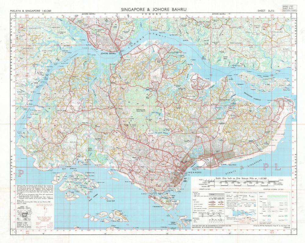
This is a 1958 British War Office map of Singapore and Johor Bahru (Johore Bahru). This is one of the earliest maps of the self-governed State of Singapore, published in the same month it was established, paving the way for independence in 1965.
A Closer Look
Centered on the island of Singapore, the map also depicts Johor Bahru and the surrounding areas of the extreme southern tip of the Malaysian peninsula. Singapore's extensive road network is illustrated and differentiated by grade. The island's urban sprawl is readily apparent, although only a handful of specific buildings are identified. The Pandan Nature Reserve and the Catchment Area Nature Reserve are labeled. The whole is overlaid with a grid measured in yards north and east. An index in the lower right explains the notations.Publication History and Census
This map was created and published by the Directorate of Military Survey, War Office, and Air Ministry in 1958 as Series L707, Sheet 3L/12. This map is cataloged in the OCLC at three institutions: the University of Chicago, the National Library of Australia, and the Australian War Memorial.Cartographer
The British War Office (1857 - 1964) was a department of the British Government responsible for the administration of the Royal Army until 1964, when its functions were transferred to the Ministry of Defense. The War Office was to the Royal Army what the Admiralty was to the Royal Navy, and later, the Air Ministry. Within the War Office, the General Staff Topographical Section was responsible for thousands of maps issued for British intelligence and military use. The Topographical Section was renamed Geographical Section in April 1907. Many, once their military use passed, were offered through licensed agents to the general public. The sole London agent for War Office material was Edward Stanford. More by this mapmaker...
Condition
Very good. Verso repairs at fold separations.
References
OCLC 222051452.