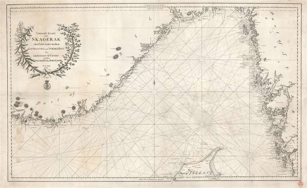
1820 Royal Danish Archive Nautical Chart of the Skagerrak and the Kattegat
Skagerak-royaldanishchart-1820$850.00
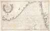


Title
Voxende Kaart over Skagerak eller Fahrvandet iomellem Kattegattet of den Norske Kyst fra Lindersaes til Faerder med den SvenskeKystafBohusLehn.
1820 (dated) 22 x 36.25 in (55.88 x 92.075 cm) 1 : 450000
1820 (dated) 22 x 36.25 in (55.88 x 92.075 cm) 1 : 450000
Description
This is an 1820 Royal Danish Nautical Charts Archive nautical chart or map of the Skagerrak and the Kattegat, two straits in Scandinavia. Depicting the region from southern Norway to the western coast of Sweden, rhumb lines criss-cross the illustrated sea areas, serving as navigational aids. Depth soundings appear along the Danish and Swedish coasts and along essential sea lanes, but are curiously absent from the Norwegian coastline. Coastal islands are illustrated and labeled. The presence of manuscript notes suggests this chart was sailed.
Blueback Charts
Blueback nautical charts began appearing in London in the late 18th century. Bluebacks, as they came to be called, were privately published large-format nautical charts known for their distinctive blue paper backing. The backing, a commonly available blue manila paper traditionally used by publishers to wrap unbound pamphlets, was adopted as a practical way to reinforce the low-quality paper used by private chart publishers in an effort to cut costs. The earliest known blueback charts include a 1760 chart issued by Mount and Page, and a 1787 chart issued by Robert Sayer. The tradition took off in the early 19th century, when British publishers like John Hamilton Moore, Robert Blachford, James Imray, William Heather, John William Norie, Charles Wilson, David Steel, R. H. Laurie, and John Hobbs, among others, rose to dominate the chart trade. Bluebacks became so popular that the convention was embraced by chartmakers outside of England, including Americans Edmund March Blunt and George Eldridge, as well as Scandinavian, French, German, Russian, and Spanish chartmakers. Blueback charts remained popular until the late 19th century, when government subsidized organizations like the British Admiralty Hydrographic Office and the United States Coast Survey, began issuing their own superior charts on high quality paper that did not require reinforcement.Publication History and Census
This map was created and published by the Royal Danish Nautical Charts Archive in 1820. One example is cataloged in OCLC and is part of the institutional collection at the Bibliothèque nordique in Paris.Cartographer
The Royal Danish Chart Archive (1784 - 1973) or Det Kongelige Danske Søkaart-Archiv was established by the Danish Crown in 1784. Impressed by the French Dépôt des Cartes de Marine, the crown recruited Captain Lieutenant Poul de Løwenørn to act as the first director of the archive. Løwenørn collected nautical charts from all parts of the world. The archive later began issuing its own charts, often improving and updating older charts. The archive was merged with the Nautical Chart Archive and Life Guard in 1973. More by this mapmaker...
Condition
Good. Some spotting and creasing as in image. Original blue paper backing.
References
OCLC 493787978.