1942 Metsker Map of Skagit County, Washington
SkagitCo-metsker-1942$350.00


Title
Metsker's Map of Skagit County, Washington.
1942 (dated) 19 x 51.25 in (48.26 x 130.175 cm) 1 : 126720
1942 (dated) 19 x 51.25 in (48.26 x 130.175 cm) 1 : 126720
Description
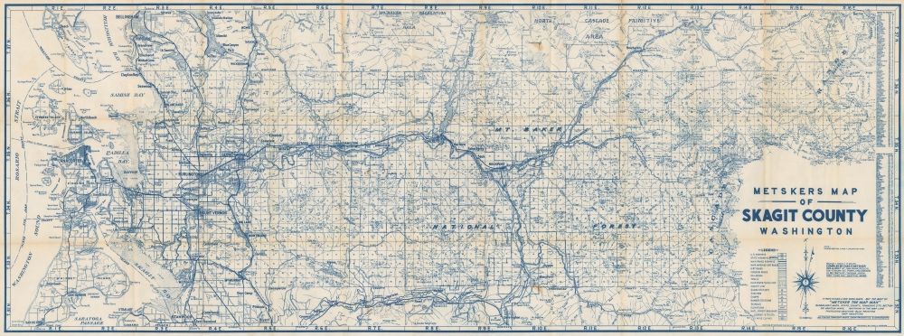
This is a 1942 Metsker map of Skagit County, Washington. The map captures the county at the peak of World War II (1939 - 1945), when it funneled critical manpower and natural resources to the war effort through nearby military bases in Island County.
A Closer Look
Coverage embraces from Rosario Strait and Washington Sound to Cutthroat Peak in Okanogan County and from Bellingham and Geneva to Stanwood and Camano Island. Bold lines mark the county's highways, while smaller roads are illustrated by thinner lines. The Seattle Municipal Railway runs along part of the Skagit River. The region's impressive topography is depicted using hachure, with ridges, peaks, buttes, and other features labeled. The Cascades dominate the eastern (left) side. Lakes, creeks, and rivers appear as well. The Mt. Baker National Forest fills nearly a quarter of the sheet.Publication History and Census
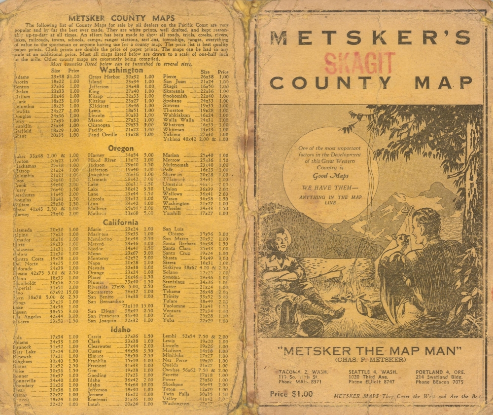
This map was created and published by Charles Metsker and Metsker Maps in 1942. Metsker Maps published editions of their county maps series beginning in the 1930s and continuing into the 1980s or 1990s. We've seen cataloged examples of the Metsker Map of Skagit County dating from every decade within that range, although we have not found a cataloged example of the present edition. Examples of various editions appear on the market from time to time.Cartographer
Charles Frederick Metsker (December 5, 1881 - October 6, 1966) was an American cartographer and publisher. Born in Douglas County, Kansas, Metsker's family moved to Winlock, Washington, in 1900. Metsker began publishing maps in 1901 in Tacoma, Washington. By the 1920s he was advertising as 'Metsker the Map Man' in Washington and Oregon newspapers. He opened a brick and mortar store in 1950 in Seattle and sold Township maps and atlases and County maps. He married Minnie B. Clevenger (1888 - 19xx) on May 11, 1905, with whom he had two children. They divorced sometime between 1910 and 1920. He married Elizabeth F. Metsker (1899 - 1982) on November 6, 1922, with whom he had a daughter. He retired in 1948 when he turned the business over to his son. He died in McMinnville, Oregon, at the age of 84. Metsker Maps joined forces with the Kroll Map Company, another Seattle-based mapmaker, in 1980. Metsker Maps continues to operate in Seattle to this day, where they can be visited at the Pike Place Market in the Sanitary Market Building. More by this mapmaker...
Condition
Very good. Light wear along original fold lines. Verso repairs to fold separations. Slight loss at a fold intersection. Accompanied by original binder.