This item has been sold, but you can get on the Waitlist to be notified if another example becomes available.
1975 Hallwag Map of the Solar System
SolarSystem-hallwag-1977$250.00


Title
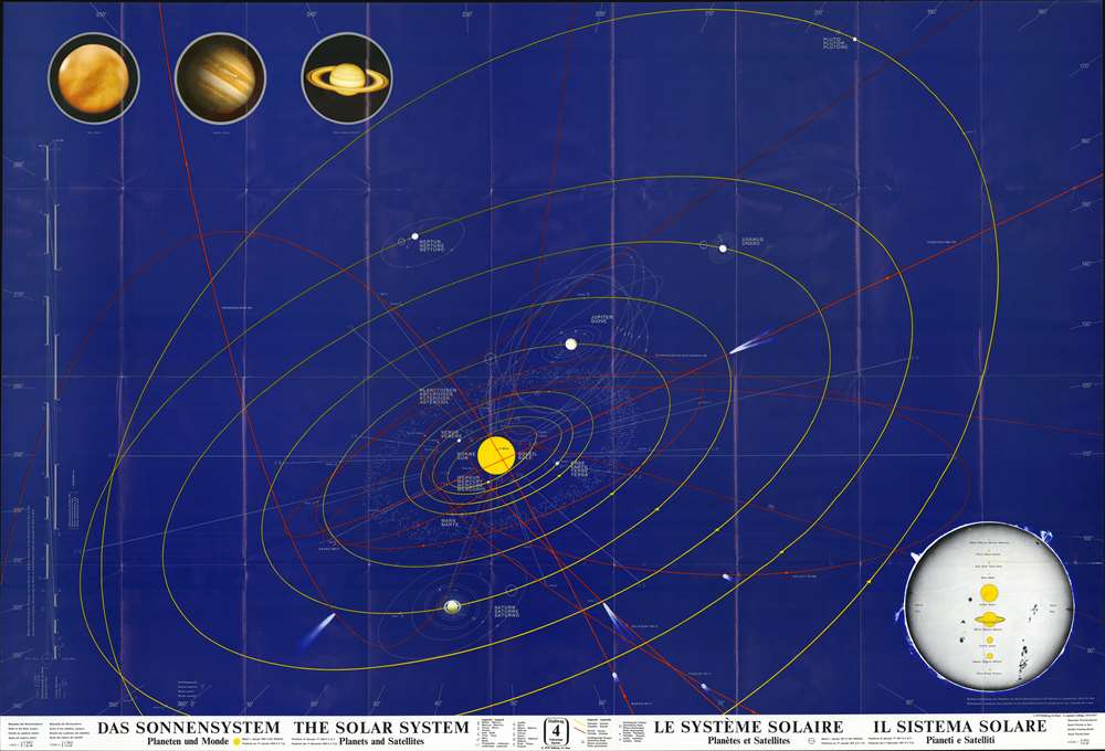
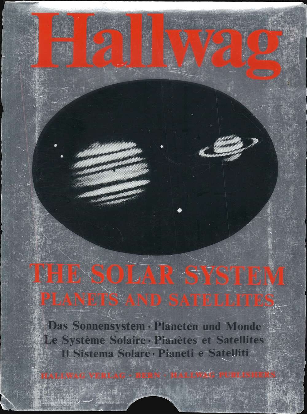
Das Sonnensystem : Planeten und Monde - The Solar System : Planets and Satellites - Le Système Solaire : Planètes et Satellites - Il Sistema Solare : Pianeti e Satelliti.
1977 (dated) 33.75 x 49.5 in (85.725 x 125.73 cm)
1977 (dated) 33.75 x 49.5 in (85.725 x 125.73 cm)
Description
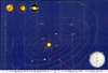
This is a 1970/1976/1977 Hallwag map of the Solar System. THe Sun appears just below center, and yellow lines trace the orbit of the planets, including Pluto. Pluto and Neptune's orbits are so large that both extend off the bottom of the sheet. All planets are labeled in German, English, French, and Italian. Thin gray lines surrounding each indicate moons. Red lines highlight the orbits of numerous comets, all of which are identified. A diagram in the lower right provides a visual representation of the size of the Sun relative to the size of each planet. Color renderings of Mars, Jupiter, and Saturn are situated in the upper left. Information concerning the map's scale, notations used, and the statement that the planets' positions were taken on January 1, 1976, appear along the bottom border.
Verso Content
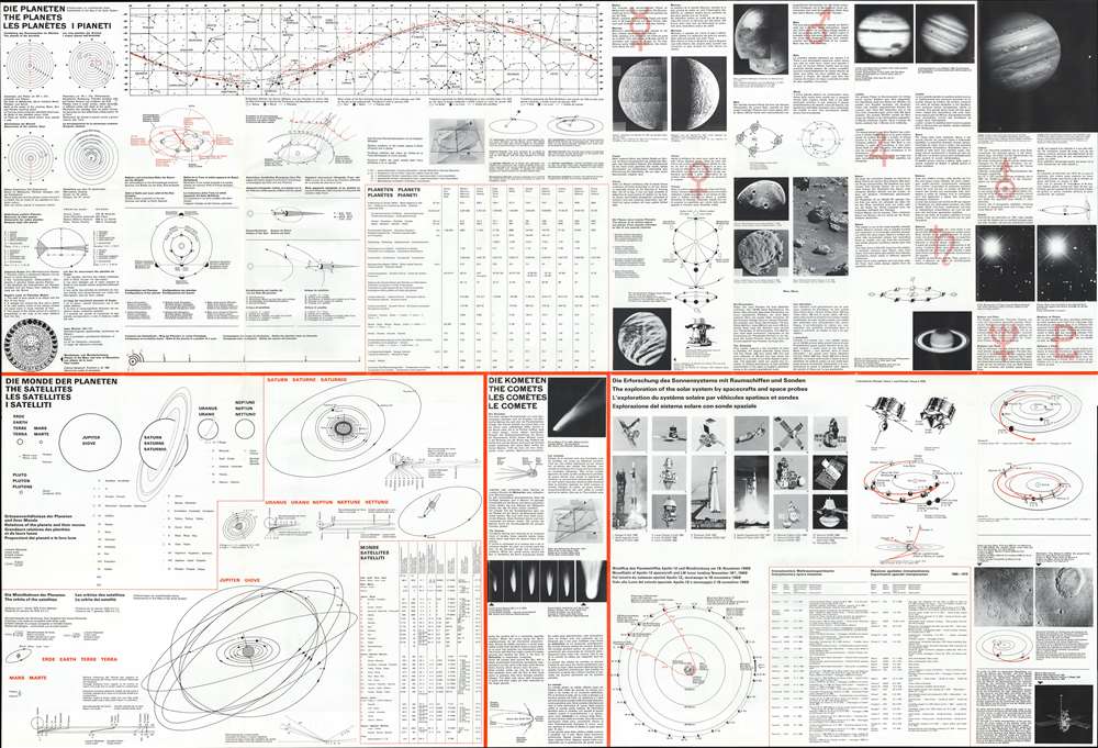
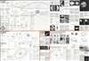
Educational content abounds on the verso. Diagrams of historical models of the Solar System, the orbit of the Earth around the Sun, and Solar and Lunar Eclipses appear in the upper left. A diagram depicting the Sun's ecliptic through the sky as seen from Earth dominates the upper border, while short paragraphs about each planet occupy the upper right. Information about the orbits of the moons of Earth, Mars, Jupiter, Saturn, Uranus, and Neptune appear in the bottom third of the sheet, along with a section about comets and another discussing space exploration vehicles.Publication History and Census
This map was created and published by Hallwag in 1976/1977. This is the '6th Supplemented Edition', suggesting that a new edition was published every year beginning with the first edition in 1970. Thirteen examples of this map (spread over five editions) are cataloged in OCLC.Condition
Very good. Exhibits wear along original fold lines. Printing on verso.
References
OCLC 81464824 (1976).