This item has been sold, but you can get on the Waitlist to be notified if another example becomes available, or purchase a digital scan.
1930 Survey of India Map of Southern Iran and the Persian Gulf
SouthernPersia-survey-1930$375.00

Title
Persia, Arabia, and Turkey in Asia.
1930 (dated) 19 x 35 in (48.26 x 88.9 cm) 1 : 2000000
1930 (dated) 19 x 35 in (48.26 x 88.9 cm) 1 : 2000000
Description
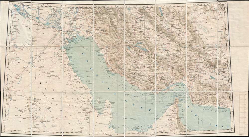
This is a 1930 Survey of India map of the Middle East on a conic projection. Featuring a highly detailed depiction of the coast of the Persian Gulf, the map illustrates the region from Saudi Arabia and Iraq to eastern Iran and from Yazid in Iran to United Arab Emirates and the Gulf of Oman. Myriad locations throughout the region are labeled, including Bahrain Island, Qatar, and Kuwait, along with Dubai (Dibai), Basra (Basrah), and Doha (Dohah). The Strait of Hormuz is illustrated in detail. Roads are illustrated throughout, such as the Darb Zubaidah (Persian pilgrim route to Mecca). Railroads, telegraph lines, and other symbols of modernity are noted as well. Other areas of the region are labeled simply as 'unexplored', creating an intriguing dichotomy. Rivers, lakes, and marshes are also noted, and the region's topography is illustrated in detail.
This map was created by the Survey of India and was published as the second edition in 1930.
This map was created by the Survey of India and was published as the second edition in 1930.
Condition
Very good. Dissected and mounted on linen in 24 panels. Close margins. Blank on verso. Accompanied by original binder.