
1861 J. Calvin Smith and Colton Map of the Southern States or Confederacy

This item has been sold.
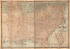
Colton's Map of the Southern States, including Maryland, Delaware, Virginia, Kentucky, Tennessee, Missouri, North Carolina, South Carolina, Georgia, Alabama, Mississippi, Arkansas, Louisiana, and Texas. Showing Also Part of Adjoining States and Territories Locating the Forts and Military Stations of the U. States and Showing all the Rail Roads, R.R. Stations, and other Internal Improvements.
First large-scale commercial map of the Confederacy.
- Digital Map Information
- Suitable for large format printing
- File Size: 198.45 MB
- File Type: ZIP / TIFF
- ICC color profile embedded
- Delivered instantly via download link
First large-scale commercial map of the Confederacy.
This is an 1861 J. H. Colton map of the Confederacy published in the first year of the American Civil War (1861 - 1865). This is the first large-scale commercial map of the Confederacy, published early in 1861, in the immediate wake of the Secession.A Closer Look
Coverage encompasses the full reach of the Confederacy, here defined as 'Southern States' as Colton was a staunch Union man, from Pennsylvania and northern Missouri to Florida, and from east Texas to North Carolina's Outer Banks. The Confederacy is shaded red, while the Northern states, which appear here only fragmentarily (Illinois, Indiana, Pennsylvania, New Jersey, and Kansas), are blue. Missouri, Kentucky, Maryland, Delaware, the Indian Territory, and western Virginia (West Virginia in 1863) are highlighted in yellow, underscoring their ambiguous border status and internal sympathies toward both sides.This is a massive map on a large scale, on which Colton provides exhaustive detail. The well-mapped road and railroad networks throughout betray Colton's awareness of this map's potential military value. Railroads played a pivotal role in the American Civil War, enabling soldiers and supplies to travel quickly between theaters of war, thus railroads and railroad junctions became key battlegrounds.
Emergence of West Virginia
On June 20, 1863, Congress granted statehood to West Virginia, making it the 35th state. West Virginia's path to statehood had its roots in the colonial era, but Virginia's Secession following Abraham Lincoln's election in 1860 proved to be the catalyst. Anti-secession sentiments were high in western Virginia, and conventions were held in Clarksburg and Wheeling denouncing Secession and making plans to combat the movement. Following Virginia's statewide vote to secede on May 23, 1861, and the Union invasion of western Virginia on May 26, the Second Wheeling Convention convened. The Convention vacated all state offices held by Confederates and called for the reorganization of the state government. The Convention also appointed a governor and filled other statewide offices of this reorganized government. Lincoln signed the West Virginia Statehood Bill on December 31, 1862.Publication History and Census
Colton credits the map to J. Calvin Smith, a well-regarded geographer active in the mid-19th century. In this, he is likely referring to Smith's 1853 wall map of the United States. Colton acquired Smith's plates sometime in the late 1850s and published two maps based on that wall map, this map, and, in 1862, an updated version of the full United States map. While this map employs the basic Smith geography, it is significantly enlarged and updated to focus on the relevant succession states.The present example is the 1861 first edition. Colton published an updated map using the same title but new cartography in 1862. Cataloging inconsistencies between these editions has made a full census of institutional holdings of his piece nearly impossible. It is, however, extremely scarce on the market.
Cartographers
Joseph Hutchins Colton (July 5, 1800 - July 29, 1893), often publishing as J. H. Colton, was an important American map and atlas publisher active from 1833 to 1897. Colton's firm arose from humble beginnings when he moved to New York in 1831 and befriended the established engraver, Samuel Stiles. He worked under Stiles as the 'Co.' in Stiles and Co. from 1833 to 1836. Colton quickly recognized an emerging market in railroad maps and immigrant guides. Not a cartographer or engraver himself, Colton's initial business practice mostly involved purchasing the copyrights of other cartographers, most notably David H. Burr, and reissuing them with updated engraving and border work. His first maps, produced in 1833, were based on earlier Burr maps and depicted New York State and New York City. Between 1833 and 1855, Colton proceeded to publish a large corpus of guidebooks and railroad maps, which proved popular. In the early 1850s, Colton brought his two sons, George Woolworth Colton (1827 - 1901) and Charles B. Colton (1832 - 1916), into the map business. G. W. Colton, trained as a cartographer and engraver, was particularly inspired by the idea of creating a large and detailed world atlas to compete with established European firms for the U.S. market. In 1855, G.W. Colton issued volume one of the impressive two-volume Colton's Atlas of the World. Volume two followed a year later. Possibly because of the expense of purchasing a two-volume atlas set, the sales of the Atlas of the World did not meet Colton's expectations, and so, in 1856, the firm also issued the atlas as a single volume. The maps contained in this superb work were all original engravings, and most bear an 1855 copyright. All of the maps were surrounded by an attractive spiral motif border that would become a hallmark of Colton's atlas maps well into the 1880s. In 1857, the slightly smaller Colton's General Atlas replaced the Atlas of the World. Most early editions of the General Atlas published from 1857 to 1859 do not have the trademark Colton spiral border, which was removed to allow the maps to fit into a smaller format volume. Their customers must have missed the border because it was reinstated in 1860 and remained in all subsequent publications of the atlas. There were also darker times ahead; in 1858, Colton was commissioned at a sum of 25,000 USD by the government of Bolivia to produce and deliver 10,000 copies of a large format map of that country. Although Colton completed the contract in good faith, delivering the maps at his own expense, he was never paid by Bolivia, which was at the time in the midst of a series of national revolutions. Colton would spend the remainder of his days fighting with the Bolivian and Peruvian governments over this payment, and in the end, after a congressional intervention, he received as much as 100,000 USD in compensation. Nonetheless, at the time, it was a disastrous blow. J. H. Colton and Company is listed as one of New York's failed companies in the postal record of 1859. This led Colton into the arms of Alvin Jewett Johnson and Ross C. Browning. The 1859 edition of Colton's General Atlas lists Johnson and Browning as the 'Successor's to J. H. Colton' suggesting an outright buyout, but given that both companies continued to publish separately, the reality is likely more complex. Whatever the case may have been, this arrangement gave Johnson and Browning access to many of Colton's map plates and gave birth to Johnson's New Illustrated (Steel Plate) Family Atlas. The Johnson's Atlas was published parallel to Colton's atlases well into the 1880s. The Colton firm itself subsequently published several other atlases including an Atlas of America, the Illustrated Cabinet Atlas, the Octavo Atlas of the Union, and Colton's Quarto Atlas of the World. They also published a large corpus of wall maps, pocket maps, and guides. The last known publications of the Colton firm date to 1897 and include a map and a view, both issued in association with the Merchant's Association of New York. Alice M. Colton married August R. Ohman (May 3, 1859 - April 22, 1934) on January 5, 1897. In 1898, Ohman joined the Colton firm, which continued to publish as Colton, Ohman & Co. until 1901. Further Details...
John Calvin Smith (1809 – June 11, 1890) was an American surveyor and geographer active in New York during the middle part of the 19th century. He was a charter member of the American Geographical and Statistical Society (American Geographical Society). He worked with other important New York cartographers including John Disturnell (1801 - 1877), George E. Sherman (1812 - 1858), and Samuel Stiles (1796 - 1861), with whom he often published under the Stiles, Sherman & Smith imprint. Stiles may have introduced Smith to J. H. Colton (1800 - 1893), who acquired many of his map plates in 1853. Most of Smith's maps focus on New York counties, but he also issued maps of the United States, Illinois, Texas, and the California gold fields. Despite being an important and prolific cartographer, much of his personal life and history are shrouded in mystery. Further Details...
Lang and Laing (fl. 1861 – August 16, 1862) were New York City based publishers and lithographers active in the middle part of the 19th century. The firm was founded by founded by William Lang and Joseph Laing and maintained offices at 117 Fulton Street, New York City. They specialized in transferring copper and steel plates to lithographic stone for more economical printing. Their most significant cartographic work is the Jacob de Cordova and Robert Creuzbaur map of Texas. The firm was dissolved in August of 1862. Lang went on to partered with Henry Pooley Cooper, and continued to publish under the Lang and Cooper imprint until 1864. Further Details...
Condition
Good. Dissected and mounted on linen in 24 panels. Soiling and dampstaining.
References
OCLC 44544077, 43977912,