This item has been sold, but you can get on the Waitlist to be notified if another example becomes available, or purchase a digital scan.
1879 Warren Map of the Southern States of the United States
SouthernUS-warren-1879$50.00

Title
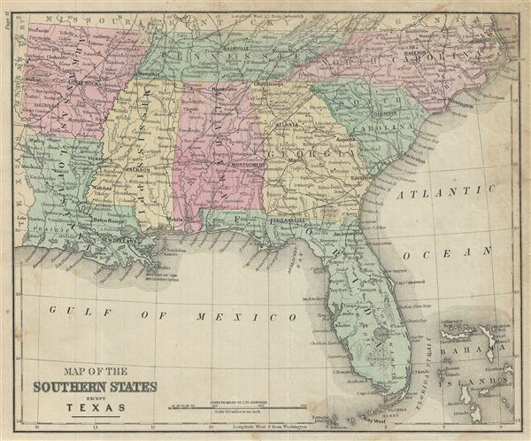
Map of the Southern States except Texas.
1879 (undated) 9.5 x 11.5 in (24.13 x 29.21 cm)
1879 (undated) 9.5 x 11.5 in (24.13 x 29.21 cm)
Description
This is an example of David M. Warren's 1879 map of the Southern states of the United States. It covers Arkansas, Louisiana, Mississippi, Tennessee, North Carolina, South Carolina, Georgia, Alabama and Florida, including the Bahamas. The mouth of the Mississippi is identified. Throughout, the map identifies various railroads, cities, towns, rivers, swamps, islands, mountain passes and an assortment of additional topographical details. The map is color coded according to regional and political boundaries with elevation rendered by hachure. Issued as page 41 in the 1879 edition of Warren's Common-School Geography.
Source
Warren, D. M., Common School Geography, 1879.
Condition
Very good. Even overall toning. Text on verso. Some foxing.