1970 Roberts Pictorial Map of South Vietnam
SouthVietnam-roberts-1970$400.00


Title
South Viet-Nam.
1970 (dated) 37.5 x 24.5 in (95.25 x 62.23 cm) 1 : 1224960
1970 (dated) 37.5 x 24.5 in (95.25 x 62.23 cm) 1 : 1224960
Description
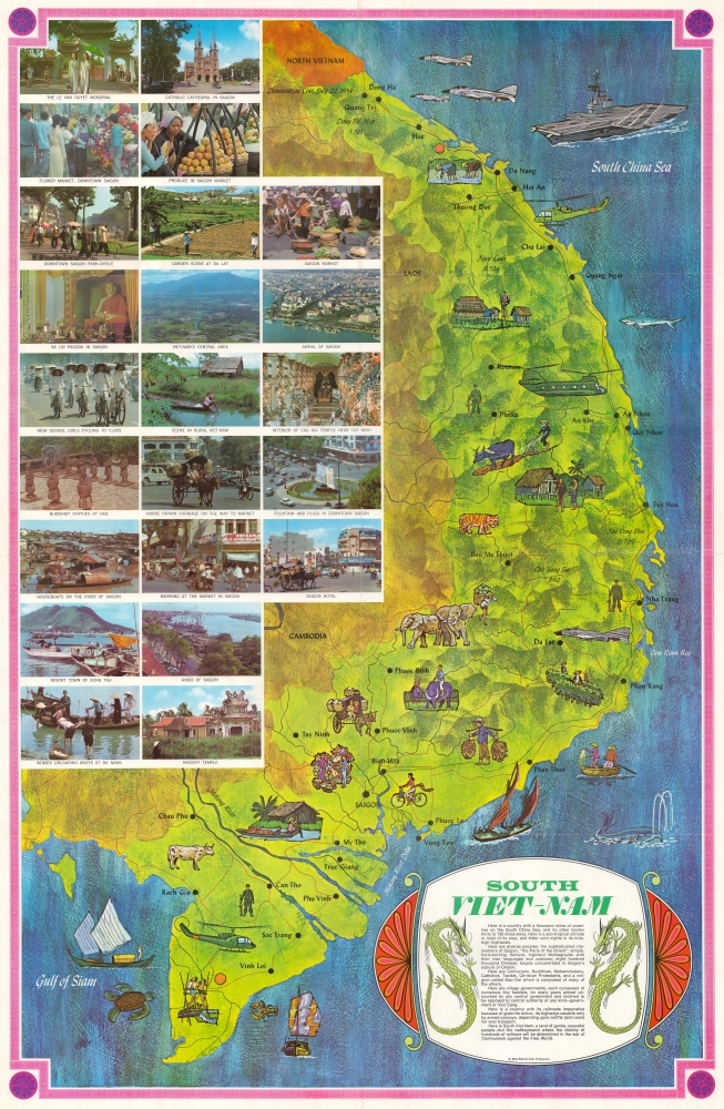
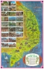
This is a c. 1970 Mike Roberts pictorial map of South Vietnam published during the Vietnam War. The map emphasizes the region's bucolic terrain and peaceful history - a striking contrast to the war then ravaging these lands.
A Closer Look
Striking pastel colors convey the country's tropical climate and reinforce the stereotypical view of the villages as illustrated in the vignettes and photographs. Other vignettes highlight farmers going about their daily lives, and vendors taking their wares to market. Vietnam's animals also appear. An ox plows a field and illustrations of a tiger and elephants are situated near the Laotian border. Printed photographs dominate almost the entire left half of the map and present views of life in Saigon, rural Vietnam, and cultural sites around the country. There are, inevitably, vignettes referencing the American military presence and the war. Huey helicopters appear near the Mekong Delta and not far from Chu Lai. A CH-47 Chinook helicopter (the one with two rotors) dominates the area between Pleiku and An Khe. An aircraft carrier plies the waters of the South China Sea just off the coast of Da Nang, and F-4 Phantom fighter jets are illustrated off the coast of Dong Ha and just above Da Lat.A Propaganda Piece?
The short text included in the title cartouche presents the viewer with an idyllic vision of South Vietnam. It waxes poetic about the country's ethnic and religious diversity. Then lauds its independent villages that have thrived for 'many years almost untouched by central authority of any kind'. It then paints a picture of the chaos inflicted upon these people by guerrillas and the war. It ends by sayingHere is South Viet Nam, a land of gentle, peaceful people - but the battleground where the destiny of hundreds of millions will be determined in the war of Communism against the Free World.
The Vietnam War
The Vietnam War, known in Vietnam as the Resistance War Against America or simply the American War, raged between November 1, 1955, and April 30, 1975, when Saigon fell to the North Vietnamese. An extension of the Cold War with a complicated history and legacy, the Vietnam War pitted the North Vietnamese, led by Ho Chi Minh, against the South Vietnamese. The South Vietnamese were supported by the United States, and the Soviet Union and China supported the North Vietnamese. American anti-communist dogma drove much of America's enthusiasm for involving themselves in Southeast Asia and their fear that 'if one country fell to Communism, then more would fall.' Eventually, as the conflict between the North and South grew fiercer, American involvement became more and more overt. Finally, American ground troops were sent into combat against the North Vietnamese and the Viet Cong. 1968, three years after the map was published, proved to be a pivotal year in the Vietnam War. That year, U.S. troop strength reached its maximum, with 549,500 soldiers in Vietnam. 1968 also saw the Tet Offensive, the most successful North Vietnamese attack on American forces, and a waning of American support for the war. U.S. forces withdrew in January 1973, and Saigon fell to the North Vietnamese on April 30, 1975.Publication History and Census
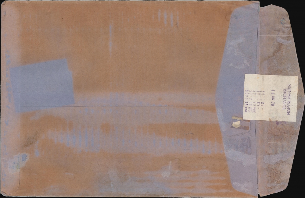
This map was created and published by Mike Roberts Color Productions c. 1970. The present example was bought at one of the Vietnam Regional Exchanges (likely on November 14, 1970), operated by the Army and Air Force Exchange Service in Vietnam from 1965 until 1975. An earlier edition was published in 1966 which was dated. Four examples of the 1966 edition are cataloged in OCLC and are part of the institutional collections at Cornell University, the Newberry Library, the Wisconsin Veterans Museum Research Center, and the National Library of Australia.Cartographer
Mike Roberts (19xx - 1989) was an American photographer and publisher, and was known as 'America's Postcard King'. Roberts left home at sixteen with twenty-five dollars, a box camera, and his Harley. Roberts arrived in the Bay Area in 1934 and began working as a photographer in Berkeley. By 1941 he was a partner in the Litho Screen Company in Oakland, which was also likely his first venture into the printing trade. Robert's first traceable postcard is postmarked June 12, 1945, and bears one of his photographs of the Yosemite Valley. Roberts used a handful of different publishers before he founded 'Mike Roberts Color Productions' in 1949, which marks his move into the world of commercial postcard production. Over the course of his career, Roberts used numerous different logos and his postcards were published by several different publishers. Roberts died in 1989 and his company continued operating until 1998. More by this mapmaker...
Condition
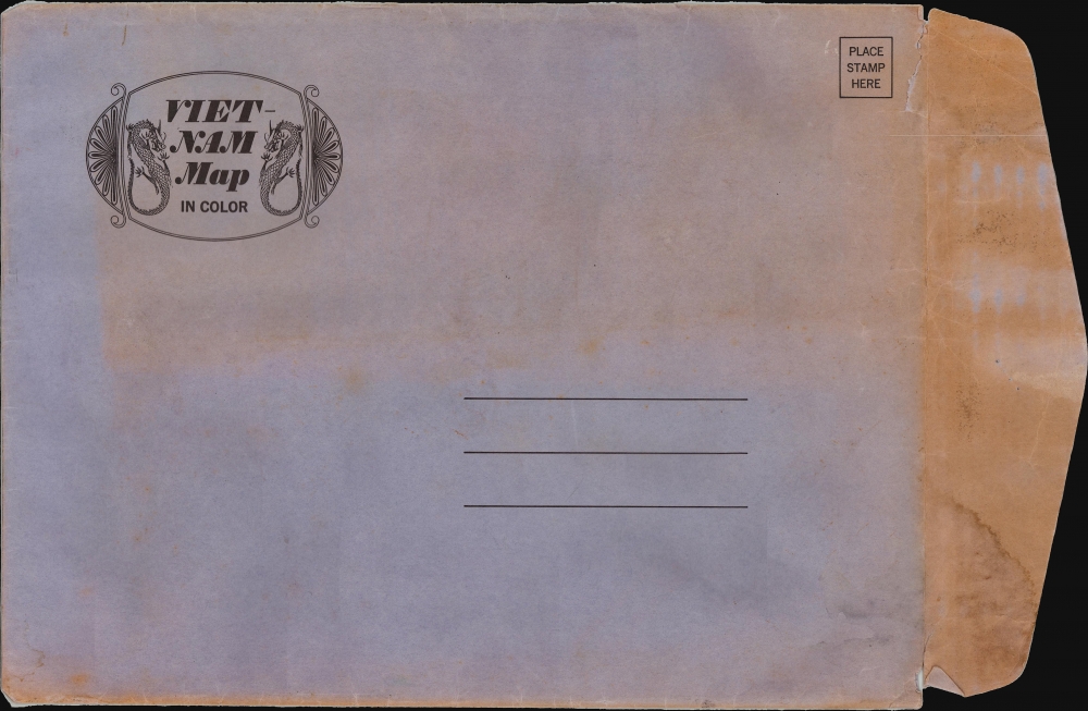
Very good. Exhibits light wear along original fold lines. Verso repair at small separation at a fold intersection. Accompanied by original envelope.
References
OCLC 63889108.