
1932 Hill / L'Auritzen Pictorial Historical Map of American Southwest


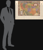
A Map of Exploration in the Spanish Southwest 1528-1793.
Californian Commemoration of the Spanish Empire.
- Digital Map Information
- Suitable for large format printing
- DPI: 600
- File Size: 114.66 MB
- File Type: ZIP / TIFF
- ICC color profile embedded
- Delivered instantly via download link
Californian Commemoration of the Spanish Empire.
This is a large-format 1932 pictorial map of the American Southwest, produced by the Automobile Club of Southern California. It is characteristic of the early 20th-century romanticization of the Spanish colonial era, which played an important part in the development of a distinctly Southern Californian identity. The map emerged during the Golden Age of American Pictorial Mapmaking.A Closer Look
The map covers from California to the Mississippi River and as far south as Texas and northern Mexico. Color-shading is used to distinguish U.S. states, highlighting the contradiction at the heart of this map, which aims to discuss the Spanish Colonial Era history of these lands from a modern (20th-century) American, and specifically Southern Californian, perspective. This idealization of the Spanish Colonial Era by a mostly Anglo-elite of Southern California was the same contradiction that led to the popularity of Spanish Revival architecture, literature on the 'romance' of the Spanish and Mexican eras of California, festivals such as the famous Ramona Pageant (first held in in Hemet, California in 1923), and a tourist interest in the Spanish missions of California, which were mostly forgotten and in a derelict state by the early 20th century.The map primarily highlights the routes and deeds of famous explorers, both overland and maritime, of the western part of North America, from Sir Francis Drake, to Sebastián Vizcaíno, to Gaspar de Portolá and Juan Bautista de Anza, who established a reliable overland route through California. Illustrations of several of these explorers and pioneers appear along the border of the map, along with key events in the Spanish history of the American Southwest, with pride of place given at the top to Junípero Serra, a Franciscan friar who established eight of the twenty-one Catholic missions in California. On the map itself, illustrations of animals, Native Americans, and ships and sea monsters appear, while settlements, waterways, some Native American groups, and the tracks of explorers are indicated. Much of the text is written in the elegant style of early modern engraved maps. Surrounding the map and illustrations, biographies of the explorers are written.
Frontiers of the Spanish Empire
Although California today has a global cultural, technological, and economic reach, it was but a far-flung frontier of New Spain in colonial times. Much of the modern American Southwest was likewise an area where the writ of Mexico City, let alone Madrid, had limited reach. The Spanish intermittently traded and fought with the various native groups in New Mexico and established a handful of settlements there, but otherwise did not venture often into the vast arid landscapes surrounding it. But by the late 18th century, Spain was concerned that the northern part of its American colonial empire was vulnerable to seizure by a rival foreign power, and sent expeditions to establish a more permanent presence in Alta California. Simultaneously, Catholic religious orders, especially the Franciscans, became interested in establishing a series of missions throughout Alta California. Although Mexican independence cut these efforts short, the eleventh-hour Spanish interest in Alta California did leave an enduring legacy, which is celebrated, if somewhat selectively, in this work.Publication History and Census
This map was compiled by Joseph J. Hill, edited by Phil Townsend Hanna, and drawn by Dillon Lauritzen. It appeared as a supplement to the January 1932 ACSC publication Touring Topics. The map is held by about 20 institutions in the OCLC and appears on the market occasionally.Cartographers
Dillon Theodore Lauritzen (January 14, 1904 - May 27, 1952), also stylized as L'Auritzen, was an artist, illustrator, and art director active in California and Illinois. Born in Salt Lake City, Utah, he moved to Los Angeles in 1917. Lauritzen began illustrating for the Automobile Club of Southern California (ACSC) in 1924, with his work appearing in Touring Topics and other ACSC magazines. Lauritzen became the Art Director at the ACSC in 1933, a position he held until his death. He primarily worked in water color paintings and had his work displayed at several events of the American Water Color Society. He also won the National Art Director Award for his work with the ACSC. Lauritzen married Thelma Marie Logan in 1926 and the two remained married until his death. Further Details...
Phil Townsend Hanna (August 24, 1896 - June 1, 1957), a lifelong Angelino, was an author, historian, and longtime public relations director for the Automobile Club of Southern California (ACSC). Born in Los Angeles, Hanna attended Polytechnic High School and then the University of Southern California. After graduating, he worked as the automobile editor of the Los Angeles Tribune, then worked for the Los Angeles Times, and the Los Angeles Bureau of the Associated Press. In 1926, Hanna became the editor of the ACSC magazine Touring Topics, later renamed Westways and by 1941 was in charge of public relations for the entire ACSC. He also wrote several books on Californian, Mexican, and Latin American history, including California Under Twelve Flags and The Dictionary of California Land Names, and published translations of Mexican and South American literature. Hanna also served as director of the California Library Council and the Friends of the Huntington Library, was a trustee of the Southwest Museum (Southwest Museum of the American Indian), and was an active member of several California historical and cultural clubs. Further Details...
The Automobile Club of Southern California (1900 - Present) is an auto club based in Los Angeles, California and an affiliate of the American Automobile Association (AAA). Founded in 1900, it was one of the first auto clubs in the United States and was dedicated to proposing traffic laws, improving road conditions, and the overall improvement of driving conditions. The Auto Club began producing its own maps in 1910, when it sent out its own team of cartographers to survey the state's roads. Its main office at the corner of Figueroa Street and Adams Boulevard was completed in 1923. Numbering nearly 8 million members in its home territory alone, today it is the largest single member of the AAA federation Further Details...
Condition
Very good. A few minor edge reinforcements.
References
OCLC 228716898, 21808989, 1336160596. Starr, K., Inventing the Dream: California Through the Progressive Era, (New York: Oxford University Press) 1986.