This item has been sold, but you can get on the Waitlist to be notified if another example becomes available, or purchase a digital scan.
1860 Garnier Map of the Earth as a Sphere
SphericiteTerre-garnier-1860$162.50

Title
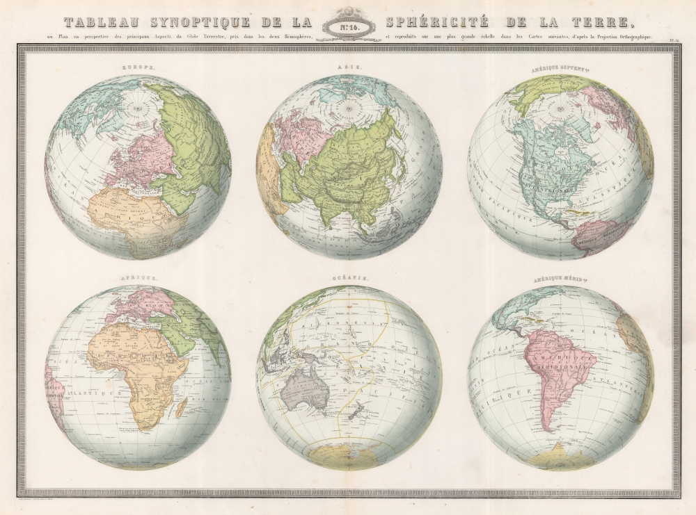
Tableau Synoptique de la Sphéricité de la Terre ou Plan en perspective des principaux Aspects du Globe Terrestre, pris dans les deux Hémisphères, et reproduits sur une plus grande échelle dans les Cartes suivantes, d'après la Projection Orthographique.
1860 (dated) 21 x 28 in (53.34 x 71.12 cm) 1 : 70000000
1860 (dated) 21 x 28 in (53.34 x 71.12 cm) 1 : 70000000
Description
This is the 1860 F. A. Garnier map of the Earth in a visual summary of the Earth's sphericity from multiple angles.
A Closer Look
The map comprises six globes on a single sheet, each taking a different angle to cover Europe, Africa, Asia, Oceania, North America, and South America.Publication History and Census
This map was drawn by F. A. Garnier and published by Veuve Jules Renouard in 1860 in Garnier's novel Atlas Spheroidal et Universel de Geographie. We note a single cataloged example, at the David Rumsey Map Collection. The map appears on the market occasionally.CartographerS
F.A. Garnier (1803 - 1863) was a French cartographer who published the Atlas sphéroidal et universel de géographie in 1862 as his only work. It is said that he spent fifteen years creating the maps for the atlas. More by this mapmaker...
Jules Renouard (February 13, 1798 - February 20, 1854) was a prosperous French book dealer, editor, publisher, and bibliographer. Renouard was born in Paris, the son of revolutionary, industrialist-politician, and book dealer Antoine-Augustin Renouard (1765 - 1853). He studied at the Lycée Louis-le-Grand. Graduating he relocated to London to peruse a career in banking, but by 1826, inherited his fathers book business. Renouard was a founding member of the Cercle de la Librairie (Book Dealers' Association) founded in 1847. Learn More...
Source
Garnier, F. A., Atlas Spheroidal et Universel de Geographie, (Paris: Veuve Jules Renouard) 1862.
Condition
Very good. Verso repair to a centerfold separation. Closed edge tears professionally repaired on verso.
References
Rumsey 5023.014.