This item has been sold, but you can get on the Waitlist to be notified if another example becomes available, or purchase a digital scan.
1915 Faires Map or Plan of Spokane, Washington
SpokaneWashington-faires-1915$50.00

Title
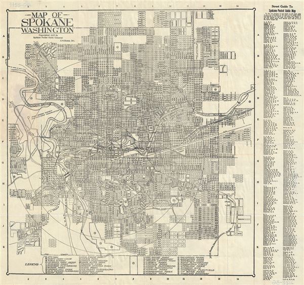
Map of Spokane Washington.
1915 (dated) 17.5 x 19 in (44.45 x 48.26 cm)
1915 (dated) 17.5 x 19 in (44.45 x 48.26 cm)
Description
This is a 1915 map or city plan of Spokane, Washington by D. M. Faires. It covers the city of Spokane and vicinity. Shows the Spokane River passing through the city. The map is highly detailed, noting individual streets, bridges, cemeteries, etc. The Fort George Washington U.S. Military Reservation is noted. A street guide is included along the right margin. The bottom contains a legend noting the various parks, playgrounds and government offices located on the map. This map is copyrighted 1915 by the Spokane Pocket Guide Company.
Condition
Very good. Minor wear along original fold lines. Minor print crease, lower left quadrant.