This item has been sold, but you can get on the Waitlist to be notified if another example becomes available, or purchase a digital scan.
1937 Map of Springfield, IL, Hometown of Abraham Lincoln
SpringfieldIL-unknown-1937$125.00

Title
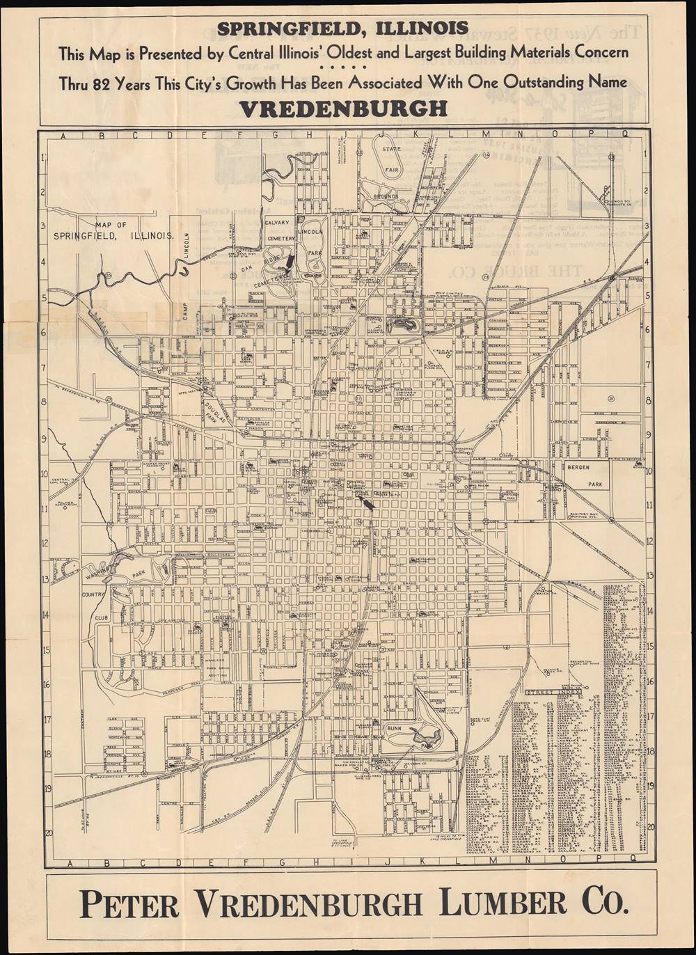
Map of Springfield, Illinois.
1937 (undated) 22.25 x 16.25 in (56.515 x 41.275 cm) 1 : 20500
1937 (undated) 22.25 x 16.25 in (56.515 x 41.275 cm) 1 : 20500
Description
This is a very rare 1937 map of Springfield, Illinois, incorporated into an advertisement for Peter Vredenburgh Lumber Co. The map highlights important sites around the city, especially those connected to Abraham Lincoln, who resided in Springfield when he began his legal and political career.
Aside from sites associated with Lincoln, schools, hospitals, police stations, fire stations, and certain businesses are also highlighted. Railroads crisscross the map, converging at depots or at Union Station near the center of the city. The state capitol complex, the state supreme court, and the governor's mansion are also prominently displayed at center.
Though he lost to Douglas in 1858, Lincoln had become a national figure, especially popular in the western states where his (somewhat embellished) image as a frontiersman garnered support. He was less popular in the northeast, where abolitionism was strong, because he was seen as too moderate on the slavery issue (though he is remembered as 'the Great Emancipator,' Lincoln's position in the 1860 election was to prevent the spread of slavery to new states, but not to abolish it in the South). After leaving Springfield to attend his inauguration, Lincoln would never return to the city alive. Following his assassination, Lincoln's funeral train returned his body to Springfield to be buried in Oak Ridge Cemetery (at top-left).
A Closer Look
This map covers the entire urban area of the Illinois state capital and includes a grid in the margins which corresponds with a street index at bottom-right. Numbered circles are spaced out evenly in rows, though it is unclear what these refer to and they may just be a basic means of dividing up the city. Sites connected with Abraham Lincoln are emphasized, with arrows pointing out Lincoln's former home, the Lincoln Monument (also known as the Lincoln Tomb), and the Lincoln Presidential Library. Stephen Douglas, a U.S. Senator from Illinois and Lincoln's opponent in their famous 1858 debates, is also memorialized in Douglas Park, towards top-left (in 2020, the park was renamed due to Douglas's tacit support of slavery and is now called Duncan Park in honor of Col. Otis B. Duncan, a decorated African American World War I veteran from Springfield).Aside from sites associated with Lincoln, schools, hospitals, police stations, fire stations, and certain businesses are also highlighted. Railroads crisscross the map, converging at depots or at Union Station near the center of the city. The state capitol complex, the state supreme court, and the governor's mansion are also prominently displayed at center.
Springfield and the Legacy of Lincoln
This map was made a little over a century after Springfield's founding. Ironically, the city had originally been named Calhoun, after South Carolina Senator John Calhoun, an ardent advocate for slavery and a forerunner of the later secessionists who started the Civil War (the city was renamed Springfield in 1832). Abraham Lincoln lived in Springfield for nearly 25 years between 1837 and 1861, when he became president, and he helped to get the city designated as the state capital in 1839.Though he lost to Douglas in 1858, Lincoln had become a national figure, especially popular in the western states where his (somewhat embellished) image as a frontiersman garnered support. He was less popular in the northeast, where abolitionism was strong, because he was seen as too moderate on the slavery issue (though he is remembered as 'the Great Emancipator,' Lincoln's position in the 1860 election was to prevent the spread of slavery to new states, but not to abolish it in the South). After leaving Springfield to attend his inauguration, Lincoln would never return to the city alive. Following his assassination, Lincoln's funeral train returned his body to Springfield to be buried in Oak Ridge Cemetery (at top-left).
Publication History and Census
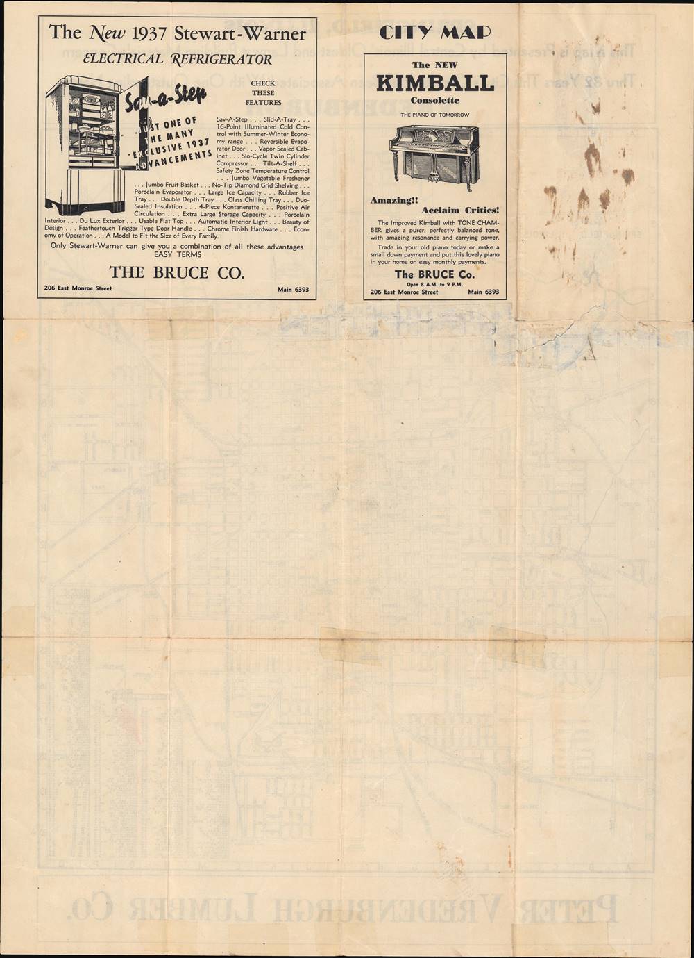
This map's primary purpose was as an advertisement for the Peter Vredenburgh Lumber Co. No publication information is available but based on the refrigerator advertisement on the verso (back), this map can be dated to 1937. The only other known example is held by the Abraham Lincoln Presidential Library in Springfield, who catalog it as having been published by William J. Winter.Condition
Good. Original fold lines visible. Previously repaired tear at top-center to left margin. Old tape visible on recto.
References
OCLC 26203132.