This item has been sold, but you can get on the Waitlist to be notified if another example becomes available, or purchase a digital scan.
1940 Ashok City Map or Plan of Srinagar, Jammu and Kashmir, India
Srinagar-ashok-1940$250.00

Title
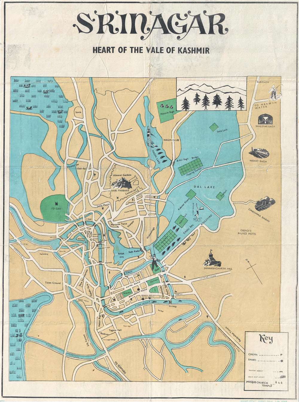
Srinagar Heart of the Vale of Kashmir.
1940 (undated) 21.75 x 16 in (55.245 x 40.64 cm) 1 : 24500
1940 (undated) 21.75 x 16 in (55.245 x 40.64 cm) 1 : 24500
Description
This is a c. 1940s Ashok city map or plan of Srinagar, the summer capital of Jammu and Kashmir province in India. The map depicts the city from the Parim Pora Bridge to Dal Lake and from Naseem Bagh and Burzhom to the Jehlum River. Situated in the stunning Kashmir Valley, Srinagar is one of the cities that has gained the moniker 'Venice of the East' due to the sheer number of lakes in its vicinity, including Dal Lake and Nagin Lake. Srinagar is also known for its houseboats, with houseboat agencies depicted by small icons. Several floating gardens are also illustrated in Dal Lake. Sites around the city are depicted by vignettes, including Chashma Shahi, Nishat Bagh, Shalimar Bagh, and the Hari Parbhat. Cinemas and banks are also noted, as are mosques, churches, and temples. Several locations throughout the city are also labeled on the map itself.
Census and Publication History
This map was created by Ashok and published in Delhi in the 1940s. We are not aware of any other known examples, as this map does not appear in the OCLC, making it an extremely rare find.Condition
Good. Backed on archival tissue for stability. Text on verso.