
1958 Soviet Ministry of Agriculture Wall Map of Stalino (Donetsk), Ukraine

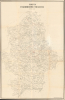
Карта Сталинской области / [Map of Stalino Oblast].
Catch up and overtake America!
$1,500.00
Choose a Collection:
This Item
Enquire
Catch up and overtake America!
A remarkable find, this is an unrecorded 1958 very large-format (5' x 3') map of Stalino Oblast (Donetsk Oblast) of Soviet Ukraine, produced by the Soviet Ministry of Agriculture. It presents the region during the height of Nikita Khruschev's agricultural modernization and production drive of the late 1950s. Today, this region is contested in an ongoing Russo-Ukrainian War (2014 - present).A Closer Look
The map covers the entirety of the oblast, with cities and towns, railways, and waterways labelled. The countryside is divided into its constituent state-run and collective units, which are named and preceded by a label or abbreviation indicating their nature (such as совхоз for state farm or с.х.арт for сельскохозяйственная артель, a specific and widespread type of collective farm, or kolkhoz). Handwritten annotations in red pencil appear around the city of Stalino (Donetsk) at the center and in the north of the oblast around Lyman (Кр. Лиман), suggesting that this map was used for the reorganization of some state-owned agricultural units.The toponyms used on this map are highly indicative of the era. The oblast itself was named Stalino when it was created in 1938, at the height of Stalin's cult of personality and purge of perceived enemies. Not long after this map's production, in 1961, it was renamed Donetsk as part of Khrushchev's Destalinization program. Likewise, the city of Mariupol (Мариуполь / Маріуполь) had been renamed Zhdanov (Жданов) in 1948, after Andrei Zhdanov (1896 - 1948), a Mariupol native and Stalin ally who died that year. In 1989, the historic name of Mariupol was restored. Nearby Primorskoe (Приморское) was also a neologism of the Stalin era, formerly and currently called Sartana (Сартана).
Historical Context
Donetsk and the wider Donbas were primarily known as a coal-producing and industrial region in late Tsarist and early Soviet times, but the region also boasts robust agricultural production. Under Stalin's industrialization drive beginning in the late 1920s, this area, as elsewhere in the Ukraine, suffered terribly from forced collectivization and the over-procurement of agricultural resources for cities and industry. The resulting famine (Holodomor) was also likely in part due to Stalin's perception of Ukraine as politically unreliable, duplicitous, and threatening. This disaster was quickly followed by another in the form of World War II (1939 - 1945), which further devastated Ukraine, with most of the cities and towns in the Donbas being depopulated and largely or completely destroyed. The city of Donetsk itself was hastily rebuilt in 1945 through the use of forced labor from Soviet-occupied, formerly German-aligned or allied countries in Eastern Europe, like Romania, Hungary, and Yugoslavia.The 1950s saw considerable readjustment from the extremely harsh policies of the Stalinist era. Nikita Khruschev (1894 - 1971), who was born in a village in nearby Kursk Oblast and had spent much of his political career in the Donbas, assumed power in 1953. Khruschev was seen as both a Ukraine expert and an agricultural expert, making this map particularly relevant during his tenure. He prioritized boosting agricultural production through modernization (sending several study delegations to the American Midwest) and by granting more autonomy to state-owned farms (sovkhozes) and especially to collectives (kolkhozes). These reforms were sensible, though some of Khruschev's other agricultural initiatives, such as the Virgin Lands Campaign and an obsession with matching America in corn production, wasted valuable resources.
In 1958, Khruschev was at the height of his power and popularity in the wake of Sputnik. Agricultural production peaked that year, and an emboldened Khruschev set an ambitious goal of surpassing the U.S. in milk, meat, and butter production, embodied in the phrase 'Catch up and overtake America!' (Догнать и перегнать Америку!). But the agricultural sector soon ran into problems, including misreporting by local officials eager to meet high production quotas. By the early 1960s, economic conditions had worsened due to the inefficient allocation of resources and drought, resulting in rising prices and unrest, an important factor in Khruschev's ouster in 1964.
Publication History and Census
This map was compiled in 1958 by the Land Management Department of Stalino Oblast (отделом землеустройства Сталинского областного) and printed by Workshop No. 3 of the Southern Enterprise of Agricultural Aerial Surveying of the USSR Ministry of Agriculture (abbreviated here as MCX). At top-left, the viewer is reminded to treat the map as equivalent to 'documents with strict reporting' (документы строгой отчетности), a high level of classification for very sensitive documents (all Soviet maps of this scale were classified at the time). At bottom-left, the print run for this map is noted as 50, yet the serial number at top-left is 'Copy No. 66,' suggesting a second printing, resulting in an actual print run of 100 or more. The gap in dates between the map's submission for production (February 6, 1958) and printing (November 15, 1958) also would support this interpretation. This map is unrecorded, even in major Russian collections (Russian State Library, National Library of Russia), and we are unaware of any other existing examples.Condition
Good. 4 sheets joined. Wear along original fold lines. Old repairs on verso. Light handwritten annotations.