This item has been sold, but you can get on the Waitlist to be notified if another example becomes available, or purchase a digital scan.
1853 Allen Map of Steamship Routes from England to India, Singapore, and China
SteamCommunicationtoAsia-allen-1853$1,750.00


Title
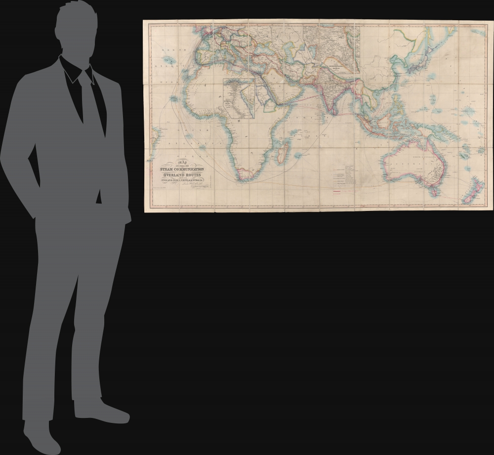
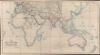
Map Showing the Steam Communication and Overland Routes between England, India, China and Australia.
1853 (undated) 28 x 51.5 in (71.12 x 130.81 cm) 1 : 20000000
1853 (undated) 28 x 51.5 in (71.12 x 130.81 cm) 1 : 20000000
Description
A striking 1853 large-scale map by W. H. Allen detailing both overland and steamship routes between England, India, Australia, and East Asia. It illustrates the height of the steamship trade between far-flung British colonies in the decades before the construction of the Suez Canal. The present example features numerous manuscript updates, some in pencil, tracing additional steamship lines run by Oriental-Lloyds-Shanghai and Eastern Atlantic. In addition, further highlighting in red illustrates telegraph lines.
A Closer Look
Centered roughly on British India, coverage embraces from Brazil to New Zealand and from England to Tasmania. The map focuses on commercial steamship lines from England to and around Africa, India, Australia, Singapore, and China. Seven lines were included when the map was printed, with three additional lines added in manuscript by one of the map's previous readers. In addition, it has been updated with bold red lines to illustrate the global telegraph network. Some of the additional manuscript work is in pencil, most is sloppy, and much of it is erasable, but we have left this content due to its considerable historical interest. There are additional inset maps focusing on Mesopotamia and the Nile Valley.Historical Context - Steamers to China
In 1818, the first steamship voyage between England and China was accomplished by the Maid of Judah, which sailed from London to Canton (Guangzhou) via the Cape of Good Hope. The voyage took 165 days, much faster than the usual 6 to 9 months by sail. It, nonetheless, was not until 1835 that a regular steamship route was established by the Peninsular and Oriental Steam Navigation Company, which ran from London to Alexandria, Egypt, and then on to Bombay (Mumbai), India, and Canton. By the late 1840s, the Peninsular and Oriental established regular fortnightly service. In 1869, the completion of the Suez Canal increased the volume, efficiency, and practicality of this voyage.Publication History and Census
This map was engraved by John Walker and published in London in 1853 by William H. Allen, likely for the British East India Company. The map is scarce. We note just three examples in institutional collections: the British Library, the National Library of Australia, and the State Library of New South Wales. The present example is made unique by numerous manuscript updates. It features a signature on the verso of one Seymour A. Slane, but we have been unable to pin this figure down.CartographerS
William Houghton Allen (April 14, 1788 - January 1855) was a bookseller and publisher in London, England. He was born in New Sleaford, Lincolnshire, England. Nothing is known of his early education, but he was admitted to the London Company of Stationers as a bookseller in 1817. Shortly afterwards, in 1818, he partnered with others to form 'Black, Kingsbury, Parbury and Allen'. This would evolve into Kingsbury, Parbury, and Allen (William Houghton Allen, Thomas Kingsbury, Charles Parbury) in 1822, and again into Parbury, Allen, and Co. in 1827. In 1835, he struck out on his or, partnering with his sons James Pearce Allen(1818 - 1878) and William Ferneley Allen (1816 - 1877) as 'W. H. Allen and Company'. As 'W. H. Allen, the firm established close ties with the British East India Company, who had offices nearby, also on Leadenhall Street. The firm later moved to 12 Waterloo Place. After Allen's death, the firm went through numerous acquisitions and mergers with the name 'W.H. Allen' persevering until 1991, when it was subsumed into Virgin Publishing. More by this mapmaker...
John Walker (1787 - April 19, 1873) was a British map seller, engraver, lithographer, hydrographer, geographer, draughtsman, and publisher active in London during the 19th century. Walker published both nautical charts and geographical maps. His nautical work is particularly distinguished as he was an official hydrographer for the British East India Company, a position, incidentally, also held by his father of the same name. Walker's maps, mostly published after 1827, were primarily produced with his brothers Charles Walker and Alexander Walker under the imprint J. and C. Walker. Among their joint projects are more than 200 maps for the influential Society for the Diffusion of Useful Knowledge Atlas (SDUK). In addition they published numerous charts for James Horsburgh and the British Admiralty Hydrographic Office, including Belcher's important map of Hong Kong and Carless' exploratory map of Karachi. The J. and C. Walker firm continued to publish after both Walkers died in the 1870s. Learn More...
Condition
Very good. Manuscript annotations throughout.
References
National Library of Australia, #3118313. OCLC 557744257.