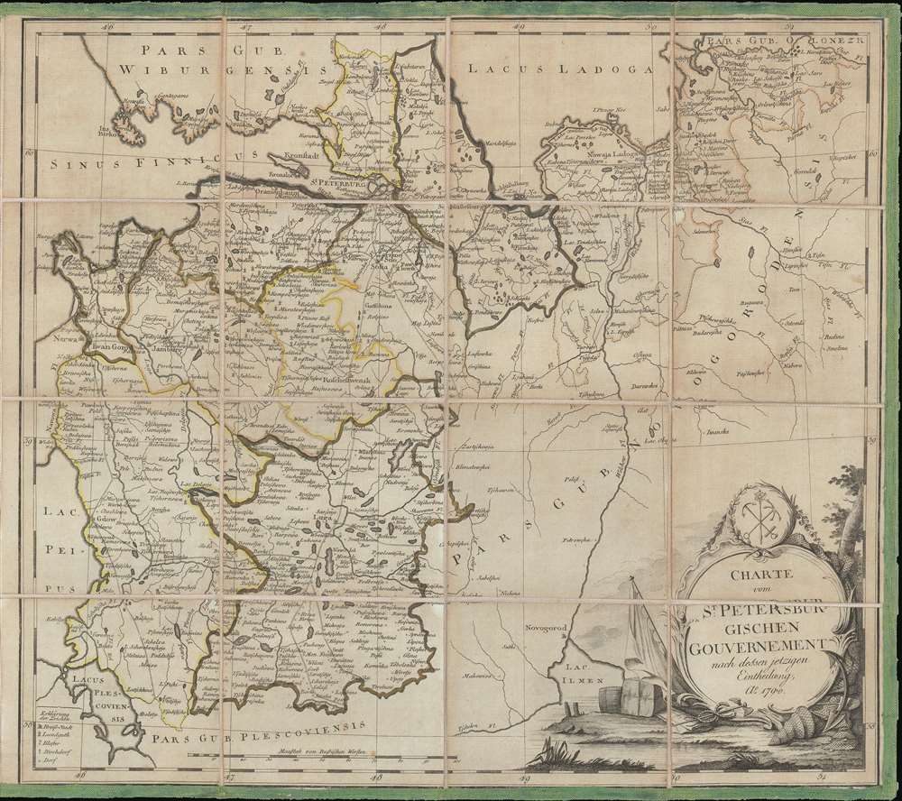
1790 Schlepper Map of the Environs of St. Petersburg, Russia
StPetersburg-schlepper-1790$1,000.00

Title
Charte vom St. Petersburgischen Gouvernement nach dessen jetzigen.
1790 (dated) 17.75 x 20.125 in (45.085 x 51.1175 cm) 1 : 700000
1790 (dated) 17.75 x 20.125 in (45.085 x 51.1175 cm) 1 : 700000
Description
This is a 1790 I.D. Schlepper map of the environs of St. Petersburg. The map depicts the region surrounding St. Petersburg from Lake Ladoga to Lake Ilmen and Lake Peipus and from the Gulf of Finland and Lake Peipus to Kapizkoi, northeast of Novgorod. Highly detailed, myriad cities, towns, and villages are labeled throughout, including St. Petersburg and Novgorod. Different counties are outlined in different colors to allow for easy differentiation. Roads are illustrated, as are rivers and lakes.
In 1790, Catherine the Great was entering the last years of her reign, having ruled as the Empress of Russia since 1762. Known as the Catherinian Era, this is considered to be the Golden Age of Russia. An age of Russian expansion, Catherine reigned from the Winter Palace in Saint Petersburg, and oversaw an era in which Russia became recognized as one of the great powers of Europe.
In 1790, Catherine the Great was entering the last years of her reign, having ruled as the Empress of Russia since 1762. Known as the Catherinian Era, this is considered to be the Golden Age of Russia. An age of Russian expansion, Catherine reigned from the Winter Palace in Saint Petersburg, and oversaw an era in which Russia became recognized as one of the great powers of Europe.
Census and Publication History
This map is extremely rare. Examples are held in two institutional collections: one is at the Bayerische StatsBibliothek in Munich and the other is held by the National Library of Russia in St. Petersburg. We have been unable to locate a record of this map previously entering the private market.Condition
Very good. Dissected and mounted on linen in 16 panels. Blank on verso.
References
OCLC 164587532. National Library of Russia 010112843.