This item has been sold, but you can get on the Waitlist to be notified if another example becomes available, or purchase a digital scan.
1950 Van Sciver City Map or Plan of St. Petersburg, Florida
StPetersburg-vansciver-1950$175.00

Title
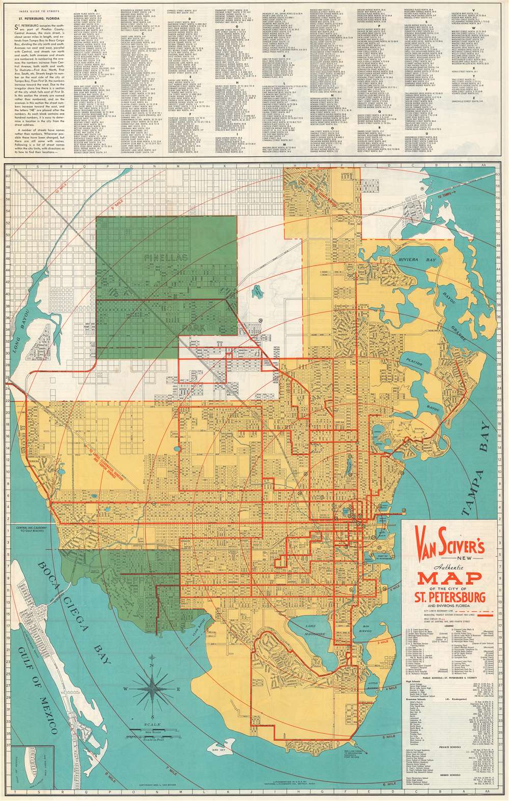
Van Sciver's New Authentic Map of the City of St. Petersburg and Environs Florida.
1950 (undated) 33.5 x 21.25 in (85.09 x 53.975 cm) 316680
1950 (undated) 33.5 x 21.25 in (85.09 x 53.975 cm) 316680
Description
This is a c. 1950 George L. Van Sciver city map or plan of St. Petersburg, Florida. The map depicts the region from Saint Petersburg Beach and the Gulf of Mexico and from the Gandy Bridge to Pinellas Point. Highly detailed, myriad streets and avenues are illustrated and labeled throughout the city. Bayous, lakes, and creeks are labeled as well. Thirty-nine locations are numerically identified on the map and correspond with an index situated along the right border just below the title. Among these sites are post offices, fire stations, hospitals, municipal facilities, and city parks. An index of public schools, private schools, and negro schools is situated just below the index of city buildings as well. An alphabetical street index is included along the top border.
Publication History and Census
This map was copyrighted by George L. Van Sciver and printed by the National Lithograph Company c. 1950.Condition
Very good. Even overall toning. Light wear along original fold lines. Map of central St. Petersburg and text on verso.