1920 Dutch East Indies Tourist Bureau Map of the Padang Highlands in Sumatra
Sumatra-touristbureau-1920$200.00

Title
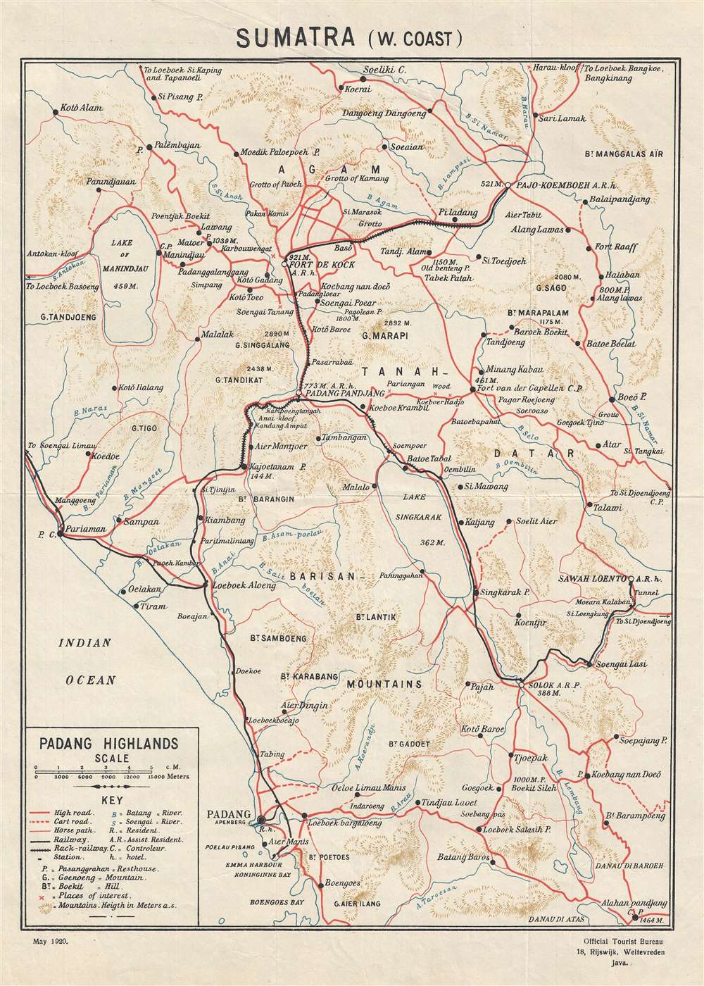
Sumatra (W. Coast)
1920 (dated) 16.5 x 11.75 in (41.91 x 29.845 cm) 1 : 300000
1920 (dated) 16.5 x 11.75 in (41.91 x 29.845 cm) 1 : 300000
Description
This is a 1920 Dutch East Indies Official Tourist Bureau map of the Padang Highlands in Sumatra. The map depicts the region from the Indian Ocean and the Lake of Manindjau to Sawah Loento and from Soeliki to Boengoes Bay. Numerous cities, towns, and villages are labeled throughout the region. Three different grades of road are illustrated: a high road, a cart road, and a horse path. Railways are also included. Padang itself if situated near the center of the bottom border, very close to the map's key. Rivers, lakes, and mountain peaks are also noted, and the elevation of most of the mountain peaks are given in meters.
This map was created for the Dutch East Indies Official Tourist Bureau and published in 1920.
This map was created for the Dutch East Indies Official Tourist Bureau and published in 1920.
Condition
Very good. Light wear along original fold lines. Verso repairs to fold separations. Blank on verso.