1925 Map of North Sydney and Mosman, Australia
Sydney-unknown-1925$400.00

Title
North Sydney / Mosman.
1925 (undated) 14.75 x 13 in (37.465 x 33.02 cm) 1 : 19000
1925 (undated) 14.75 x 13 in (37.465 x 33.02 cm) 1 : 19000
Description
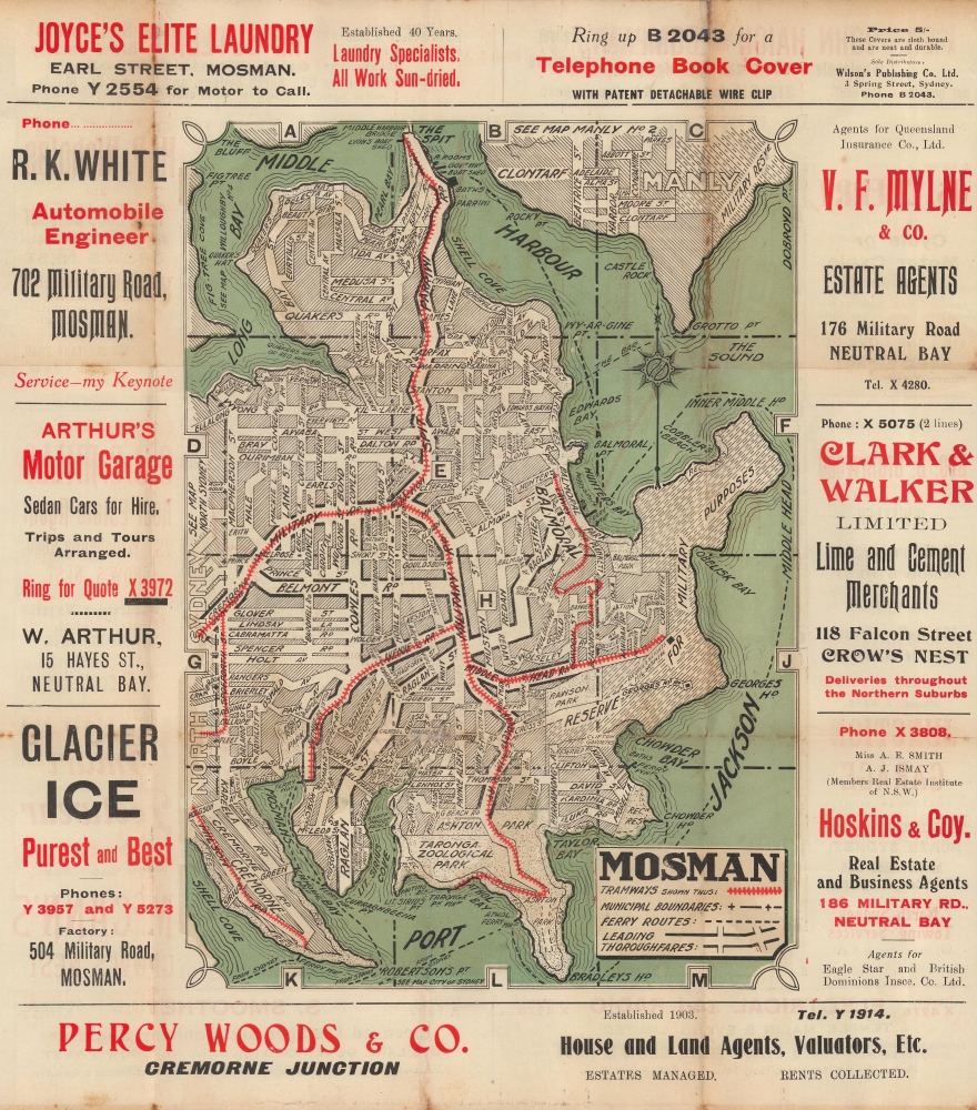
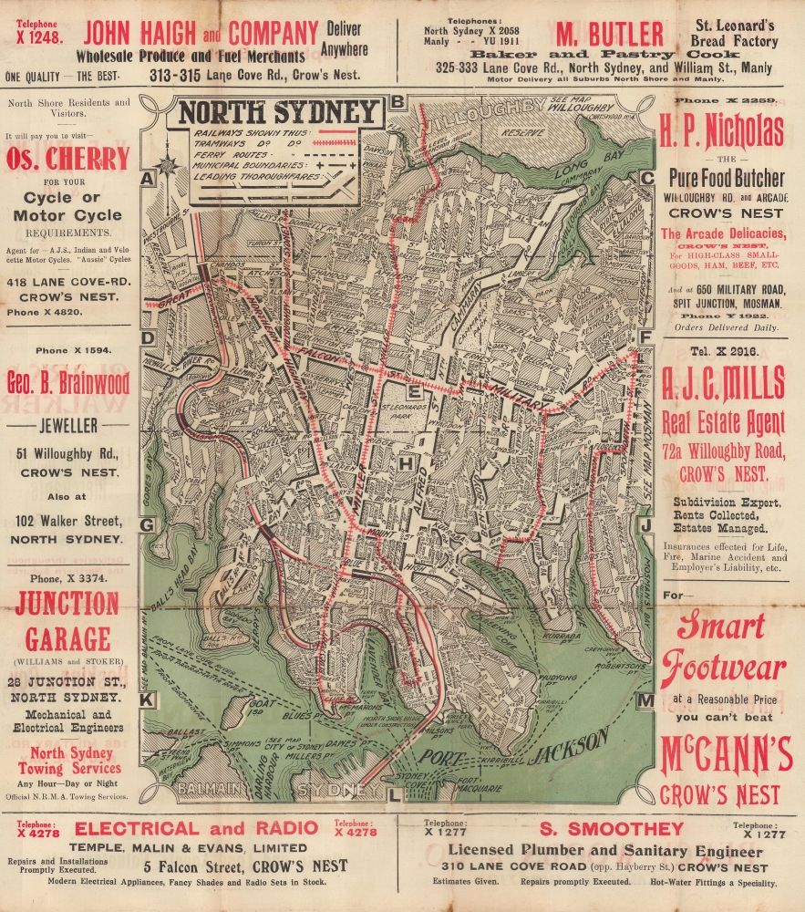
A curious two-sided c. 1925 map of Mosman and North Sydney, suburbs of Syndey, Australia. Together, the maps give a sense of the development of the Lower North Shore, which both necessitated and was further facilitated by the construction of the Syndey Harbour Bridge.
A Closer Look
One side of the map displays the suburb of Mosman, with roads, tramways, ferry lines, parks, military land, and other features (including the Taronga Zoological Park) noted. The reverse side includes a similar map of North Sydney, notable for the density of trams and the North Shore Line railway running through the suburb (in the late 19th century, Syndey was home to the second largest tram network in the British Empire / Commonwealth, after London). Also significant is the presence of the Syndey Harbour Bridge (here under construction and labelled as 'North Shore Bridge'), an impressive feat of engineering and one of Australia's most famous landmarks. Both maps are surrounded by letters forming a grid laid into a border, as well as advertisements, mostly relating to automobiles and real estate.Publication History and Census
This map was produced by an unknown creator around the year 1925. Though undated, the labelling of the Syndey Harbour Bridge as 'under construction' indicates a date between 1923 and 1932, consistent with other features on the map. Notes that refer to other maps (for example, 'See Map City of Sydney') suggest that the present sheet was part of a larger series. We have been unable to locate any other examples of this map in institutional holdings or on the market.Condition
Good. Wear and soiling along fold lines.