This item has been sold, but you can get on the Waitlist to be notified if another example becomes available, or purchase a digital scan.
1932 Township of Tel-Aviv Bilingual English and Hebrew City Plan or Map of Tel Aviv
TelAviv-technicaldepartment-1932$175.00

Title
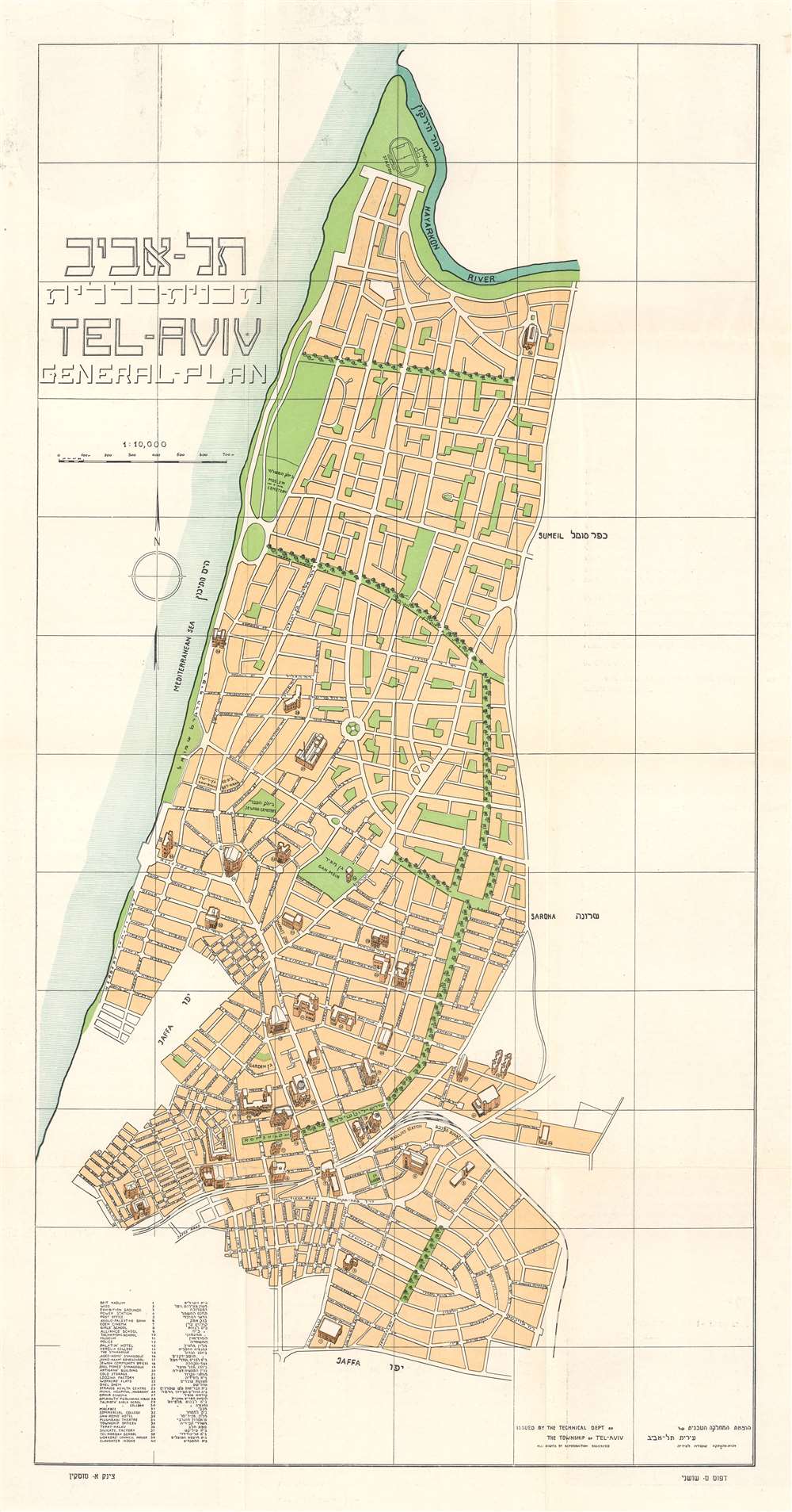
.תל - אביב תכנית -- כללית / Tel-Aviv General-Plan.
1932 (undated) 24 x 12.25 in (60.96 x 31.115 cm) 1 : 10000
1932 (undated) 24 x 12.25 in (60.96 x 31.115 cm) 1 : 10000
Description
This is a c. 1932 Technical Department of the Township of Tel-Aviv bilingual English and Hebrew city plan or map of Tel Aviv. Published during the era of British Mandatory Palestine, the map depicts the city from the Hayarkon River to Jaffa. Major streets in the center of town are labeled in both English and Hebrew. The city's green spaces stand out to the viewer. Two of these spaces are identified as cemeteries: one Jewish and one Muslim. Thirty-eight locations, drawn in the monumental pictorial style, appear throughout the city and are numerically labeled. These numbers correspond with an index situated in the lower left corner.
Publication History and Census
This map was created and published by the Technical Department of the Township of Tel-Aviv c. 1932. We have not located any other cataloged examples.Condition
Very good. Exhibits light wear along original fold lines. Text in Hebrew and English on verso.