1876 Walker Map of Tenafly, Palisade, New Jersey
TenaflyPartof-walker-1876$175.00

Title
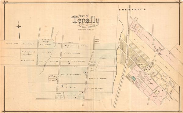
Part of Tenafly, Palisade Township.
1876 (undated) 16.75 x 27.25 in (42.545 x 69.215 cm)
1876 (undated) 16.75 x 27.25 in (42.545 x 69.215 cm)
Description
Vividly detailed 1876 map of Tenafly, Palisade Township, New Jersey, showing roads and property owners' names. Published as plates 88-89 in Walker & Pease' exquisite 'topographical, illustrated, historical, descriptive' Atlas of Bergen County, New Jersey, 1876. Similar maps of Demarest, Overton and New Milford appear on verso.
Source
Walker, A. H., and Pease, C. C. Atlas of Bergen County, New Jersey, 1876.
Condition
Good. Even overall toning. Original centerfold exhibits some wear and in verso reinforcement. Minor discolorations here and there. Edge wear mostly confined to margins.
References
Phillips (Atlases) #2152.