1940 Kroll Map Company Map of Alaska
TerritoryAlaska-kroll-1940-2$300.00
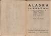

Title
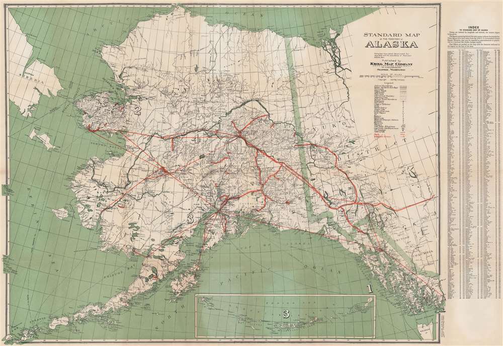
Standard Map of the Territory of Alaska.
1940 (undated) 25.5 x 37.5 in (64.77 x 95.25 cm) 1 : 3000000
1940 (undated) 25.5 x 37.5 in (64.77 x 95.25 cm) 1 : 3000000
Description
An impressive piece, this is a c. 1940 Kroll Map Company map of Alaska. The map illustrates the territory before it became a state (1959) and just prior to World War II (1939 - 1945), in which Alaska played a significant role. Coverage extends from Siberia to the Yukon Territory, and from the Arctic Ocean and the town of Barrow to Unalaska. Cities and towns are identified throughout, including Anchorage, Juneau, Seward, and Fairbanks.
Road Network
The map lavishes attention on the state's road network. Roads are illustrated in several different ways, based upon quality. Some are denoted by solid parallel red lines, while others, like the Valdez-Fairbanks Auto Road, wagon roads, and sled roads, a variety of black lines. The Valdez-Fairbanks Road is solid black, while the sled roads are illustrated using parallel dashed lines.Other Transportation Networks and Resources
Proposed air routes through Alaska, which must have been a priority given the global political climate of 1940, are marked by solid red lines. Alaska's seemingly unending natural resources are cataloged, with notations for marble, tin, gold, copper, coal, and oil. An inset map of the Aleutian Islands from Umnak to Attu appears along the bottom border. A town index is situated along the right border, locating each by its coordinates.Publication History and Census
This map was created and published by the Kroll Map Company c. 1940. We note eight cataloged examples in OCLC, in the collections at Yale University, Harvard College, University of Minnesota - Twin Cities, the Denver Public Library, the University of Alaska Fairbanks, Georgia Southern University, the University of Oklahoma, the Buffalo and Erie County Public Library. We note another example at the David Rumsey Map Collection, Stanford.Cartographer
Kroll Map Company (1911 - Present) is a Seattle-based map company. Founded in 1911 when Carl Kroll acquired both Anderson Map Company and Washington Map and Blueprint Company, both of which had been in business since the 1870s. From its inception, Kroll Map Company has ‘focused on mapping for real estate and local government, custom mapping, and the publication of numerous general mapping products.’ Carl Kroll sold a half-share of the company to John Loacker, his close friend and employee, in 1920. Loacker then purchased the company outright in 1925. He maintained the feel of a family business by working with his son Waldemar, who eventually took over. Waldemar J. Loacker (April 16, 1902 - February 12, 1995) worked at Kroll for the rest of his life, only leaving the company after suffering a stroke in 1992. Then his son John Loacker (b. 1955), who began working at Kroll in his youth, officially inherited the business and continues operating it to this day. In 1999, Kroll Map Company and Metsker Maps of Seattle formed a partnership of ‘two historic Seattle businesses.’ Today, the Kroll Map Company creates custom maps for individuals worldwide. More by this mapmaker...
Condition
Very good. Exhibits wear along original fold lines. Verso repairs to fold separations and at fold intersections. Exhibits a small area of infill at a fold intersection.
References
Rumsey 8490.003. OCLC 18613614; 54640726.