This item has been sold, but you can get on the Waitlist to be notified if another example becomes available, or purchase a digital scan.
1938 Freeman Diazotype Map of Texas in 1836 (Proof State)
Texas-freeman-1938-2$750.00


Title
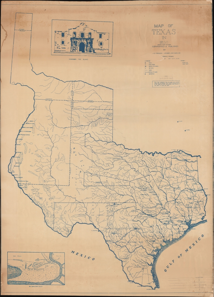
Map of Texas in 1836.
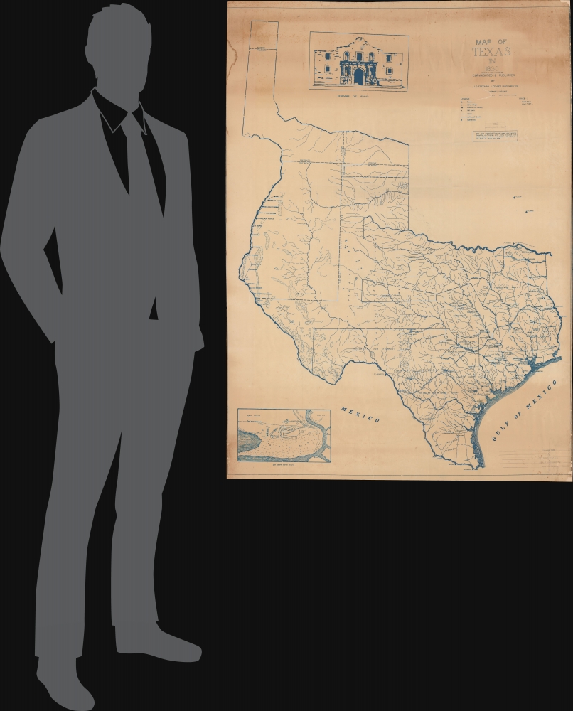
1938 (dated) 58.5 x 42.25 in (148.59 x 107.315 cm) 1 : 1267200
1938 (dated) 58.5 x 42.25 in (148.59 x 107.315 cm) 1 : 1267200
Description
A rare diaziotype map of Texas as it appeared in 1836, when Texas declared its independence. This example is especially notable as it is a proof state with manuscript corrections. The map was issued in 1938, the result of meticulous research in the Texas State Archives and General Land Office by John D. Freeman, surveyor.
This is a proof state of the map and several differences can be seen compared to the ultimate published state (previously sold by us). For instance, the scale ratio under the title crossed out here did not appear on the published state, while text that is outlined in pencil here appears in blue print on the published state.
Stephen F. Austin (1793 - 1836) took over his father Moses's grant and began an aggressive campaign to draw English speaking Protestant settlers to Texas. Austin's efforts were aided by the Mexican Provisional Government, who approved the 1824 General Colonization Law authorizing all heads of household who were citizens or immigrants to Mexico to claim land. After the law passed, the government was inundated with requests by foreign speculators to establish colonies - many of whom received grants of their own.
In the wake of the Panic of 1819, United States underwent an extended period of inflation marked by soaring land prices. Texas, with vast tracks of arable land, warm climate, and free grant system, became an extremely attractive prospect. Austin's drive to populate Texas with English speaking settlers was thus enormously successful. Conflicts between the English protestant 'Empresarios' and the Catholic Mexican government ultimately led to the secession of Texas and the Mexican-American War.
A Closer Look
Coverage embraces the full claims of the Republic of Texas, extending from Santa Fe to the Sabine River, and from the 'stovepipe' in modern-day Wyoming to the Rio Grande at Matamoras, Mexico. The map displays both the historic claims of the Republic of Texas and the overlaying configuration of modern states. It further marks the boundaries of various Empresario grants, including those of Austin, Burnet, and Robertson. Fortifications, roads, mineral resources, American Indian settlements, and ports are also named. An illustration of the Alamo appears at top-center. An inset detail map in the lower left focuses on the San Jacinto Battle Ground, site of the decisive battle of the Texas Revolution, near Galveston Bay.This is a proof state of the map and several differences can be seen compared to the ultimate published state (previously sold by us). For instance, the scale ratio under the title crossed out here did not appear on the published state, while text that is outlined in pencil here appears in blue print on the published state.
Republic of Texas
The Republic of Texas was a short-lived nation established in March 1836 when it seceded from Mexico. Following the independence of Mexico from Spain, the American Stephen Fuller Austin led a group of 300 Empresarios to settle Texas, near Austin, where they received a grant from the Mexican government. As more Americans moved to Texas, resentment and strife began to build between the American settlers and Mexican authorities. This and other factors ultimately led to the Texan Revolution in 1835 and the declaration of Texan independence in 1836. Texas remained an independent republic until it joined the United States ten years later in 1846.Texas Borders
The borders of the Republic of Texas were in dispute from the earliest days of the Texan Revolution. The Republic-claimed borders followed the Treaties of Velasco between the newly created Texas Republic and Mexican leader, Antonio López de Santa Anna. The treaties established an eastern boundary following the 1819 Adams-Onís Treaty between the United States and Spain, which established the Sabine River as the eastern boundary of Spanish Texas and the western boundary of the Missouri Territory. The Republic's southern and western boundary with Mexico was more nuanced. Texas claimed the Rio Grande del Norte as its western and southernmost border, while Mexico argued for a boundary much further east at the Nueces River. When Texas was annexed into the United States, the agreement followed the Republic claimed boundary, thus absorbing Mexican claimed territory as far west as Santa Fe. This escalated already existing tensions between the United States, the former Republic of Texas, and Mexico, ultimately triggering the Mexican-American War (1846 - 1848).Texas Empresario Land Grants
In the early 19th century Spain instituted a series of reforms intended to settle and develop Texas, the most significant of which occurred in 1820, when it began to allow colonists of any religion (previously they had to be Catholic) to settle. The only colonist to receive land under the Spanish system was Moses Austin (1761 - 1821), who claimed his grant in 1820, only to die a year later in 1821. In that same year, the Mexican War of Independence (1810 - 1821) ended with Mexican independence from Spain. The new Mexican government continued the reforms, instituting the Texas Empresario system.Stephen F. Austin (1793 - 1836) took over his father Moses's grant and began an aggressive campaign to draw English speaking Protestant settlers to Texas. Austin's efforts were aided by the Mexican Provisional Government, who approved the 1824 General Colonization Law authorizing all heads of household who were citizens or immigrants to Mexico to claim land. After the law passed, the government was inundated with requests by foreign speculators to establish colonies - many of whom received grants of their own.
In the wake of the Panic of 1819, United States underwent an extended period of inflation marked by soaring land prices. Texas, with vast tracks of arable land, warm climate, and free grant system, became an extremely attractive prospect. Austin's drive to populate Texas with English speaking settlers was thus enormously successful. Conflicts between the English protestant 'Empresarios' and the Catholic Mexican government ultimately led to the secession of Texas and the Mexican-American War.
Diazo Print or Whiteprint
The diazo print (whiteprint or diazo for short) is a photo reproductive technique best understood as a reverse cyanotype or blueprint. The process yields distinctive blue lines on white paper. Like cyanotypes, the diazo process gained popularity in architecture circles, where it was a simple and effective way to duplicate documents in the field. The earliest diazotypes appeared around 1880 and were adopted for military and field cartographic use from about 1895. The diazo process was commercialized in 1923, when the German firm, Kalle and Company, developed Ozalid, a patented diazo paper that made diazotyping even easier. By the 1950s, it supplemented cyanotypes as the reprographic technique of choice for technical drawings.Publication History and Census
This map was compiled by John Dorbrandt Freeman of Austin and drafted by H. B. Poff, Fort Worth. The present example was diaziotyped in 1938 from Poff's original manuscript. The map was reissued in a much-reduced format in the 1970s. Of this cyanotype example, we are aware of only one other known example - sold by Geographicus earlier this year. OCLC locates seven examples of the 1970s small format reissue.Cartographer
John Dorbrandt Freeman (February 18, 1898 - May 14, 1976) was a Texas surveyor, civil engineer, and historian. He is the husband of Delma Turnbow Freeman, a well-known genealogist and author. Freeman was born in Lampasas, Texas. For most of his life he was a self-employed licensed surveyor based in Austin and Fort Worth. He was also a hobbiest historian and in 1936-1938 issued a large map of Texas as it appeared in 1836. More by this mapmaker...
Condition
Average. Toning through, but especially strong in upper quadrants. Loss reinstated near title, top right corner, lower right corner, top left.