This item has been sold, but you can get on the Waitlist to be notified if another example becomes available, or purchase a digital scan.
1836 James / Lee Map of the Republic of Texas in the Year it was Founded
Texas-lee-1836$3,000.00

Title
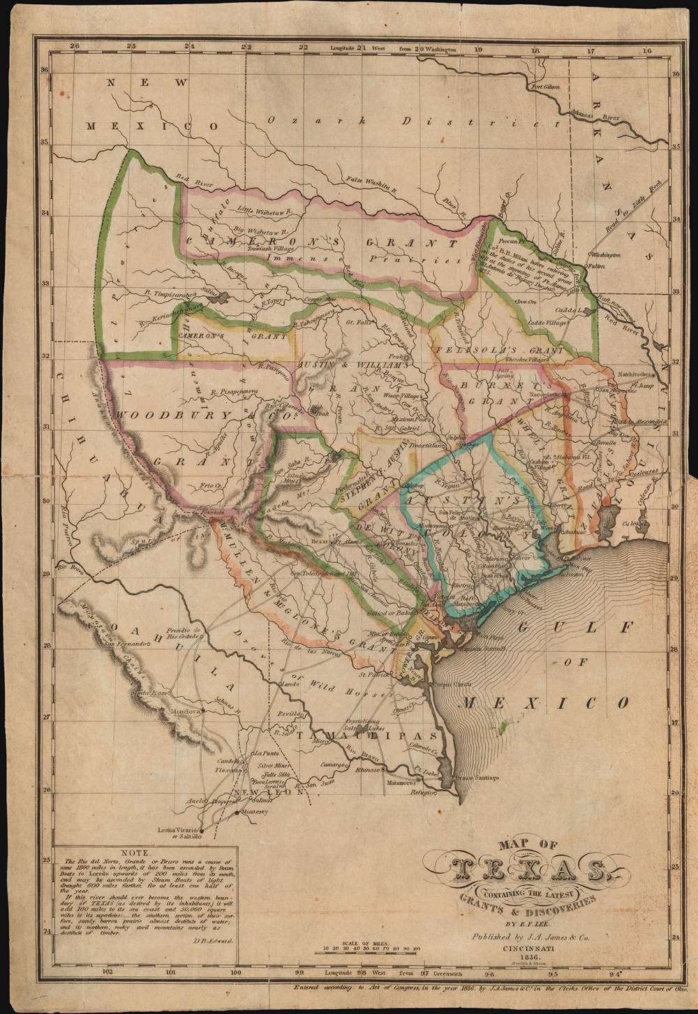
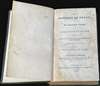
Map of Texas, containing the latest Grants and Discoveries by E. F. Lee.
1836 (dated) 13 x 9.25 in (33.02 x 23.495 cm) 1 : 4435200
1836 (dated) 13 x 9.25 in (33.02 x 23.495 cm) 1 : 4435200
Description
The rare 1836 Edmund F. Lee map of Texas and accompanying History of Texas by David Barnett Edward - a seminal work published on the eve of the March 1836 Texan Revolution and founding of the Republic of Texas. The map is loosely derived from the Stephen Austin map, the only readily available source at the time, but has been reduced and revised by Lee for smaller format publication. It unveils Texas extending from the Sabine to the Nueces River and from Corpus Christi to the Red River. A note in the lower left expresses the Texan ambition to extend the boundary west as far as the Rio Grande. The map notes several early Texas Empresario Land Grants, including: 'McMullen and McGlone', Woodbury, Cameron (2), 'Austin and Williams', Austin, DeWitt, Austin's Colony, De Leon, Burnet, Powers, Whelin, Zavallo, and Felisola.
Edward's History of Texas
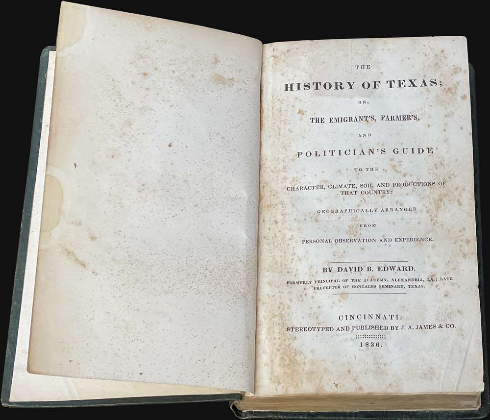
Here in its first edition (identifiable for the lack of advertisements), ex-library example, is David Barnett Edward's The History of Texas; or, The Emigrant’s, Farmer’s, and Politician’s Guide to the Character, Climate, Soil and Productions of That Country, considered 'One of the best accounts of Texas on the eve of the Revolution. The book attempts to be unprejudiced, but the author was clearly anti-Texan at heart.' (Basic Texas Books, page 53). According to Streeter (1199),This contemporary history by Edward, notwithstanding some idiosyncrasies of the author, is one of the essential Texas books. It gives a good account of the physical features and towns and products of the Texas of 1835, followed (pp. 142-176) by an excellent analysis of the colonization laws of the republic and state. Pages 177 to the end are devoted for the most part to the political events from 1832 to about October, 1835, with copious extracts from the New Orleans newspapers of December, 1835, on the ill-fated Tampico expedition of Mexia.His outspoken anti-Anglo-Texan sentiment forcing Edward out of Texas by 1835 - before this book was published. Later, Stephen F. Austin branded the book 'a slander on the people of Texas.' Edward by contrast maintained that American settlers in Texas had
Edward performs a useful service in giving lengthy verbatim extracts from many of the important documents of the period. He gives on pages 160-162 eighteen of the first thirty-two articles of the text of Decree 39 for the regulation of justice, first passed in 1827 and reprinted in 1831 (entry Nos. 720 and 720A), which is given in Kimball only by title, and is not reprinted in Gammel. Only one copy of the 1827 edition and one copy of the 1831 reprint are known. Edward also reprints, at pages 162-176, the entire text of the law of April 17, 1834, on the administration of the courts, which, as stated in the note to the law (entry No. 805), lacks, as reprinted in Kimball and Gammel, the important Section X at the end. He also reprints, with some changes in order and actual wording, the Constitution of 1833, first printed in New Orleans in 1833 (entry No. 1141), another pamphlet of great rarity not reprinted by Gammel, and other memorials and manifestos difficult to find in the original.
The map must have been lithographed as late as January, 1836, for it has a note on Milam’s death at the storming of Bexar by the Texans on December 10, 1835. The book was undoubtedly anathema to the local members of the Methodist Episcopal Church of Texas, for under a section, 'Abuses of Religion' (pp. 295-313), Edward tells some rather discreditable stories about several ministers of that denomination and gives their names. Gonzalez Seminary, an institution advertised in the Texas Gazette as early as October 16, 1830, was sponsored, or at least patronized, by the authorities of the Methodist Episcopal Church, so very likely Edward, in his remarks on Methodist clergymen, was paying off old scores. As noted in an earlier entry for Edward in the year 1834 (entry No. 1145), he, at that time when he was 'late Preceptor, Gonzalez Seminary, (Texas),' had already a copyright for 'Observations on Texas, embracing the Past, the Present, and the Future' but so far as we know his present History of Texas is his first publication on Texas. According to the preface Edward, a native of Scotland, had spent six months in Texas in 1830 as a member of an exploring expedition and from the title page of his book, copyrighted in 1836, he was at that time no longer a preceptor of Gonzalez Seminary.
by their perverse conduct, forfeited every claim to protection from the civil law; and therefore must either come under military control, or altogether be expelled from the [Mexican] Republic.
Texas Empresario Land Grants
In the early 19th century Spain instituted a series of reforms intended to settle and develop Texas, the most significant of which occurred in 1820, when it began to allow colonists of any religion (previously they had to be Catholic) to settle. The only colonist to receive land under the Spanish system was Moses Austin (1761 - 1821), who claimed his grant in 1820, only to die a year later in 1821. In that same year, 1821, the Mexican War of Independence (1810 - 1821) ended with Mexican independence from Spain. The new Mexican government continued the reforms, instituting the Texas Empresario system. Stephen F. Austin (1793 - 1836) took over his father Moses's grant and began an aggressive campaign to draw English speaking protestant settlers to Texas. Austin's efforts were aided by the Mexican Provisional Government, who approved the 1824 General Colonization Law authorizing all heads of household who were citizens or immigrants to Mexico to claim land. After the law passed, the government was inundated with requests by foreign speculators to establish colonies - many of whom received grants of their own. In the wake of the Panic of 1819, United States underwent an extended period of inflation marked by soaring land prices. Texas, with vast tracks of arable land, warm climate, and free grant system, became a very attractive prospect. Austin's drive to populate Texas with English speaking settlers was thus enormously successful. Conflicts between the English protestant 'Emprasarios' and the Catholic Mexican government ultimately led to the Succession of Texas (1836) and the Mexican American War (1846 - 1848).Texas Borders
In the lower left Edward adds an interesting note regarding the Texas ambition to expound the boundaries of Texas westward to the Rio Grande,If this river [Rio Grande] should ever become the western boundary of TEXAS (as desired by its inhabitants,) it will add 100 miles to its sea coast and 50,000 square miles to its superfices.Texas would indeed take this step in the coming months, with the Texan Revolution and the founding of the Republic of Texas. The borders of the Republic of Texas were in dispute from the earliest days of the Texan Revolution. The Republic-claimed borders followed the Treaties of Velasco between the newly created Texas Republic and Mexican leader, Antonio López de Santa Anna. The treaties established an eastern boundary following the 1819 Adams-Onís Treaty between the United States and Spain, which established the Sabine River as the eastern boundary of Spanish Texas and western boundary of the Missouri Territory. The Republic's southern and western boundary with Mexico was more nuanced. Texas claimed the Rio Grande del Norte as its western and southernmost border, while Mexico argued for a boundary much further east at the Nueces River. When Texas was annexed into the United States, the agreement followed the Republic claimed boundary, thus absorbing Mexican claimed territory as far west as Santa Fe. This escalated already existing tensions between the United States, the former Republic of Texas, and Mexico, ultimately triggering for the Mexican-American War (1846 -1848).
Republic of Texas
The Republic of Texas was a short-lived nation established in March of 1836 when it ceded from Mexico. Following the independence of Mexico from Spain, the American Stephen Fuller Austin led a group of 300 Empresarios to settle Texas, near Austin, where they received a grant from the Mexican government. As more Americans moved to Texas, resentment and strife began to build between the American settlers and Mexican authorities. This and other factors ultimately led to the Texan Revolution in 1835 and the declaration of Texan independence in 1836. Texas remained an independent republic until it joined the United States 10 years later in 1846.Note on Provenance
This is an ex-library copy, deaccessioned from the collections at the Stephen F. Austin State Teachers College in Nagadoches, Texas. The book must have been added to their collection sometime between 1930 and 1969, essentially between its founding and transition from 'college' to 'university'.Publication History and Census
This map was prepared for publication in David B. Edward's The History of Texas; or, The Emigrant's, Farmer's, and Politician's Guide to the Character, Climate, Soil, and Productions of that Country, one of the seminal early works on Texas. The map was drawn by E. F. Lee and published in Cincinnati by J. A. James. It can only have been published in January or February of 1836, as it notes Col. Benjamin Rush Milam's (1788 - 1835) death at the December 10, 1835 Texan storming of Bexar, but predates the March 1836 Texan Revolution. We note examples of the separate map at the Sam Houston State University and the Family History Library. The book is well represented institutionally, but it is unclear if the represented works are the first edition or a more common 1975 reissue. Scarce on the market.CartographerS
Edmund Francis Lee (1809 - July 18, 1857) was an American surveyor and civil engineer active in the early to mid-19th century. Lee is most famous for the 'Lee Map', the first survey of Mammoth Cave. Lee was born in Berlin, Connecticut and studied civil engineering at the American Literary, Scientific, and Military (A. L. S. M.) Academy. He relocated to Cincinnati, Ohio around 1835, where he drafted one of the first maps of Texas for Joseph A. James (1807 - 1882). Shortly thereafter he was contracted to chart the first 8 miles of Mammoth Cave. The subsequent map became the definitive map of Mammoth Cave until it was resurveyed in the 1880s. Subsequently in mid-1836, Lee relocated to Jeffersonville, Indiana where he taught geography, mathematics, drafting, surveying, and civil engineering in the newly formed Literary and Scientific Academy. He was apparently poorly suited to teaching, and resumed civil engineering, re-platting Jeffersonville and other towns in Kentucky in Indiana. In 1846 he was elected county surveyor of Louisville, Kentucky. In this position he completed, in 1850, a detailed topographical survey of Kentucky became the definitive map of the state throughout the Civil War (1861 - 1865). He also designed several cemeteries, including Cave Hill Cemetery, Louisville. More by this mapmaker...
David Barnett Edward (1797 - 1870) was a Scottish-American educator, administer and explorer most associated with Texas. Edward was born in Forfarshire, Scotland. He lived in the West Indies and Columbia before immigrating to the United States in 1819. He worked as a teacher at the Academy of Alexandria, Louisiana before being transferred to the Gonzales Seminary at the DeWitt Colony, Texas. Around 1830, Edward participated in an exploratory mission around Texas, during which he formed a generally negative view of the English-speaking Empresarios then settling Texas. His subsequent work, The History of Texas: or, The Emigrant's, Farmer's, and Politician's Guide to the Character, Climate, Soil and Productions of that Country, written from 1831 to late 1835, and issued early in 1836, was issued on the eve of the Texan Revolution (March 1836). The work is detailed and based on first-hand knowledge, but generally pro-Mexican, anti-Anglo-Texan, and while thus unpopular in its day, is today considered one of the seminal publications on Texas. Around 1835, Edward, hated in Texas for his work, moved to Cincinnati, Ohio. He lived here until his 1870 death in Wheelersburg. Learn More...
Joseph Allen James (May 17, 1807 - March 27, 1882) was a bookseller, engraver, stereotype founder, and publisher active in Cincinnati in the early to late 19th century. He was born in Newark, New Jersey. His firm, J. A. James and Company was based at 1 Baker Street, between Walnut and Vine. Additionally, he partnered with his brother, Uriah Pierson James (1811 - 1889) in 'J.A. and U.P. James Company', also a stereotype foundry. He was also a partner in the printing concern 'James and Gazlay'. James died at Fort Monroe, Virginia in 1882. Learn More...
Curtis Miller Doolittle (August 26, 1799 - June 1, 1849) was an American artist, printer, and engraver. He was born in Westfield, Connecticut, the son of Amos Doolittle (1776 - 1858). Based upon the dates, this is not Amos Doolittle (1754 - 1832) the great American engraver, but may be his son, 'A. B. Doolittle', making Curtis Miller Doolittle his grandson. He relocated to Cincinnati, Ohio, sometime in the 1830s. From 1836, he partnered with Samuel Bishop Munson (1806 - 1880), likely a cousin, to found the bank note and map engraving firm of 'Doolittle and Munson.' Learn More...
Samuel Bishop Munson (May 29, 1806 - April 18, 1880) was an American engraver based in New Haven, Connecticut and later Cincinnati, Ohio. Munson was born in New Haven, Connecticut and studied engraving under Simeon Smith Jocelyn (1799 - 1879). He relocated to Cincinnati in 1836, immediately establishing a business partnership with Curtis Miller Doolittle (1799 - 1849), 'Doolittle and Munson', engravers of maps and bank notes. In 1838, he married Hannah Selina Sellew (1814 - 1861). Learn More...
Source
Edward, David, The History of Texas; or, The Emigrant's, Farmer's, and Poitician's Guide... (Cincinnati: J. A. James and Co.) 1836.
Condition
Good. Overall toning. Some verso repairs to old seam splits and margin repairs.
References
OCLC 849516372. Day, James M., Maps of Texas, 1527-1900, #388. Howes, W., U.S.iana (1650-1950): A Selective Bibliography in which are Described 11,620 Uncommon and Significant Books Relating to the Continental Portion of the United States, #E-48. Sabin, J., A Dictionary of Books Relating to America: from its Discovery to the Present Time, #21886. Streeter (Texas) #1199. Storm, Colton, A Catalogue of the Everett D. Graff Collection of Western Americana, #1208.