This item has been sold, but you can get on the Waitlist to be notified if another example becomes available, or purchase a digital scan.
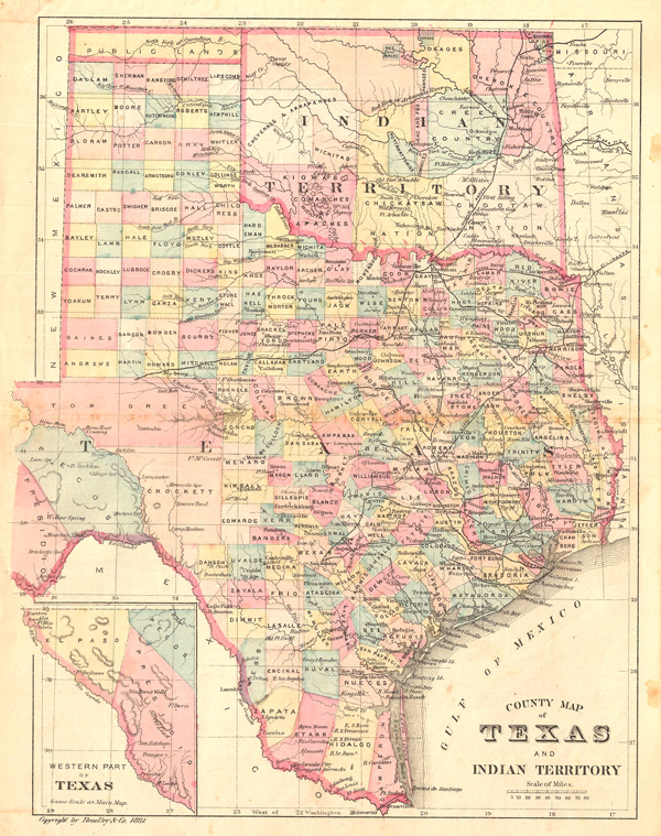
1881 Bradley Map of Texas and Indian Territory (Oklahoma)
TexasOklahoma-bradley-1881$100.00

Title
County Map of Texas and Indian Territory.
1881 (dated) 12 x 9 in (30.48 x 22.86 cm)
1881 (dated) 12 x 9 in (30.48 x 22.86 cm)
Description
This is an attractive county map of Texas and the Indian Territory (Oklahoma), showing counties in light pastels, roads, rivers, and relief shown by fine hachures. An inset in the lower right focuses on the western part of Texas. By William M. Bradley, from his Bradley's Alas of the World for Commercial and Library Reference, 1881.
Cartographer
Bradley, Garretson and Co. (fl. c. 1880 - 1900) were prominent cartographic publishers active in the later part of the 19th century. Bradley acquired Samuel Augustus Mitchell Junior's atlas plates in the late 1880s which he used to publish his own version of Mitchell's atlas. The firm had offices both in Philadelphia, at 66 North Fourth Street, and in Brantford, Ontario. More by this mapmaker...
Source
Bradley, W., Bradley's Alas of the World for Commercial and Library Reference, 1881.
Condition
Very good, light foxing and overall toning. Original centerfold, as issued.