This item has been sold, but you can get on the Waitlist to be notified if another example becomes available.
1962 Association Francaise de Geographie Pictorial Map of Hawaii
TourduMondeHawaii-geographie-1962$75.00

Title
Hawaï. Programme 'Tour du Monde'.
1962 (dated) 8.25 x 11 in (20.955 x 27.94 cm) 1 : 2150000
1962 (dated) 8.25 x 11 in (20.955 x 27.94 cm) 1 : 2150000
Description
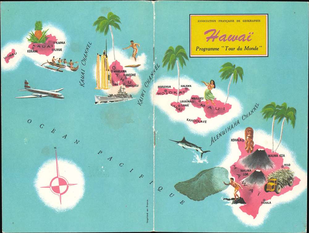
This is a 1962 Association Française de Géographie pictorial map of Hawaii. Part of the Association's Programme 'Tour du Monde', this beautiful piece would have been the cover for a short booklet about Hawaii. Pictorial vignettes highlight aspect of life in the Hawaiian Islands, including surfing, fishing, and hula dancing. Palm trees and pineapples evoke Hawaii's tropical climate and the King Kamehameha statue on Oahu reflects the archipelago's history. A battleship references the U.S. Navy's presence at Pearl Harbor and the modern airliner suggests the ease with which tourists could now visit this island paradise.
The Programme 'Tour du Monde'
The Programme 'Tour du Monde' began in 1960 and ran through 1968. It consisted of a series of booklets, each of which focused on a specific country (or in the case of the Hawaii booklet a part of a country). Over 100 different booklets were published over the course of the program.Publication History and Census
This map was created by Tallandier in Paris and published by the Association Française de Géographie in 1962. Two examples are cataloged in OCLC and are part of the institutional collections at the Bibliothèque Diderot in Lyon and the Bibliothèque nationale de France.Condition
Very good. Exhibits wear along original centerfold. Exhibits light soiling. Places where once bound with staples evident. Only the cover. The booklet is not present.
References
OCLC 494225697, 460802952.