This item has been sold, but you can get on the Waitlist to be notified if another example becomes available, or purchase a digital scan.
1945 'Uncle Sugar' Pictorial Map of the Tenth Air Force during World War II
TransientTenth-sugar-1945$150.00

Title
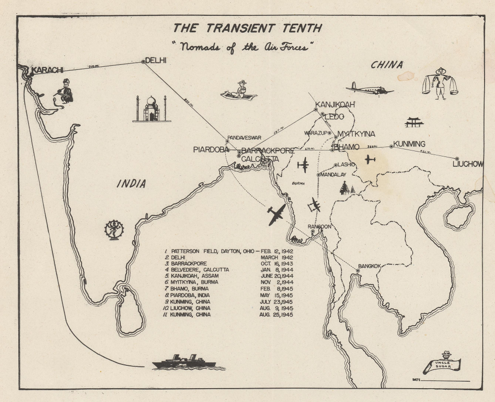
The Transient Tenth 'Nomads of the Air Forces.'
1945 (undated) 6.75 x 8.5 in (17.145 x 21.59 cm) 1 : 21000000
1945 (undated) 6.75 x 8.5 in (17.145 x 21.59 cm) 1 : 21000000
Description
This is a c. 1945 'Uncle Sugar' map of East Asia chronicling the movements of the Tenth Air Force during World War II (1939 - 1945).
A Closer Look
Depicting from Karachi, India (now Pakistan) to Liuchow (now Liuzhou), China, the map highlights 10 of the 11 command headquarters listed here. These include New Delhi, Calcutta, and Piardoba, India; Myitkyina and Bhamo, Burma; and Kunming and Liuchow, China. Solid black lines connect these cities with intervening distances in miles. Other identified cities include Rangoon, Mandalay, and Bangkok. The railroad between Rangoon and Mandalay is also illustrated. Airplane silhouettes appear alongside illustrations of the Taj Mahal and Chinese and Burmese temples. A snake charmer is illustrated near Karachi, and a U.S. soldier riding a magic carpet appears between Delhi and Kanjikoah.The Tenth Air Force during World War II
The Tenth Air Force was constituted on February 4, 1942, and activated on February 12, 1942, at Patterson Field in Dayton, Ohio (Wright-Patterson Air Force Base). Elements of the Tenth shipped out to India between March and May 1942. The Tenth was tasked to secure and maintain supply lines between India and China, known as 'the Hump', referring to the Himalayas. They operated this route until the Fourteenth Air Force took over in March 1943. The Tenth also provided close air support for Lieutenant General Joseph Stilwell's forces fighting the Japanese in India and Burma. They were transferred back to the United States on December 15, 1945, and deactivated on January 6, 1946.This map was drawn by an artist known only as 'Uncle Sugar' and published c. 1945. This is the only known cataloged example.
Condition
Good. Some soiling.