1966 Turkish Ministry of Tourism and Information Map of Turkey
Turkey-ministrytourism-1966$300.00

Title
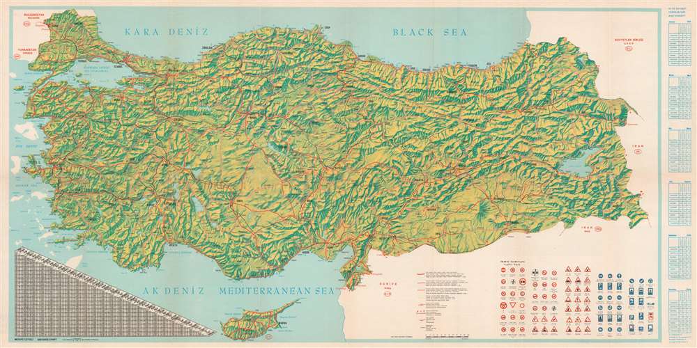
Turkey Panoramic Map.
1966 (dated) 19.25 x 38.5 in (48.895 x 97.79 cm) 1 : 1850000
1966 (dated) 19.25 x 38.5 in (48.895 x 97.79 cm) 1 : 1850000
Description
This is a 1966 Turkish Ministry of Tourism and Information bilingual English and Turkish panorama tourist map of Turkey. The country's mountainous terrain takes center stage, allowing the viewer a brief but comprehensive view of Turkey's topography. Three different types of red lines illustrate three different road grades, from hard-surfaced roads to 'loose surfaced roads of low standards,' which snake their way from one end of the country to the other and. The black lines represent railroads. A table on the lower right presents Turkish traffic signs to foreign visitors. A chart on the lower left details distances between Turkish cities, while a series of tables along the right border provide average temperatures and humidity levels for eight Turkish cities.
Publication History and Census
This map was created by APA OFSET of Istanbul for the Turkish Ministry of Tourism and Information in 1966. Two examples are cataloged in OCLC and are part of the institutional collections at the University of Pennsylvania in Philadelphia and Queen's University in Kingston, Ontario.Condition
Very good. Exhibits wear along original fold lines and slight loss at fold intersections. Verso repairs to fold separations and at fold intersections. Text and printed photographs on verso.
References
OCLC 767736011.