This item has been sold, but you can get on the Waitlist to be notified if another example becomes available, or purchase a digital scan.
1845 Ewing Map of the United States
UnitedStatesCanada-ewing-1845$75.00

Title
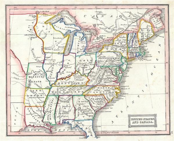
United States and Canada.
1845 (undated) 8 x 9.5 in (20.32 x 24.13 cm) 1 : 6300000
1845 (undated) 8 x 9.5 in (20.32 x 24.13 cm) 1 : 6300000
Description
This is a fascinating 1845 Thomas Ewing map of the United States including parts of Canada. The map covers the United States east of the Mississippi as well as the Trans-Mississippi territories of Louisiana, Arkansas and Missouri.
This ephemeral map details United States during a period of rapid development and westward expansion. Throughout the 1840s emigration and settlement to the west of the Mississippi led to a transformation of the national map. The present example focuses on the eastern portion of the country in the days just prior before the Mexican-American War. Texas, in 1846, would join the Union leading to U.S. invasion of Mexican California and the subsequent events of the Mexican-American War.
This map was published in 1845 by Oliver and Boyd as part of Ewing's New General Atlas.
Source
Oliver and Boyd, Ewing's New General Atlas: containing Distinct Maps of all the Principal States and Kingdoms throughout the World, (Edinburgh) 1845.
Condition
Very good. Minor foxing at places. Blank on verso.