This item has been sold, but you can get on the Waitlist to be notified if another example becomes available, or purchase a digital scan.
1875 Colton Pocket Railroad Map of the United States
UnitedStatesRailroad-colton-1875-2$375.00


Title
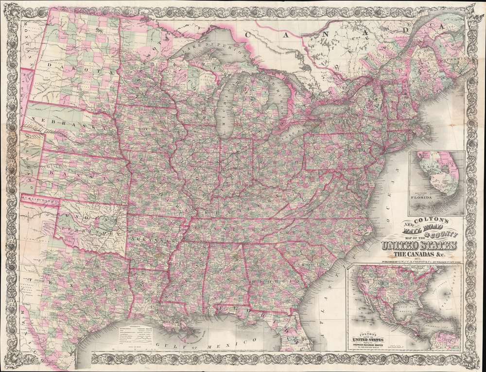
Colton's New Railroad and County Map of the United States the Canadas etc.
1875 (dated) 33 x 42.5 in (83.82 x 107.95 cm) 1 : 3041280
1875 (dated) 33 x 42.5 in (83.82 x 107.95 cm) 1 : 3041280
Description
An uncommon pocket map of the United States issued in 1875 by J. H Colton. This large map depicts most of the inhabited parts of the United States at the time, from Texas, Kansas, Nebraska, and Dakota eastward to the Atlantic. Colton offers a wealth of cartographic detail including counties defined by color coding and elevation rendered by hachure. The map includes railroad lines, towns, cities, and notations regarding various American Indian nations. Colton's choice to terminate the map on the eastern slopes of the Rocky Mountains (106th meridian) is suggestive of the fact that this is, in essence, a railroad map and the transcontinental railroad had yet to be completed when this map was first issued in 1860. An inset map in the lower right quadrant details the entire United States and offers more information regarding proposed railway lines extending to the Pacific. A further inset above the title details south Florida, identifying the then-young city of Miami, though no railroad had yet extended into the region. The whole is surrounded by a wide decorative vine motif border.
Publication History and Census
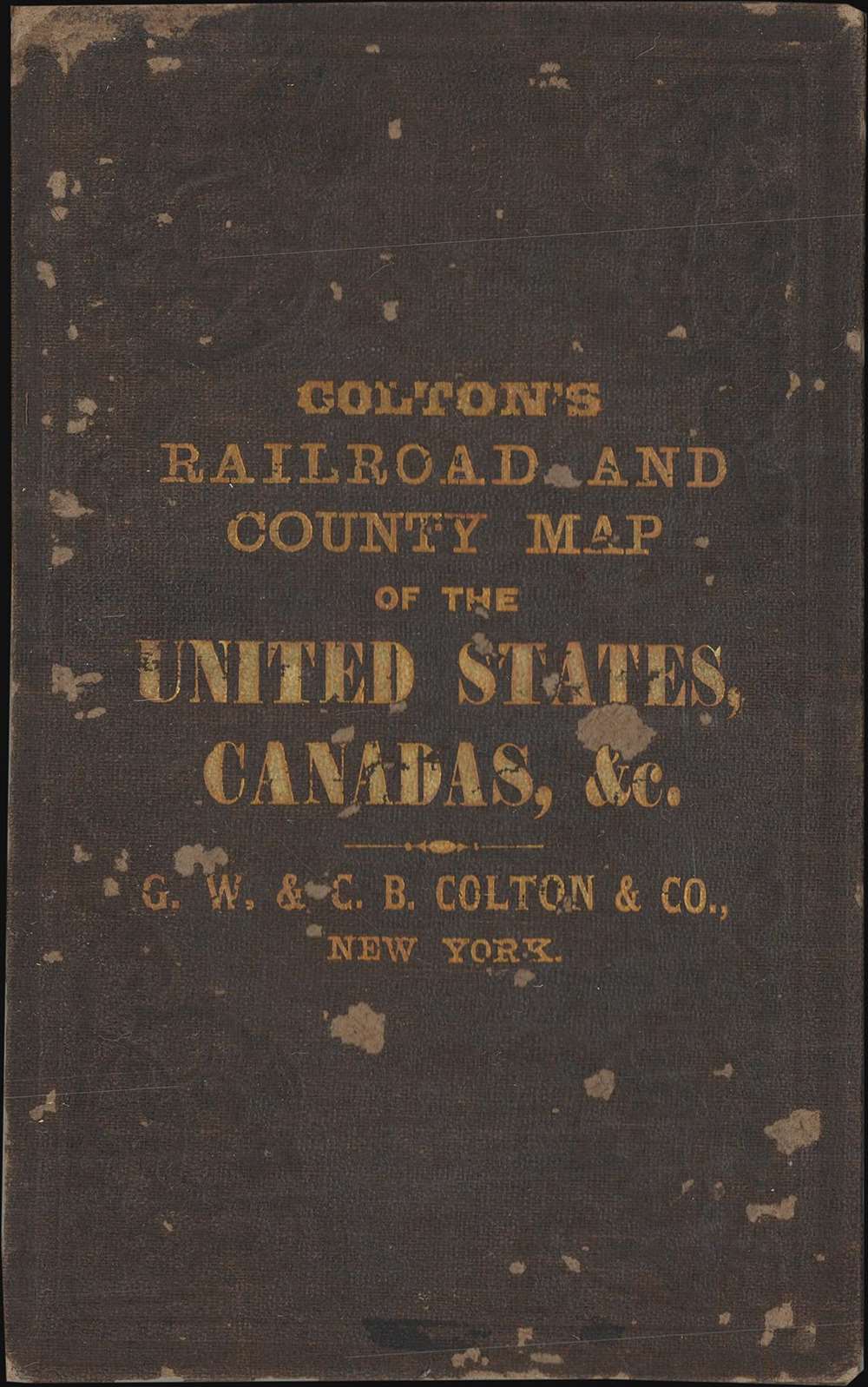
Colton first issued this map in 1860. Numerous reissues and updates followed including a dissected linen-backed British edition. The present example, 1875, is the latest example we have come across and among the scarcest of the series. In fact, we have been unable to locate any other examples of the 1875 edition. This map was published by G. W. and C. B. Colton from their office at 172 William Street, New York City.Cartographer
Joseph Hutchins Colton (July 5, 1800 - July 29, 1893), often publishing as J. H. Colton, was an important American map and atlas publisher active from 1833 to 1897. Colton's firm arose from humble beginnings when he moved to New York in 1831 and befriended the established engraver, Samuel Stiles. He worked under Stiles as the 'Co.' in Stiles and Co. from 1833 to 1836. Colton quickly recognized an emerging market in railroad maps and immigrant guides. Not a cartographer or engraver himself, Colton's initial business practice mostly involved purchasing the copyrights of other cartographers, most notably David H. Burr, and reissuing them with updated engraving and border work. His first maps, produced in 1833, were based on earlier Burr maps and depicted New York State and New York City. Between 1833 and 1855, Colton proceeded to publish a large corpus of guidebooks and railroad maps, which proved popular. In the early 1850s, Colton brought his two sons, George Woolworth Colton (1827 - 1901) and Charles B. Colton (1832 - 1916), into the map business. G. W. Colton, trained as a cartographer and engraver, was particularly inspired by the idea of creating a large and detailed world atlas to compete with established European firms for the U.S. market. In 1855, G.W. Colton issued volume one of the impressive two-volume Colton's Atlas of the World. Volume two followed a year later. Possibly because of the expense of purchasing a two-volume atlas set, the sales of the Atlas of the World did not meet Colton's expectations, and so, in 1856, the firm also issued the atlas as a single volume. The maps contained in this superb work were all original engravings, and most bear an 1855 copyright. All of the maps were surrounded by an attractive spiral motif border that would become a hallmark of Colton's atlas maps well into the 1880s. In 1857, the slightly smaller Colton's General Atlas replaced the Atlas of the World. Most early editions of the General Atlas published from 1857 to 1859 do not have the trademark Colton spiral border, which was removed to allow the maps to fit into a smaller format volume. Their customers must have missed the border because it was reinstated in 1860 and remained in all subsequent publications of the atlas. There were also darker times ahead; in 1858, Colton was commissioned at a sum of 25,000 USD by the government of Bolivia to produce and deliver 10,000 copies of a large format map of that country. Although Colton completed the contract in good faith, delivering the maps at his own expense, he was never paid by Bolivia, which was at the time in the midst of a series of national revolutions. Colton would spend the remainder of his days fighting with the Bolivian and Peruvian governments over this payment, and in the end, after a congressional intervention, he received as much as 100,000 USD in compensation. Nonetheless, at the time, it was a disastrous blow. J. H. Colton and Company is listed as one of New York's failed companies in the postal record of 1859. This led Colton into the arms of Alvin Jewett Johnson and Ross C. Browning. The 1859 edition of Colton's General Atlas lists Johnson and Browning as the 'Successor's to J. H. Colton' suggesting an outright buyout, but given that both companies continued to publish separately, the reality is likely more complex. Whatever the case may have been, this arrangement gave Johnson and Browning access to many of Colton's map plates and gave birth to Johnson's New Illustrated (Steel Plate) Family Atlas. The Johnson's Atlas was published parallel to Colton's atlases well into the 1880s. The Colton firm itself subsequently published several other atlases including an Atlas of America, the Illustrated Cabinet Atlas, the Octavo Atlas of the Union, and Colton's Quarto Atlas of the World. They also published a large corpus of wall maps, pocket maps, and guides. The last known publications of the Colton firm date to 1897 and include a map and a view, both issued in association with the Merchant's Association of New York. Alice M. Colton married August R. Ohman (May 3, 1859 - April 22, 1934) on January 5, 1897. In 1898, Ohman joined the Colton firm, which continued to publish as Colton, Ohman & Co. until 1901. More by this mapmaker...
Condition
Very good. Professionally flattened and backed with archival tissue.
References
Rumsey 4812.002 (1866), 0163.002 (1871). Not in OCLC.