This item has been sold, but you can get on the Waitlist to be notified if another example becomes available, or purchase a digital scan.
1900 Méliton Gonzalez Wall Map of Uruguay
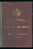
Uruguay-melitongonzalez-1900$2,500.00


Title
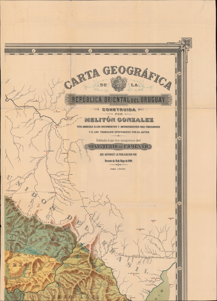
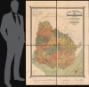
Carta Geográfica de República Oriental del Uruguay.
1900 (dated) 56 x 75 in (142.24 x 190.5 cm) 1 : 500000
1900 (dated) 56 x 75 in (142.24 x 190.5 cm) 1 : 500000
Description
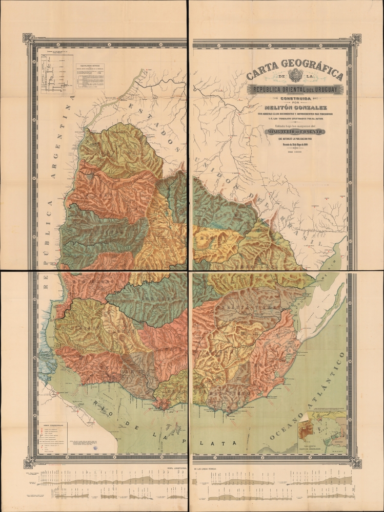
This is a spectacular, four sheet chromolithograph map of the Republic of Uruguay, published in 1900 in Montevideo by Melitón Gonzalez, Uruguay's Director of Public Works. This grand work captures Uruguay's push for modernization that characterized the end of the 19th century.
A Closer Look
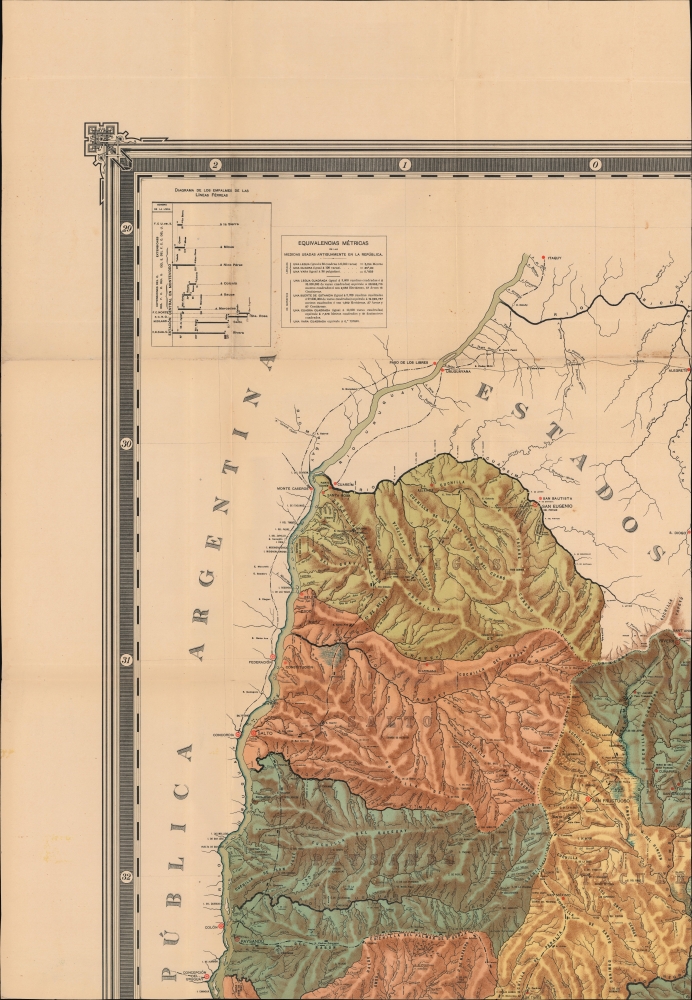
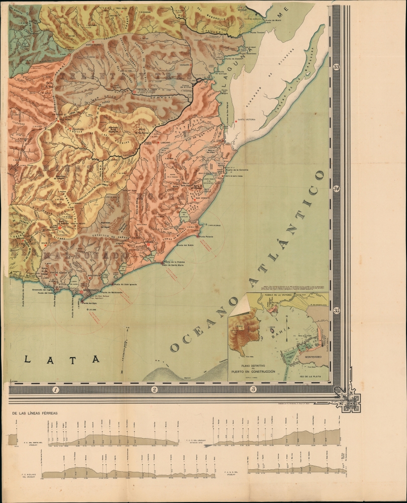
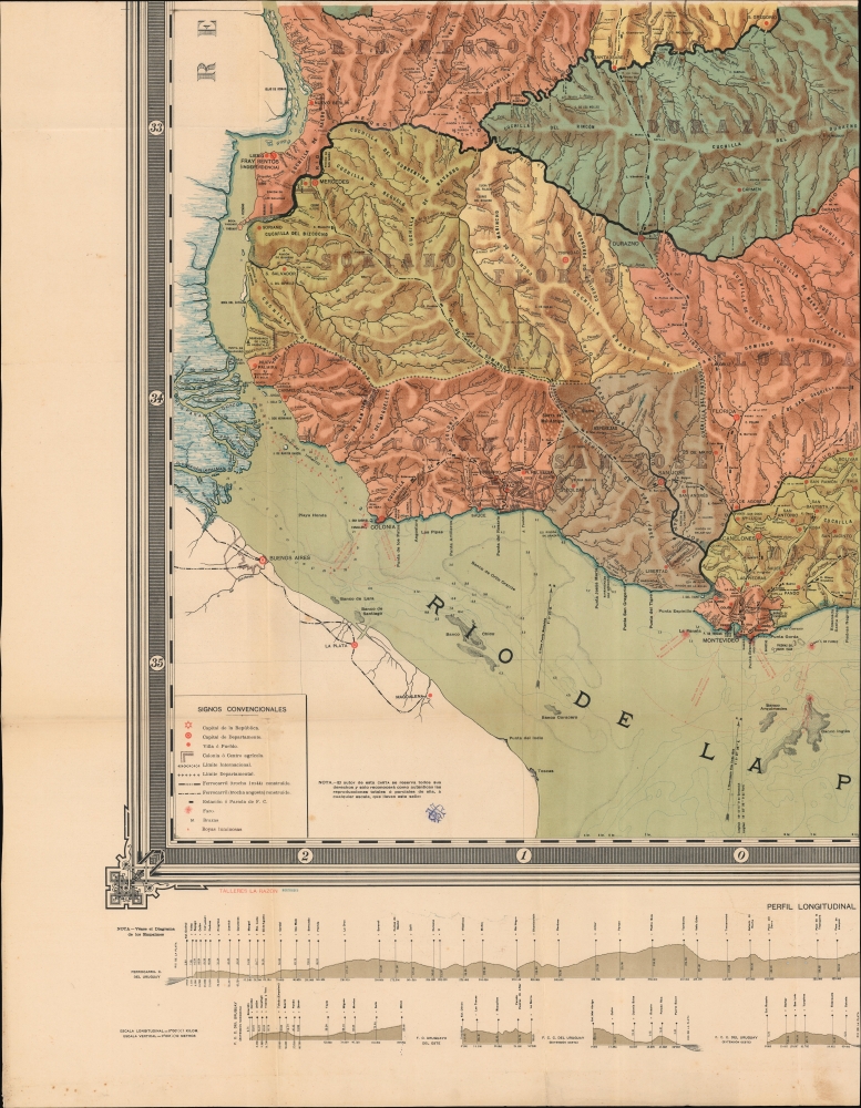
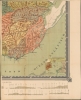
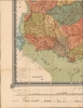
This monumental work presents a central map of the Republic, divided into departments detailed with topography, settlements, and roads. Completed railroads are marked, indicating those of standard gauge and those of narrow gauge. Diagrams along the bottom illustrate elevations along Uruguay's nine railway lines; a diagram at the upper left details railroad junctions. The modernization of Uruguay's waterways is also alluded to: lighthouses and illuminated buoys are marked along the coasts, detailing their height and their effective range. A detailed inset map focuses on Montevideo's port, still in its planning stages - the plan is entitled 'Definitive Plan of the Port Under Construction' (It was a long project, not actually completed until 1930).Historical Context
By the late 19th century, Uruguay was undergoing a nationwide transformation, moving on from its tumultuous early years into a period of consolidation and development. The political landscape, dominated by the Colorado party with the Nacional (Blanco) party as the only effective minority opposition, began to stabilize after decades of civil war, paving the way for social, economic, and infrastructure development. Even so, the era was characterized by authoritarianism. Nonetheless, this regime's focus on expanded agriculture and livestock farming, the construction of railroads, immigration, and urbanization led to sustained economic growth. Montevideo, the capital, became a cultural and commercial hub, reflecting the broader changes sweeping the nation. This period laid the groundwork for Uruguay's emergence as a modern state in the early 20th century.Agricultural Colonies
As part of the overall push for centralized development of the country, the government took the authority to create agricultural colonies organized from expropriated lands. Thus, public lands, occupied by tenants, could be used for the formation of agricultural colonies. Such colonies are here identified, with their borders distinctively marked. That the map employs a particular nomenclature and symbol for these expropriated lands indicates their importance: this is the first large scale map of the Republic we have seen to do so. We see one of these northwest of Montevideo: the Centro Agricola Supervielle near Libertad; nine colonies are concentrated in the area between Sauce and Santa Ecilda in southeastern Colonia province; and Colonia Díaz west of Mercedes. Another appears at the German immigrant settlement of Nuevo Berlin in the Rio Negro province, and the Islas de la Paloma in Tacuary province. Near San Eugenio in the North are the Colonias General Rivera, and Del Pintado.Chromolithography
Chromolithography, sometimes called oleography, is a color lithographic technique developed in the mid-19th century. The process involved using multiple lithographic stones, one for each color, to yield a rich composite effect. Oftentimes, the process would start with a black basecoat upon which subsequent colors were layered. Some chromolithographs used 30 or more separate lithographic stones to achieve the desired product. Chromolithograph color could also be effectively blended for even more dramatic results. The process became extremely popular in the late 19th and early 20th centuries when it emerged as the dominant method of color printing. The vivid color chromolithography produced made it exceptionally effective for advertising and propaganda imagery.Publication History and Census
This map is dated 1900, and was printed by Talleres La Razon in Montevideo on behalf of its author. The map is very rare: we see a single example recorded in OCLC, located in the British Library. This is the only example we are aware of in private hands.Cartographer
Melitón González (1837 - 1913) was an Uruguayan surveyor, administrator and author. He was born in Montevideo, but little else is known of his education or early life. He was appointed Director of Public Works in 1876, and between 1906 and 1913 he served as Director of the Topography Section of that Ministry. He also served as secretary of the Uruguayan legation in London - a position which led him into controversy. He leveled charges of corruption at the head of the legation, who was negotiating contracts for the construction of the new Port of Montevideo. For his troubles, he stood accused of treason. We do not see the result of this turmoil, but it cannot have lasted long as González's work continued quite unabated. In addition to his labor for Uruguay, he also produced important cartographic work for the Argentine Republic, where he served as Chief of Public Works of the Province of Entre Ríos, of which he drew a complete map, as well as the current province of Chaco. He published influential texts for geodesists and surveyors in 1877 and 1909. On the occasion of his work in the provinces of northern Argentina, he also wrote in 1887 a article on the Eastern limits of the territory of the Misiones (the portion of Argentina lying between Uruguay and Paraguay). In 1890 he wrote a volume, in connection with the Argentine Institute of Geography, El Gran Chaco Argentino - a description of the disputed western portion of the Rio de la Plata basin, much of which was established as part of Argentina following the War of the Triple Alliance. In 1879, Gonzalez appeared in a conference at the Rural Association of Uruguay. He produced a monumental map of Uruguay 'according to the most reliable documents and background and the work carried out by the author' which was published by Uruguay's Ministry of Development in 1900. More by this mapmaker...
Condition
Very good. Slight wear and toning along a few fold lines; few wormholes. Four sheets that fold into their original binder. Could be joined by a restorer.
References
OCLC 557803115.