1949 Gadbois and Ritter Cartoon Pictorial Map of the U.S.N.T.C. Great Lakes
USNTCChristmas-gadboisritter-1949$600.00


Title
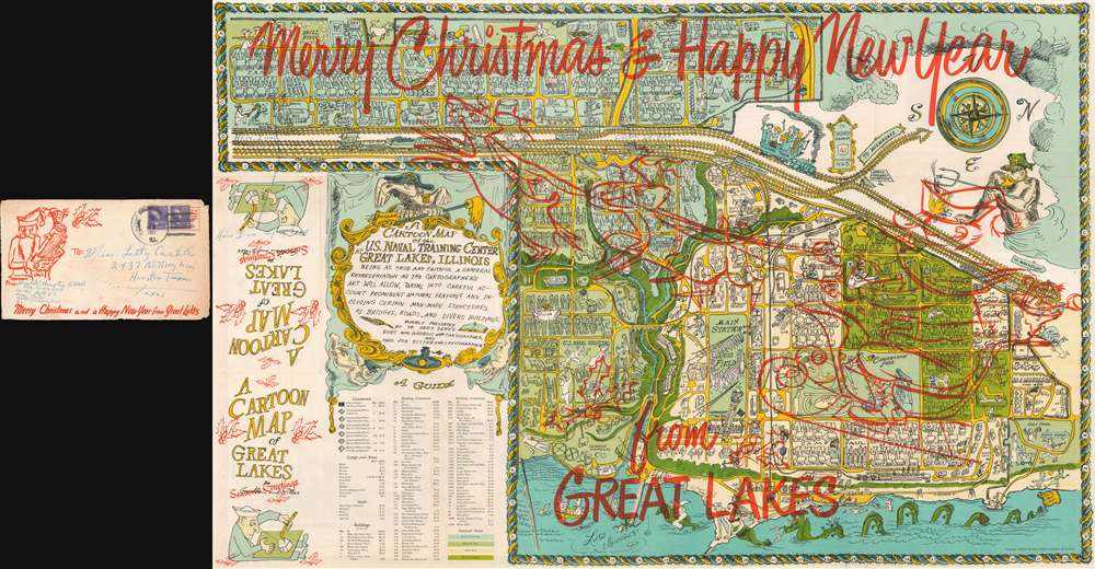
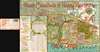
Merry Christmas! And Happy New Year! A Cartoon Map of the U.S. Naval Training Center at Great Lakes, Illinois.
1949 (dated) 22 x 34 in (55.88 x 86.36 cm)
1949 (dated) 22 x 34 in (55.88 x 86.36 cm)
Description
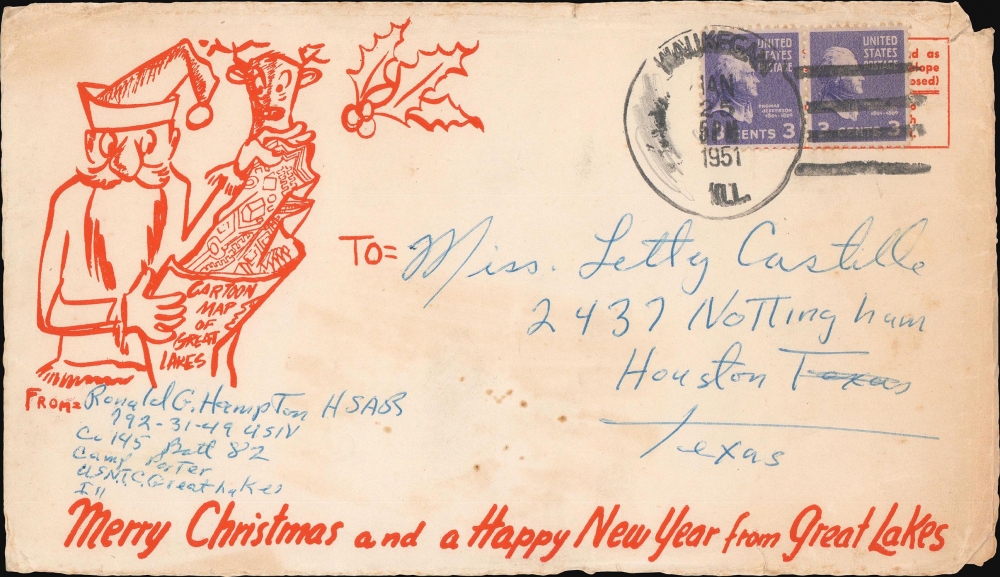
This is a 1949 Robert William Gadbois and Theodore J. Ritter cartoon pictorial map of the U.S. Naval Training Center Great Lakes. This example features overprinting wishing the viewer a 'Merry Christmas and Happy New Year from Great Lakes' and an illustration of Santa in his sleigh with some reindeer and holly.
A Closer Look
The map illustrates the Navy training center on the banks of Lake Michigan just north of Chicago, Illinois, from the east. Coverage embraces from Camp Porter to Foss Park and from the drill field to Lake Michigan. Numerous camps, set up to house the tens of thousands of men present at the camp at any one time, are identified (most of which are named after Naval heroes), including Camp Downes, Camp Dewey, Camp Barry, Camp Moffett, and Camp Paul Jones. Ross Field, across from the main railway station, is named after Captain Albert R. Ross, who supervised the base's construction. The Naval Hospital is also prominently labeled, complete with a patient drawn chasing a nurse. Other comic illustrations include a man in a striped suit, sailors playing ping pong, and another sailor drilling holes in the Drill Field. Others include a sea monster in Lake Michigan wearing a sailor's 'gob cap,' a sailor riding a gigantic sea horse, and another sailor being romanced by a mermaid. There's even an octopus using a fishing pole to fish off a pier! A large decorative cartouche is situated in the lower left quadrant, just above an index of over one hundred buildings located throughout the base.U.S. Naval Training Center Great Lakes
Naval Station Great Lakes was founded in 1905, and construction began that year. The base opened its gates on July 1, 1911. Great Lakes was then a fairly modest installation, occupying only 165 acres. By the end of World War I, in 1918, the base had grown to 1,200 acres, and over 125,000 sailors had passed through on their way to fight. After the war ended, the training of recruits slowed to a crawl and even halted for a while. The only major operations at the base were the air base and the Radio School. By 1940, however, with threats from both oceans, increased enlistments in the Navy were finally approved by Congress. Within ten months of the attack on Pearl Harbor, the base had grown from 172 acres to nearly 1,600, with seventeen separate camps in operation. By mid-1943, over 700 instructors were working at the base. Great Lakes was also the first naval installation to train African-American troops, although the base wouldn't be integrated until mid-1945. By the end of World War II, four million men were in uniform in the U.S. Navy, and over one million of them had passed through Great Lakes. Today, Great Lakes is the largest training facility for the U.S. Navy and even houses the elite Naval Special Warfare Preparatory School, where sailors hoping to become Navy SEALs are sent to train.Publication History and Census
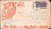
This map was created by Robert William Gadbois and Theodore J. Ritter and published in 1949. The present example is accompanied by its original mailing envelope, which also features Christmas illustrations: Santa is illustrated enjoying the enclosed map. We have handled two different editions of this map, one featuring the Christmas overprinting and another that does not. Only two examples of the edition without the overprinting are cataloged in OCLC. They are part of the collections at the Library of Congress and the University of Illinois Urbana-Champaign, and it rarely appears on the market. We are aware of no other examples of this map featuring the Christmas overprinting.CartographerS
Robert William Gadbois (fl. c. 1940 - 1960) was an artist active in the United States and Canada during the mid-20th century. After receiving his M.F.A. from the University of Iowa in 1950, Gadbois began teaching art at the University of Winnipeg along with three other new hires from Iowa. Gadbois and his contemporaries reenergized the art program in Winnipeg and drove a new interest in modern and surrealist art. More by this mapmaker...
Theodore J. Ritter (fl. c. 1940 - 1950) was a writer active in the United States during the mid-20th century. Ritter wrote several books about life in the navy centered around a character named Elmore which he produced with Robert William Gadbois. Learn More...
Condition
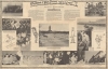
Very good. Light wear along original fold lines. Closed tear extending one half inch into printed area from bottom margin professionally repaired on verso. Text and printed photographs on verso. A few manuscript annotations on recto and verso. Accompanied by original mailing envelope.
References
Rumsey 8744.002. OCLC 948645527.