
1969 U.S. Army Cold War Era Bibliography of the U.S.S.R w/ 9 Folding Maps.

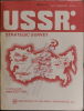
USSR: Strategic Survey; a bibliography, 1969 Edition.
Cold War - study your enemy.
$650.00
Choose a Collection:
This Item
Enquire
Cold War - study your enemy.
This is a 1969 Department of the Army Cold War (1947 - 1991) dossier on Soviet Russia (U.S.S.R.) offering a bibliographic summary on topics ranging from ethnic groups to economc regions to railway and civilian aviation routes to the border wiht ChinaA Closer Look
Per the foreword, the work contains 'one thousand abstracts of unclassified literature' compiled through the 'cooperation in research and documentation by many Government agencies and large organizations'. The present example was withdrawn from the library at Marine Corps Base 29 Palms in Twentynine Palms, California. At over 200 pages with 15 appendices, the bibliography is divided into four sections:- Introduction
- National Policy, Strategy, and Objectives
- Soviet Nation: The Spectrum of Politics, Sociology, and Economics
- Further Research on the Soviet Union (w/ appendices)
The Maps
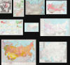
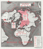
The maps, which may never previously have been unfolded, include:- Russian Sea Power This map was created by Robert M. Chapin, Jr. for TIME Magazine and originally published on February 23, 1968. It presents the world from a skewed polar perspective with Moscow at the center. Red ship silhouettes highlight the global reach of the Soviet Navy, identifying cruisers, destroyers, submarines, patrol boats, and the fishing fleet. Red lines illustrate routes popular with the Soviet Navy. Four boxes detail the Soviet Pacific, Northern, Baltic, and Black Sea fleets. Anchors mark naval bases at Severomorsk, Kaliningrad, Sevastopol, and Vladivostok. 16.5x14.5 inches.
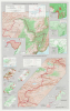
- China-U.S.S.R. Border: Eastern Section. China-U.S.S.R. Border: Western Section This map illustrates the China-Soviet border from Korea to Afghanistan in two sections. The largest maps present the border c. 1965, but state that the 'names and boundary representation are not necessarily authoritative'. Smaller maps surround the two border maps and illustrate, clockwise from the top center: Kharbarovsk; vegetation and mineral resources along the eastern sector of the border; climatic factors along the eastern sector; urban population and rural population density along the eastern sector; border history and claims along the western sector; urban population and rural population density along the western sector; ethnic groups along the western sector; selected administrative units along the western sector; vegetation and economic resources along the western sector; and the border history and claims along the eastern sector. 20.5x13 inches.
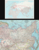
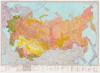
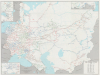
- Eastern Soviet Union This is a March 1967 National Geographic map of the Eastern Soviet Union. Coverage extends from Riga to Tokyo and from Chevak, Alaska, to Kabul, Afghanistan. Roads, railroads, canals, oil fields, and pipelines are illustrated. Stars mark cities with scheduled air service. 19x25 inches.
- [Commercial Air Routes.] This map illustrates commercial aviation connections between Moscow and points in Europe, Africa, the Middle East, and Asia. 11.25x18 inches.
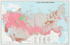
- U.S.S.R.-Major Ethnic Groups This map documents the ethnic diversity of the U.S.S.R. Colors distinguish Indo-European (pink), Uralian (green), Altaic (brown), Paleo Asiatic (green), and Caucasian (brown) regions. Symbols further differentiate ethnicities within each group. The source for this map was published in Moscow in 1956. 17x26 inches.
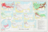
- U.S.S.R. in Maps 10 maps fill this sheet with a wide array of data: ethnic groups, administrative divisions, population, location, and comparative area, the chemical industry, metallurgy, fuels and metallic minerals, machinery and metalworking, physical regions, and land utilization. 29.5x29 inches.
- U.S.S.R. and Adjacent Areas, Administrative Map This map illustrates administrative divisions. Text is Russian but in the Latin alphabet. The information along the bottom is in a mix of English and Russian. 32x44 inches.
- U.S.S.R. Major Economic Regions and Economic-Administrative Regions Compiled in March 1964, this map breaks down the economic regions of the Russian Soviet Socialist Republic and the other Soviet Socialist Republics. Roman numerals mark major economic regions, while Arabic numerals mark the economic-administrative regions. A note along the bottom border states that 'the United States has not recognized the incorporation of Estonia, Latvia, and Lithuania into the Soviet Union'. 22x37.75 inches.
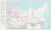
- U.S.S.R.: Railroad Systems This map illustrates the railroad network of 25 railroads across the Soviet Union from the Baltic Sea to the Sea of Japan and from the Barents Sea to Iran and Afghanistan. Railroads are highlighted in red, blue, or green, and numbered to a corresponding table in the lower right. 26.25x36.75.
Publication History and Census
This book was published by the Department of the Army in 1969 and printed by the U.S. Government Printing Office. It is well represented in institutional collections but is rare on the private market.Condition
Very good. Quarto. Shelf wear and wear to the spine. 29 Palms Library stamp on front cover. All 9 maps present and in excellent condition.
References
OCLC 52808.