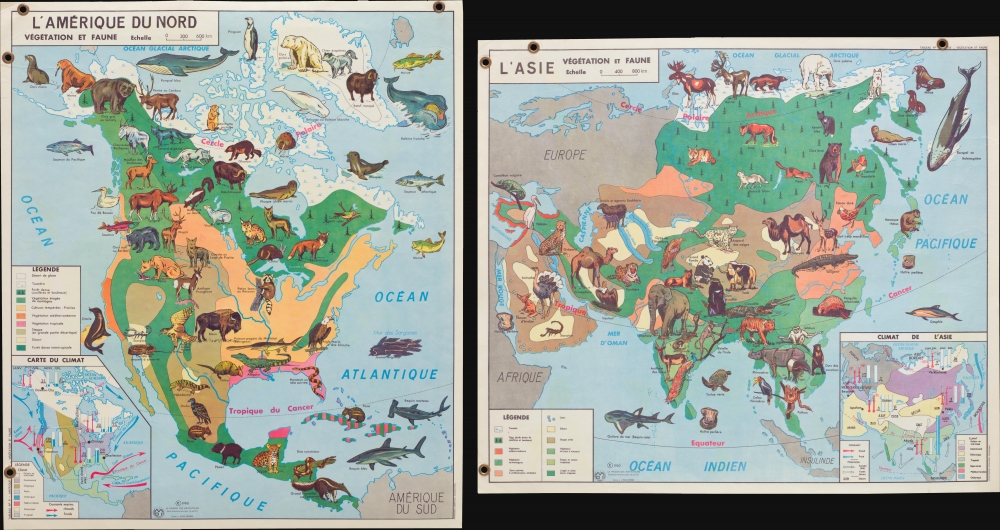
1960 Anscombre Pictorial Map of Plants and Animals of North America and Asia
VegetationFauna-anscombre-1960$250.00


Title
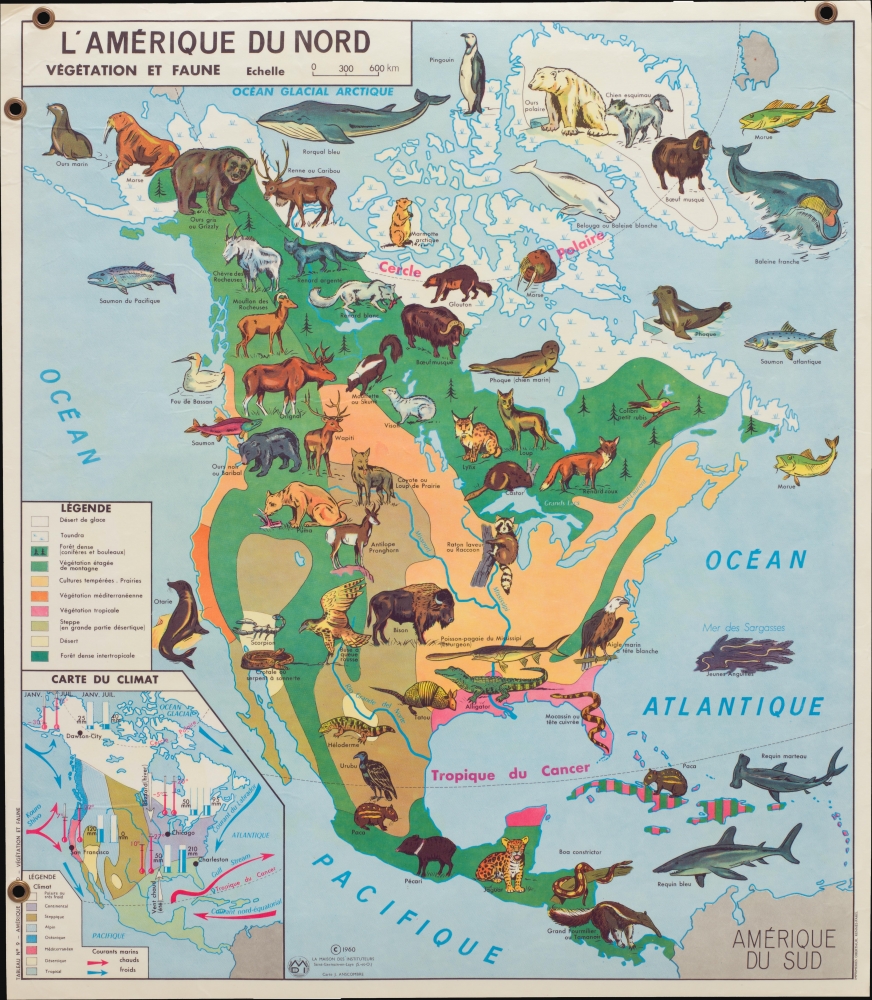
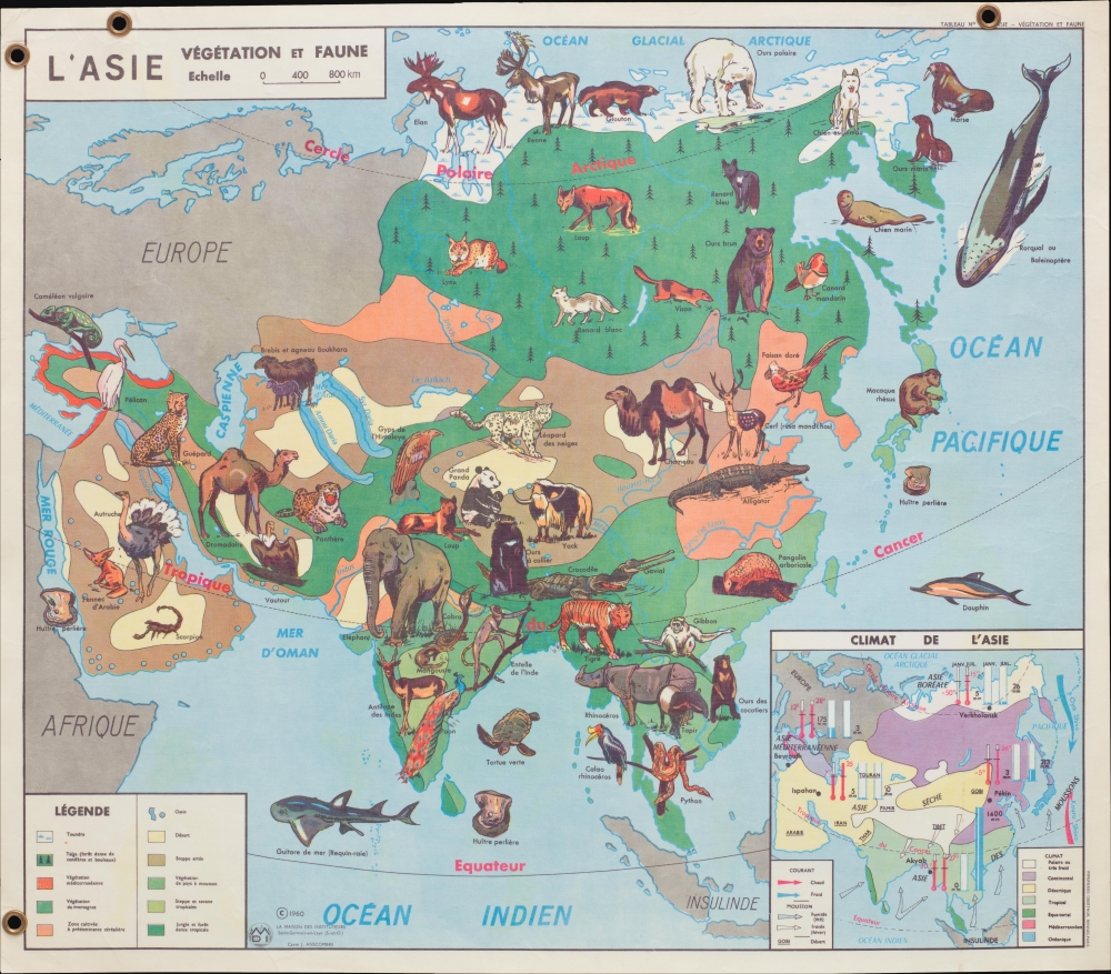
L'Amérique du Nord Végétation et Faune. / L'Asie Végétation et Faune.
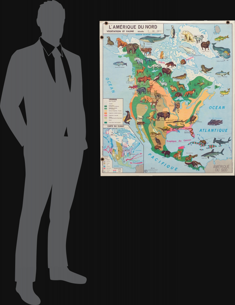
1960 (dated) 36 x 31.25 in (91.44 x 79.375 cm)
1960 (dated) 36 x 31.25 in (91.44 x 79.375 cm)
Description
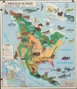
This is a 1960 Jean Anscombre double-sided pictorial map of the plants and animals of North America and Asia. Depicting the entirety of North America on the recto and the entirety of Asia on the verso, the maps are strikingly colored and wonderfully illustrated.
Animals and Vegetation
Both maps feature 'portraits' of the animals native to these continents, each identified by the French name. Some of the species illustrated in North America include the moose, beaver, raccoon, mountain goat, pronghorn antelope, bison, bald eagle, jaguar, and giant anteater. In Asia, the wolverine, polar bear, Mandarin duck, golden pheasant, Indian rhinoceros, sun bear, pangolin, yak, snow leopard, and giant panda make an appearance. The vegetation present on both continents is illustrated using colors that correspond to legends situated on the right of both maps. Each color represents a different zone of vegetation. Inset maps, situated, respectively, in the lower right corner of the map of Asia and the lower left corner of the map of North America, detail the climate throughout both continents, complete with average amounts of precipitation, average temperatures, wind directions, and ocean currents.Publication History
This map was created and published by Jean Anscombre and La Maison des Instituteurs in 1960 and printed by the Imprimeries Oberthur. These are the only known cataloged examples.Condition
Very good. Laminated. Map of North America on one side map of Asia on the other. Four grommets present on map originally used for display purposes in classroom. Scales are 1 : 10500000 / 1 : 12600000.