1868 Colton Pocket Map of Vermont w/ Railroads
Vermont-colton-1868$1,500.00


Title
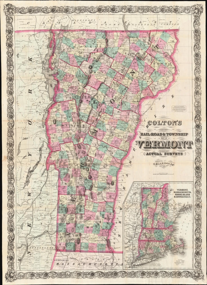
Colton's Rail-Road and Township Map of Vermont from County Maps and Actual Surveys.
1868 (dated) 38.75 x 28 in (98.425 x 71.12 cm) 1 : 316800
1868 (dated) 38.75 x 28 in (98.425 x 71.12 cm) 1 : 316800
Description
A striking 1868 example of G. W. and C. B. Colton's 1868 pocket map of Vermont. The map is novel as Colton's only large-scale separate-issue map to focus exclusively on Vermont. It is also of interest for its illustration of the Vermont gold region - a little-known chapter in the state's history.
A Closer Look
Coverage embraces Vermont and adjacent parts of New York, Massachusetts, New Hampshire, and Canada. Coverage in New York is expanded to accommodate Lake Champlain, Lake George, and railroad links to the Hudson River. Vermont itself is divided into counties and subdivided into townships. Topography is emphasized with hachure, and major mountains are named, among them Stratton, Killington, and Mansfield (Stowe) - today popular ski resorts. In the lower right, a large inset, reduced from Colton's atlas map of New England, places Vermont within a regional context. Just south, across the border, the Hoosac Tunnel (Hoosic) is illustrated, though the tunnel was still under construction and would not open until 1875.Vermont's Gold Rush
One of the more captivating aspects of this map is its treatment of the Vermont gold region. Gold mining in Vermont is a lesser-known chapter in the state's history. While Vermont isn't typically associated with significant gold discoveries, there were sporadic crazes. The primary period of interest occurred in the mid to late 19th century, around the time this map was issued. In the wake of the California Gold Rush, gold fever swept across the country, and even minor discoveries could result in minor rushes. When alluvial deposits were discovered in the Green Mountains, prospectors flocked to Vermont in hopes of striking it rich, particularly in Windsor County. Nonetheless, the overall yield of gold in Vermont was modest, and the mining activity rapidly waned as prospectors moved on to more lucrative areas. Today, historical remnants such as old mine shafts and equipment serve as reminders of Vermont's brief flirtation with gold.Publication History and Census
This map was engraved and published in 1868 by Colton's Geographical Establishment under G. W. and C. B. Colton. The map is copyrighted to 1860, but we see no examples of that edition in any records. We do see an 1864 edition in 4 institutions and this 1868 edition in 3: Bennington Museum, Yale University, and the University of Missouri.Cartographer
Joseph Hutchins Colton (July 5, 1800 - July 29, 1893), often publishing as J. H. Colton, was an important American map and atlas publisher active from 1833 to 1897. Colton's firm arose from humble beginnings when he moved to New York in 1831 and befriended the established engraver, Samuel Stiles. He worked under Stiles as the 'Co.' in Stiles and Co. from 1833 to 1836. Colton quickly recognized an emerging market in railroad maps and immigrant guides. Not a cartographer or engraver himself, Colton's initial business practice mostly involved purchasing the copyrights of other cartographers, most notably David H. Burr, and reissuing them with updated engraving and border work. His first maps, produced in 1833, were based on earlier Burr maps and depicted New York State and New York City. Between 1833 and 1855, Colton proceeded to publish a large corpus of guidebooks and railroad maps, which proved popular. In the early 1850s, Colton brought his two sons, George Woolworth Colton (1827 - 1901) and Charles B. Colton (1832 - 1916), into the map business. G. W. Colton, trained as a cartographer and engraver, was particularly inspired by the idea of creating a large and detailed world atlas to compete with established European firms for the U.S. market. In 1855, G.W. Colton issued volume one of the impressive two-volume Colton's Atlas of the World. Volume two followed a year later. Possibly because of the expense of purchasing a two-volume atlas set, the sales of the Atlas of the World did not meet Colton's expectations, and so, in 1856, the firm also issued the atlas as a single volume. The maps contained in this superb work were all original engravings, and most bear an 1855 copyright. All of the maps were surrounded by an attractive spiral motif border that would become a hallmark of Colton's atlas maps well into the 1880s. In 1857, the slightly smaller Colton's General Atlas replaced the Atlas of the World. Most early editions of the General Atlas published from 1857 to 1859 do not have the trademark Colton spiral border, which was removed to allow the maps to fit into a smaller format volume. Their customers must have missed the border because it was reinstated in 1860 and remained in all subsequent publications of the atlas. There were also darker times ahead; in 1858, Colton was commissioned at a sum of 25,000 USD by the government of Bolivia to produce and deliver 10,000 copies of a large format map of that country. Although Colton completed the contract in good faith, delivering the maps at his own expense, he was never paid by Bolivia, which was at the time in the midst of a series of national revolutions. Colton would spend the remainder of his days fighting with the Bolivian and Peruvian governments over this payment, and in the end, after a congressional intervention, he received as much as 100,000 USD in compensation. Nonetheless, at the time, it was a disastrous blow. J. H. Colton and Company is listed as one of New York's failed companies in the postal record of 1859. This led Colton into the arms of Alvin Jewett Johnson and Ross C. Browning. The 1859 edition of Colton's General Atlas lists Johnson and Browning as the 'Successor's to J. H. Colton' suggesting an outright buyout, but given that both companies continued to publish separately, the reality is likely more complex. Whatever the case may have been, this arrangement gave Johnson and Browning access to many of Colton's map plates and gave birth to Johnson's New Illustrated (Steel Plate) Family Atlas. The Johnson's Atlas was published parallel to Colton's atlases well into the 1880s. The Colton firm itself subsequently published several other atlases including an Atlas of America, the Illustrated Cabinet Atlas, the Octavo Atlas of the Union, and Colton's Quarto Atlas of the World. They also published a large corpus of wall maps, pocket maps, and guides. The last known publications of the Colton firm date to 1897 and include a map and a view, both issued in association with the Merchant's Association of New York. Alice M. Colton married August R. Ohman (May 3, 1859 - April 22, 1934) on January 5, 1897. In 1898, Ohman joined the Colton firm, which continued to publish as Colton, Ohman & Co. until 1901. More by this mapmaker...
Condition
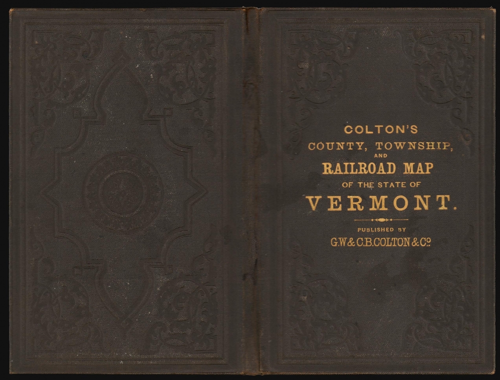
Very good. Slight wear and toning on old fold lines. Minimal verso reinforcement at many fold intersections. Accompanies original gilt stamped binder.
References
OCLC 1422014813. Bennington Museum, 2007.124. Yale University, Beinecke Library, 8303857.