This item has been sold, but you can get on the Waitlist to be notified if another example becomes available.
1976 Saigon Giai Phong Newspaper Election Map of Vietnam
Vietnam-giaiphong-1976$550.00

Title
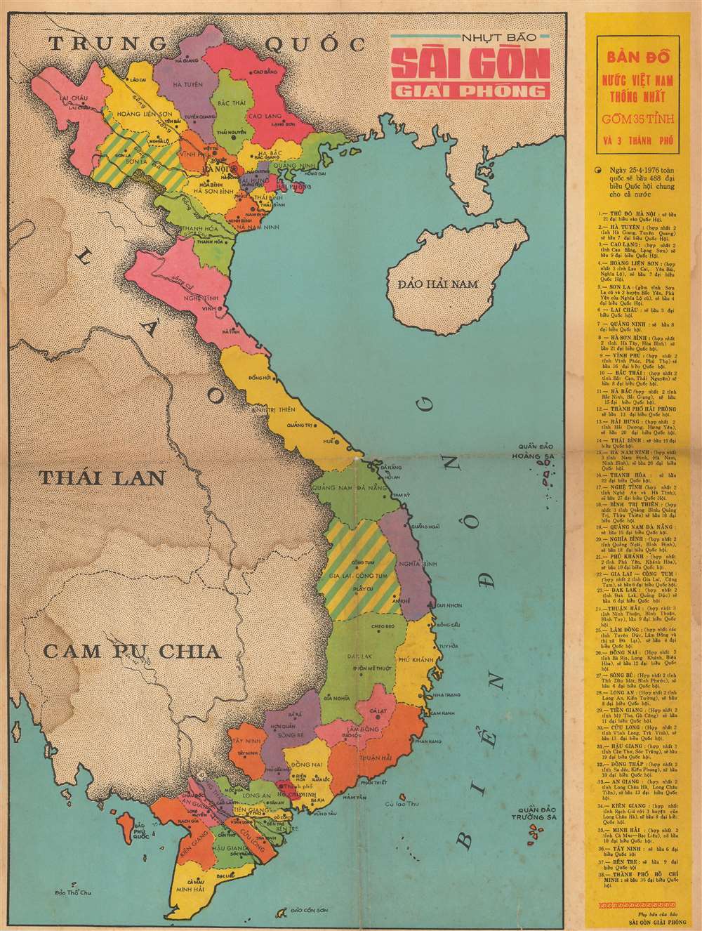
BẢN ĐỒ NUỐC VIỆT NAM THỐNG NHẤT GỒM 35 TỈNH VÀ 3 THÀNH PHỐ. / Vietnamese United Nations Map Included 35 Provinces and 3 Cities.
1976 (dated) 20.75 x 15.75 in (52.705 x 40.005 cm) 1 : 3244000
1976 (dated) 20.75 x 15.75 in (52.705 x 40.005 cm) 1 : 3244000
Description
This is a 1976 Saigon Giai Phong map of Vietnam illustrating the districts created for the 1976 parliamentary elections, the first parliamentary elections in Vietnam after the end of the Vietnam War (1955 - 1975) and the reunification of North and South Vietnam. The map depicts the region from Thailand to Hainan and from Yunnan Province in China to the Cà Mau Peninsula. Vietnam is divided into thirty-eight different parliamentary districts. These are divided between thirty-five provinces and three cities: Hanoi, Haiphong, and Ho Chi Minh City. Cities and towns throughout the country are labeled, including Hanoi, Haiphong, Hué, and Da Nang. A list of all thirty-eight districts, that includes a breakdown of how the delegates will be allotted, is included along the right border.
Sài Gòn Giải Phóng
Sài Gòn Giải Phóng (Liberated Saigon in English) is a newspaper published by the Vietnamese Communist Party in Ho Chi Minh City. It is published in Vietnamese, English, and Chinese.Publication History and Census
This map was created and published by Sài Gòn Giải Phóng newspaper in 1976. This is the only known surviving example of this map.Condition
Good. Wear along original fold lines. Soiling. Verso repairs to fold separations. Blank on verso.