1945 Newsmap of Japan and the Strategic Bombing Campaign
VolIVNo16F-newsmap-1945$800.00


Title
Newsmap. For the Armed Forces. V-E Day + 13 Weeks - 190th Week of U.S. Participation in the War. Monday, 6 August, 1945. Week of 24 July to 31 July. Volume IV No. 16F. 'In a few months we expect to run out of targets in Japan.' / Special Devices.
1945 (dated) 34.25 x 46.25 in (86.995 x 117.475 cm)
1945 (dated) 34.25 x 46.25 in (86.995 x 117.475 cm)
Description
This August 6, 1945 Newsmap illustrates the World War II (1939 - 1945) U.S. strategic bombing campaign against Japan. August 6, also corresponds to the world's first use of an Atomic Bomb against the Japanese at Hiroshima - although that fact is not presented here and was likely not known to the mapmakers.
A Closer Look
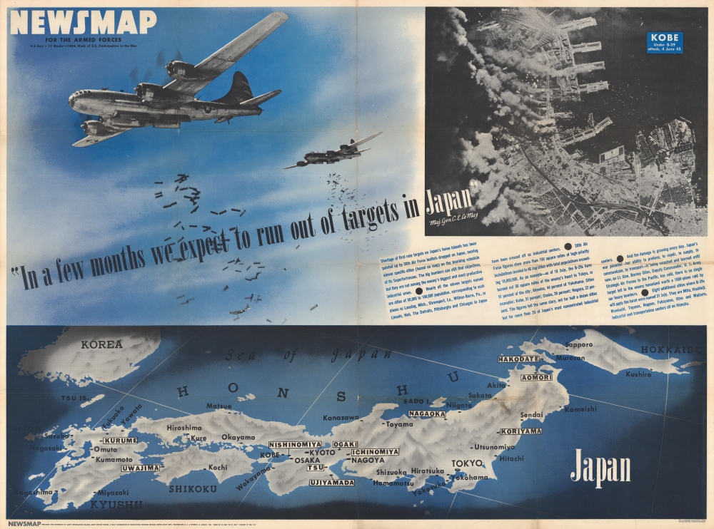
A photograph of two B-29 Superfortresses (with bomb bay doors open and bombs tumbling toward their target) dominates the sheet. An aerial photograph of Kobe during a B-29 raid appears on the upper right, with most of the city obscured by smoke from the raging fires. The brutality of the American bombing offensive becomes is underscored by General Curtis Le May, the commander of the Twentieth Air Force, 'In a few months we expect to run out of targets in Japan'. The accompanying text provides additional detail, stating that 51% of Tokyo, 51% of Kobe, and 44% of Yokohama, just to cite a few, had been destroyed by the B-29s. White boxes highlight eleven additional cities: the Twentieth's next targets.The B-29 and the Bombing Campaign against Japan
At the outbreak of World War II in the Pacific, Japan successfully captured Wake Island, Guam, and the Philippines, effectively eliminating all possibility of American air attacks against the Home Islands. It took until 1944 for the U.S. Army Air Forces (USAAF) to be able to conduct a sustained air offensive against the Home Islands. The campaign began from airfields in India and China, with B-29 Superfortresses based in India and refueling in China before bombing targets on Kyushu. However, supplying these air groups proved next to impossible and put a sustained offensive from the bases out of the question. Then, after U.S. forces captured Guam, Saipan, and Tinian in the Mariana Islands between June and August 1944, airfields were constructed from which B-29s could attack Japan. The air offensive began as a strategic bombing campaign at the end of November 1944. However, these strategic raids proved ineffective, due to high altitude and other difficulties.A Change of Tactics
The ineffective nature of high-altitude precision bombing led the USAAF to change tactics and institute a low-altitude firebombing campaign of Japanese cities. Japan's cities were built mostly of wood and cloth, making them susceptible to firebombing. The first firebombing raid on March 9-10, 1945 proved to be the most destructive of the war. In that raid, 16 square miles of Tokyo were destroyed, over 120,000 people were killed or injured, and more than one million were rendered homeless. Firebombing raids of this sort continued throughout March, April, May, and June. By the end of May, over 50% of Tokyo had been destroyed and it was removed from the XXI Bomber Command's list. In mid-June, the XXI Bomber Command began attacking small cities, with populations as small as 62,280, and, since the targets were so small, the bombers would be divided between multiple cities on one day. The aerial bombardment campaign continued until the atomic attacks on Hiroshima and Nagasaki, with a raid against Yawata and Fukuyama occurring between the two atomic attacks. Bombing raids mostly ended after the Japanese government began surrender negotiations, with only two raids occurring on August 10th, the day after the raid on Nagasaki. Truman ordered an end to the offensive on the 10th, fearing that if attacks continued they would be interpreted in such a way that the Japanese would believe the negotiations had failed.Verso Content - Training Navy Pilots
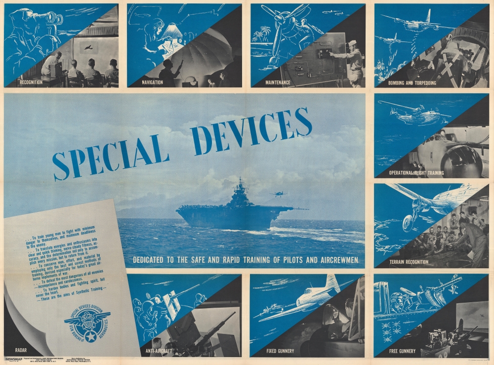
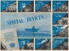
Photographs printed on the verso highlight nine aspects of training undergone by Navy airmen and aircrews. Among these are navigation, maintenance, recognition, bombing and torpedoing, and gunnery. A photograph of an airplane about to land on an aircraft carrier dominates the center of the sheet.Publication History and Census
This map was created and published by the Army Information Branch on Monday, August 6, 1945. We note seven cataloged examples in OCLC: Davidson College, Southern Illinois University at Edwardsville, the University of Missouri - Columbia, Denison University, Ohio Wesleyan University, the Library of Michigan, and the Denver Public Library.Cartographer
The Army Orientation Branch (1940 - c. 1949) created special maps for teaching the Army Orientation Course and was based at The Pentagon in Washington, D.C. The Army Orientation Branch was part of the Information and Education Division. More by this mapmaker...
Source
Newsmap series.
Newsmaps were published weekly between April 1942 and March 1946. Their content usually featured world maps, short summaries of the week’s military action, and photographs of troops and materiel. Early Newsmaps were printed on one side only, but, later in the war, they were printed on both sides, with the reverse bearing large-format maps, photographs, or other visual information. Several different versions of Newsmaps were produced: a large domestic version, a smaller overseas version, and an industrial version, which included more information about war production efforts. Two other editions appear in the United States Government Publications Monthly Catalogs, a 'Newsmap Special Edition' and a 'Newsmap Special Supplement for Special Training Units'.
Per the National Archives and Records Administration, ‘NEWSMAPS were not issued for general distribution. The posters were distributed to military installations, government and civilian groups working on War Department projects, and certain depository libraries, as designate by Congress, and one copy to Congressmen, if requested.’ The importance of the Newsmaps to the Army is related in the 1944 Basic Field Manual for The Special Service Company. The Manual states that as soon as the company reaches its destination ‘the company commander should contact the Special Service Branch in theater of operations headquarters, for copies of the weekly Newsmap.’ Also per the Manual
Per the National Archives and Records Administration, ‘NEWSMAPS were not issued for general distribution. The posters were distributed to military installations, government and civilian groups working on War Department projects, and certain depository libraries, as designate by Congress, and one copy to Congressmen, if requested.’ The importance of the Newsmaps to the Army is related in the 1944 Basic Field Manual for The Special Service Company. The Manual states that as soon as the company reaches its destination ‘the company commander should contact the Special Service Branch in theater of operations headquarters, for copies of the weekly Newsmap.’ Also per the Manual
The librarian should check the weekly Newsmap as soon as it is made available and should post it in a conspicuous place. He should take steps to see that the place where the Newsmap is posted is made known to all troops of the area in which the company or platoon is operating. This can be done effectively through notices in soldier newspapers, verbal announcements by those directly in charge of troops, and by posting announcements on bulletin boards.
Condition
Very good. Light wear along original fold lines. Verso repairs to fold separations and at fold intersections. Images dedicated to training Navy pilots and aircrew printed on verso.
References
OCLC 63117172, 48120818.