This item has been sold, but you can get on the Waitlist to be notified if another example becomes available, or purchase a digital scan.
1914 Philip Map of Europe at the Outbreak of World War I
WarMap-philip-1914-2$137.50

Title
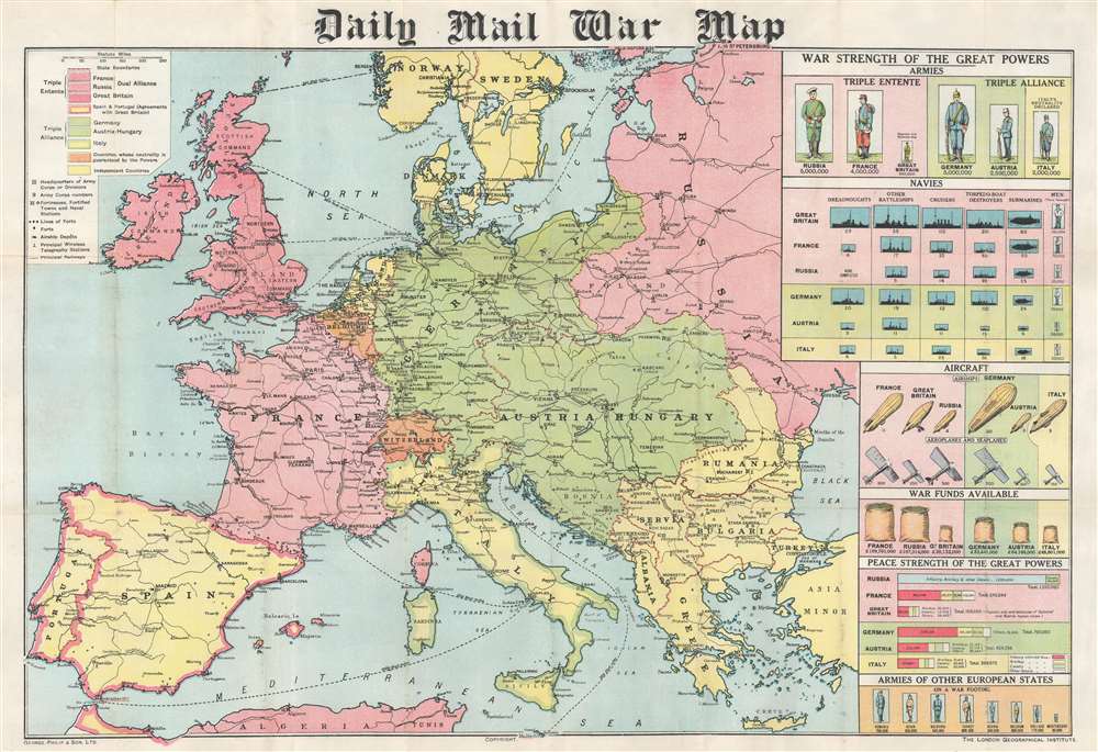
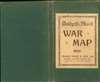
Daily Mail War Map.
1914 (undated) 22 x 32 in (55.88 x 81.28 cm) 1 : 5000000
1914 (undated) 22 x 32 in (55.88 x 81.28 cm) 1 : 5000000
Description
This is a 1914 George Philip map of Europe at the beginning of World War I. Philip uses colors to illustrate the alliances between the Triple Entente (Great Britain, France, and Russia) and the Triple Alliance (Germany, Austria-Hungary, and Italy). Neutral and independent countries are shaded other colors, although their neutrality did not save them from the onslaught of war in Belgium's case. Major cities are identified across the continent, along with fortresses, airship depots, wireless stations, and railways. Infographics along the right border provide an incredible visual summary of each country's military strength. The infographics create compelling comparisons between the belligerents. The comparison between standing armies, for example, lays bare the shocking difference between the Russian and French armies and the British army. At the same time, the British navy vastly outclasses all others in every category. Aircraft appear as well, an intriguing prospect in 1914 since airships and airplanes had never before been used in combat.
Publication History and Census
This map was created by George Philip and Son and published by the Daily Mail in 1914. Ten examples are cataloged in OCLC and are part of institutional collections in the United States and the United Kingdom, including the Osher Map Library at the University of Southern Maine, Texas A and M University, Stanford University, Yale University, Oxford University, and the British Library.Cartographer
George Philip (1800 - 1882) was a map publisher and cartographer active in the mid to late-19th century. Philip was born into a Calvinst family in Huntly, Aberdeenshire, Scotland. Around 1819 he apprenticed himself to William Grapel, a Liverpool printer and bookseller. Fifteen years later, in 1834, Philip founded his own Liverpool book and map firm. Philip's earliest cartographic ventures were mostly educational material issued in tandem with John Bartholomew Sr., August Petermann, and William Hughes. In 1848, Philip admitted his son, George Philip Jr. (1823 - 1902) into the firm, renaming it George Philip and Son Ltd. George Philip Jr. ran the firm until his death in 1902, by which time it had developed into a major publishing concern. His successors established the London Geographical Institute, a factory where they embraced modern printing techniques to produce thousands of economical and high quality maps. In April 1988, George Philip & Son was acquired by Octopus Publishing, a branch of Reed International. Nonetheless, today the firm trades and publishes to this day as George Philip and Son. More by this mapmaker...
Condition
Very good. Mounted on linen. Light wear along original fold lines.
References
OCLC 76891085.