This item has been sold, but you can get on the Waitlist to be notified if another example becomes available, or purchase a digital scan.
1875 Gray Map of Washington and Oregon
WashingtonOregon-gray-1875$75.00

Title
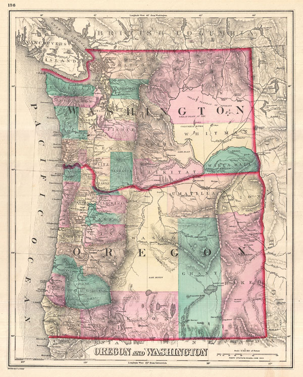
Oregon and Washington.
1875 (undated) 15 x 12.5 in (38.1 x 31.75 cm) 1 : 1584000
1875 (undated) 15 x 12.5 in (38.1 x 31.75 cm) 1 : 1584000
Description
A visually stunning 1875 map of Oregon and Washington by Ormando Gray. Offers beautiful engraving and vivid hand color at the county level. Shows cities and railways as well as topographical features such as lakes, rivers, valleys and mountains. A very nice example of late 19th century American cartography.
Cartographer
Ormando Wyllis Gray (March 3, 1829 – July 6, 1912) was a mid to late 19th century map publisher with offices in New York City, Philadelphia, PA, and Danielsonville, Connecticut. Born in Townshend, Vermont, he attended Norwich College where he studied civil engineering and became a civil engineer and surveyor. Gray's first commercial atlas was an 1869 survey of Windhamd and Toland counties, Connecticut. His most important work seems to have been done in conjunction with other, more prominent map publishers, including Henry Walling and G.W. and C.B. Colton. Gray is best known for his state and county atlases, though did, with his sons, also independently issue at least two national atlases in the late 1870s. He retired from the map publishing business in 1890. He died at home in Bernardston, Massachusetts. He married Roxcena L. Arnold in 1851, with whom he had three daughters and one son. More by this mapmaker...
Condition
Very good. Blank on verso.
References
Rumsey 3888.048.