1883 Stemler Topographical and Geological Atlas of western Sumatra, Indonesia
WestSumatra-stemler-1883$950.00
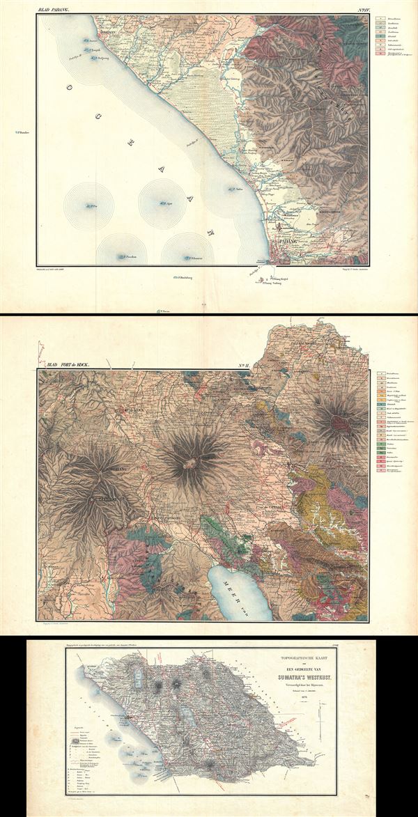

Title
Topographische en Geologische Beschrijving van een gedeelte van Sumatra's Westkust.
1883 (dated) 23 x 14.5 in (58.42 x 36.83 cm) 1 : 100000
1883 (dated) 23 x 14.5 in (58.42 x 36.83 cm) 1 : 100000
Description
This is a beautiful 1883 topographical and geological atlas by C. F. Stemler of part of the west coast of Sumatra, Indonesia. Covers part of West Sumatra from Padang to Payakumbuh (Paja Koemboeh). The atlas includes:
1. Eight sheets of geological mapsAn detailed key in included in sheet VII. Each map is exceptionally detailed, noting lakes, rivers, cities, mountains, peaks, and a host of additional topographical and geological features. Published by C. F. Stemler of Amsterdam in 1883.
2. Two sheets with seven colored elevation profiles
3. Three sheets with five drawing and profiles of lakes, including Lakes Singkarak, Maninjao, Dibawah, Diatus and Talang
4. One sheet of Topographic overview or index map
5. One sheet details the topography of the twin volcano peaks of Mount Singgalang and Mount Tandikat and Mount Merapi
Source
Stemler, C. F., Topographische en Geologische Beschrijving van een gedeelte van Sumatra's Westkust, Amsterdam, 1883.
Condition
Very good. Contains 15 sheets. Maps exhibit minor wear along original fold lines. Accompanied by original cardboard binder.