This item has been sold, but you can get on the Waitlist to be notified if another example becomes available, or purchase a digital scan.
1882 Berghaus Wall Map of the World
World-berghaus-1882$1,000.00

Title
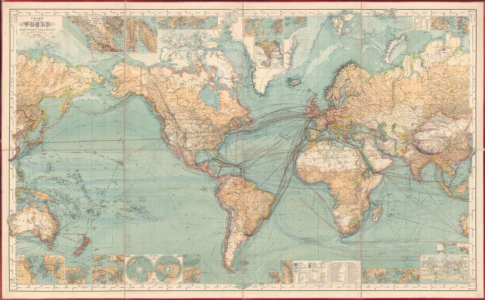
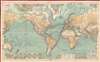
Chart of the World on Mercator's Projection.
1882 (dated) 38.5 x 62.25 in (97.79 x 158.115 cm) 1 : 15000000
1882 (dated) 38.5 x 62.25 in (97.79 x 158.115 cm) 1 : 15000000
Description
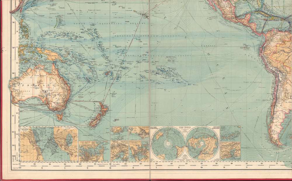
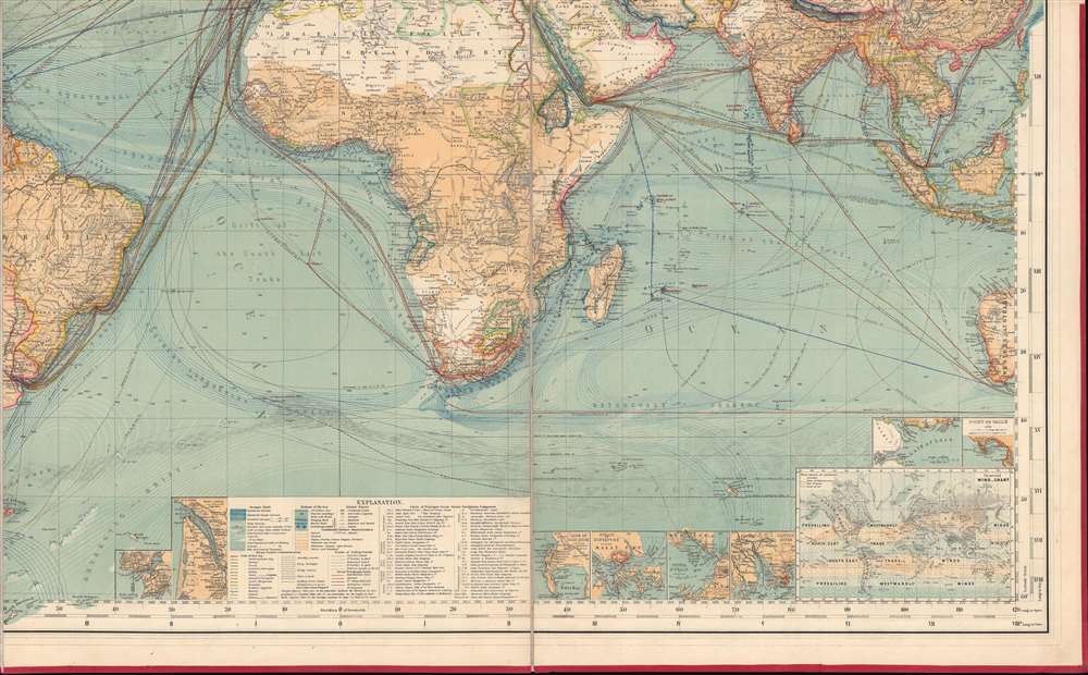
This is an 1882 Hermann Berghaus large-scale map of the world. Typical of German maps production in the late 19th century, this map is both cartographically and informationally dense, featuring a wealth of detail and data systematically organized for easy digestion. This ranges from land and sea transportation networks, to climatological data, to topography, political distinctions, communication infrastructure (telegraph lines), oceanographic content, and more. Of particular interest is Berghaus' focus on the transatlantic mail packets.
Insets
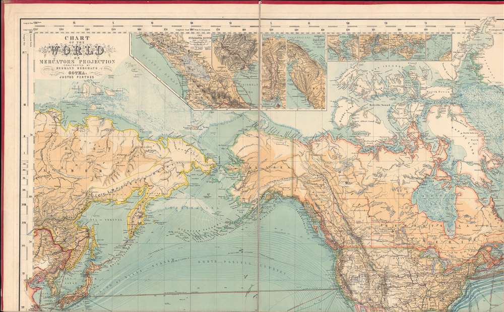
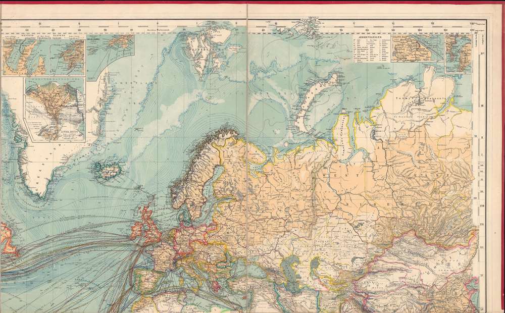
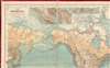
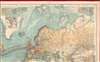
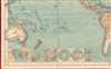
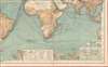
Augmenting the main map, numerous insets occupy the top and bottom border areas. Along the top border, these focus on the 'Nicaragua Route', the Isthmus of Panama, the Isthmus of Honduras, the Isthmus of Darien, San Francisco, New York, Portsmouth and Southampton, the Dover Strait, the Atlantic Telephone Cables, Lower Egypt (the Nile and the Nile Delta), the Entrance to the English Channel, Shanghai, and Tokyo Bay (Yedo). Along the bottom border, the insets illustrate the lines of magnetic declination, Port Jackson, Honolulu, Port Philip, Auckland, the World on a Polar Projection, the Virgin Islands, Rio de Janeiro, Lisbon, Bordeaux, the Cape of Good Hope, Singapore, the Sunda Strait, Hong Kong and Guangzhou, and a Wind Chart of the World.Steam Packets in the mid- and late-19th century
Packet ships, which gained their name from the mail packets transported on government mail contracts, began operating as early as the 17th century. Packet boats carried mail from Britain across the Atlantic to their American colonies, and then to the United States following the American Revolution at least once a month. With the advent of steam powered navigation in the late 1830s and 1840s, transporting mail long distances became much faster and more economical. This technological advancement created an opportunity for a wider swath of the populace to send mail internationally.How Transatlantic Mail Was Handled
Letter destined to cross the Atlantic, were first sent to one of several major ports, then forwarded from that city's central post office to a steamer on the date of departure (for examples Saturday in New York City). Since the arrival of steam packets was a major event, their anticipated arrival and departure dates were be printed in local newspapers. Thus, senders would know which steamers would be arriving on what date and would even write the name of their intended ship on the letter, essentially providing routing instructions to postal workers. Once the mail arrived in its destination, it would be delivered to the local post office, or, depending on the line carrying the mail, picked up dockside.Publication History and Census
This map was constructed by Hermann Berghaus, engraved by E. Kühn and Wilhelm Weiler, and published by Justus Perthes in 1882. We note six examples cataloged in OCLC which are part of the collections at Brown University, Cornell University, the Buffalo and Erie County Public Library, the University of Chicago, the University of Alaska Fairbanks, and the Bibliothèque nationale de France. Berghaus first issued this map in conjunction with the Justus Perthes company of Gotha in 1863. It went through at least 14 subsequent editions.CartographerS
Hermann Berghaus (November 16, 1828 - December 3, 1890) was a German cartographer active in Gotha, Germany, in the second half of the 19th century. Berghaus was born in Herford, Westphalia, the son of a pastor. His received his primary education as schools in Herford and Halle, where he discovered a talent for drawing. From 1842 to 1845 he studied cartography and art under his uncle, the Postdam educator, geographer, and surveyor Heinrich Karl Wilhelm Berghaus (1797 - 1884). Shortly after 1845 Berghaus was recruited by Wilhelm Perthes, son of Justus Perthes, to work at the Geographical Institute of Justus Perthes at Gotha (Justus Perthes' Geographische Anstalt Gotha). His work there included his most noteworthy project, a densely detailed and impressive large format folding chart of the world first published in 1863 and updated in at least 14 editions to about 1909. Other than his great work map, Berghaus' work was primarily dedicated to updating obsolete versions of earlier Perthes map publications. The exacting work caused him to lose his eyesight, a common problem for cartographers and engravers, in 1888. His work earned him an Honorary Doctorate of Philosophy at the University of Königsberg (1868), a gold medal at the Congress of Cartographers in Venice (1881), and an appointment to the German Academy of Sciences Leopoldina (1883). More by this mapmaker...
Johan Georg Justus Perthes (September 11, 1749 - May 2, 1816) was one of the most important German cartographic engravers of the 19th century. He was born in the Thuringian town of Rudolstadt, the son of a court physician. In 1778, he began working as a bookseller in Gotha. Perthes began his publishing empire shortly thereafter with the 1784 issue of the famed survey of European nobility known as the Almanac de Gotha. In the next year, 1785, he founded the cartographic firm of Justus Perthes Geographische Anstalt Gotha. His son Wilhelm Perthes (1793 - 1853) joined the firm in 1814. Wilhelm had prior publishing experience at the firm of Justus Perthes' nephew, Friedrich Christoph Perthes, who ran a publishing house in Hamburg. After Justus Perthes died in 1816, Wilhelm took charge and laid the groundwork for the firm to become a cartographic publishing titan. From 1817 to 1890. the Perthes firm issued thousands of maps and more than 20 different atlases. Along with the visionary editors Hermann Berghaus (1797 - 1884), Adolph Stieler (1775 - 1836), and Karl Spruner (1803 - 1892), the Perthes firm pioneered the Hand Atlas. When Wilhelm retired, management of the firm passed to his son, Bernhardt Wilhelm Perthes (1821 – 1857). Bernhardt brought on the cartographic geniuses August Heinrich Peterman (1822 - 1878) and Bruno Hassenstein (1839 - 1902). The firm was subsequently passed to a fourth generation in the form of Berhanrd Perthes (1858 – 1919), Bernhard Wilhelm's son. The firm continued in the family until 1953 when, being in East Germany, it was nationalized and run as a state-owned enterprise as VEB Hermann Haack Geographisch-Kartographische Anstalt Gotha. The Justus family, led by Joachim Justus Perthes and his son Wolf-Jürgen Perthes, relocated to Darmstadt where they founded the Justus Perthes Geographische Verlagsanstalt Darmstadt. Learn More...
Wilhelm Weiler (1825 - 1895) was a German engraver. He worked for Justus Perthes in Gotha on numerous maps, including at least one edition of Hermann Berghaus's 'Chart of the World on Mercator's Projection'. He also worked on maps published in Petermanns Geographische Mitteilungen Learn More...
Condition
Very good. Dissected and mounted on linen in 8 panels. Light wear along original fold lines. Light soiling.
References
OCLC 994505636, 1182577744.